Old Maps of Lamona, Washington for Genealogy
Trace your family roots with 10 historic maps of Lamona. These high-res maps reveal old neighborhoods, homesites, landmarks, and streets — helping you uncover where your ancestors lived and how the area evolved over time.
- Explore historic neighborhoods: Identify where your relatives may have lived in the 1800s or 1900s.
- Compare maps over time: Trace the changes in streets, buildings, and landmarks for multi-generational research.
- Perfect for genealogy & ancestry research: Used by family historians and researchers to map out lineage and migration.
These maps are an incredible resource for exploring your personal connection to Lamona's past.
Lamona, WA maps
(10)- 1953 Map of Ritzville, 1966 Print
 1953 Ritzville1966 Print · USGSEastern Washington was undergoing a massive agricultural and industrial transformation in the mid-fifties as irrigation from the Grand Coulee Dam reached the plateau. Researchers can trace the mid-century rail network of the Great Northern and locate vital local sites like Larson Air Force Base and Odessa.3 unique versions available
 - 1959 Map of Ritzville
 1959 Ritzville1959 Print · USGSEastern Washington in the late fifties reveals a landscape transformed by massive irrigation projects and postwar growth. Genealogists and historians can trace rail-line communities from Ritzville to Davenport and locate landmarks like Larson Air Force Base and Telford Station.
 - 1965 Map of Ritzville
 1965 Ritzville1965 Print · USGSCentral Washington during the mid-sixties shows a landscape shaped by massive irrigation projects and the Cold War. Genealogists and historians can trace rail-town life and military presence through Ephrata Air Base, the Telford Station, and local schools.
 - 1969 Map of Lamona, 1972 Print
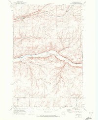 1969 Lamona1972 Print · USGSLincoln County farming and rail transport are captured here in the late sixties, centered on the railroad siding of Lamona. Genealogists and local historians can trace family land via named routes like Thiel Road and Arlt Rd near the banks of Crab Creek.
 - 1982 Map of Ritzville, 1983 Print
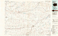 1982 Ritzville1983 Print · USGSEastern Washington's scabland landscape is captured here in the early eighties as a network of rail-towns and coulees. Researchers can trace the BURLINGTON NORTHERN route through Odessa, Lamona, and Ritzville or locate landmarks like Sprague Lake and Karakul Hills.
 - 2011 Map of Lamona, 2011 Print
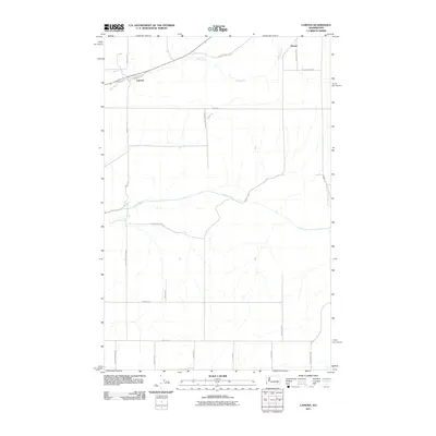 2011 Lamona2011 Print · USGSCovers Lamona, including Downs, Adams County, and other nearby areas
 - 2013 Map of Lamona, 2013 Print
 2013 Lamona2013 Print · USGSCovers Lamona, including Downs, Adams County, and other nearby areas
 - 2017 Map of Lamona, 2017 Print
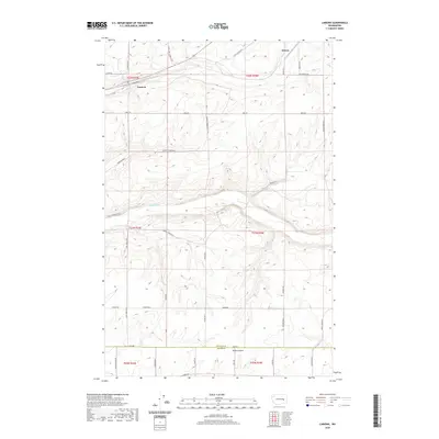
 2017 Lamona2017 Print · USGSCovers Lamona, including Downs, Adams County, and other nearby areas
 - 2020 Map of Lamona, 2020 Print
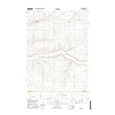
 2020 Lamona2020 Print · USGSCovers Lamona, including Downs, Adams County, and other nearby areas
 - 2023 Map of Lamona, 2023 Print
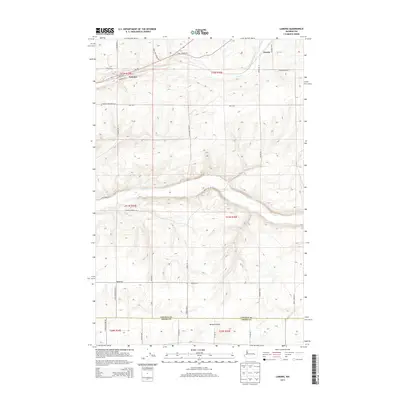
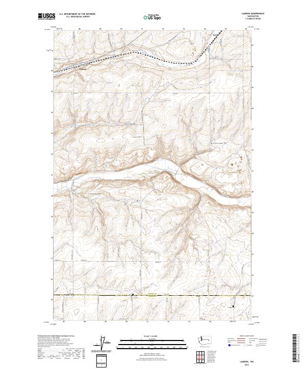 2023 Lamona2023 Print · USGSThe rural coulee country of eastern Washington is captured here in 2023, showing the enduring agricultural settlements at the county line. Researchers can locate family landmarks such as Griffith Cem, County Line Cem, and the small community of Lamona.
End of results
Showing maps 1-10 of 10
Top cities near Lamona
Frequently asked questions
- What are the different types of historical maps available for Lamona?
- What is the oldest map of Lamona?
- Where can I purchase historical maps of Lamona for my home or office?
- Where can I download high-res historical maps of Lamona?
- Are there historical topographic maps available for Lamona?
- Is there historical aerial imagery available for Lamona?
- Where are historical maps of Lamona sourced from?