Old Maps of Wilbur, Washington for Academic Research
Study the evolution of Wilbur with 14 high-resolution historic maps. Whether you're teaching, researching, or modeling changes in land use, these maps provide essential visual documentation of urban, environmental, and geographic change.
- Analyze long-term change: Track patterns in development, transportation, and natural features.
- Ideal for environmental or urban studies: Support academic projects with primary historical map data.
- Use in the classroom or lab: Educators and researchers rely on these maps to bring historical context to life.
These maps are a powerful tool for teaching, research, and visualizing how Wilbur has changed over the decades.
Wilbur, WA maps
(14)- 1948 Map of Grand Coulee Dam, 1955 Print
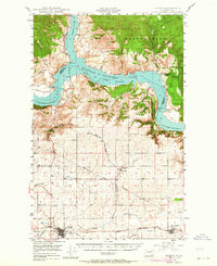
 1948 Grand Coulee Dam1955 Print · USGSThe Grand Coulee region underwent a massive transformation by the late 1940s as the dam transformed the river valley into a sprawling reservoir. Trace the growth of Coulee Dam and Grand Coulee, and locate rural landmarks like the Grand Coulee Grange and Bagdad Junction.6 unique versions available
 - 1948 Map of Wilbur, 1964 Print
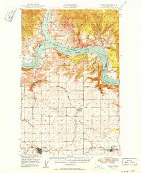
 1948 Wilbur1964 Print · USGSLincoln County is captured here in the years following the creation of the Grand Coulee reservoir. Genealogists and historians can trace the rail-side growth of Wilbur and Creston or locate rural landmarks like the Potlatch Grange and Sherman.2 unique versions available
 - 1950 Map of Wilbur
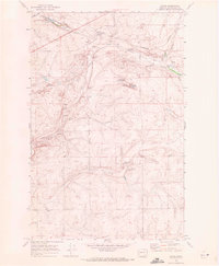
 1950 Wilbur1950 Print · USGSThe Washington plateau and the newly formed Franklin D Roosevelt Lake appear here in the late 1940s as the regional landscape adjusted to massive hydrological change. Genealogists can locate family landmarks in Wilbur and Creston, or trace rural life through the Potlatch Grange and Keller Ferry.
 - 1950 Map of Grand Coulee Dam
 1950 Grand Coulee Dam1950 Print · USGSThe Grand Coulee region during the late 1940s reveals a landscape transformed by the new reservoir and the massive engineering of the dam. Researchers can trace local history through the Lafollette Cem, the community at Elmer City, and rural sites like the Grand Coulee Grange.2 unique versions available
 - 1953 Map of Ritzville, 1966 Print
 1953 Ritzville1966 Print · USGSEastern Washington was undergoing a massive agricultural and industrial transformation in the mid-fifties as irrigation from the Grand Coulee Dam reached the plateau. Researchers can trace the mid-century rail network of the Great Northern and locate vital local sites like Larson Air Force Base and Odessa.3 unique versions available
 - 1959 Map of Ritzville
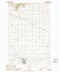
 1959 Ritzville1959 Print · USGSEastern Washington in the late fifties reveals a landscape transformed by massive irrigation projects and postwar growth. Genealogists and historians can trace rail-line communities from Ritzville to Davenport and locate landmarks like Larson Air Force Base and Telford Station.
 - 1965 Map of Ritzville
 1965 Ritzville1965 Print · USGSCentral Washington during the mid-sixties shows a landscape shaped by massive irrigation projects and the Cold War. Genealogists and historians can trace rail-town life and military presence through Ephrata Air Base, the Telford Station, and local schools.
 - 1969 Map of Govan, 1972 Print
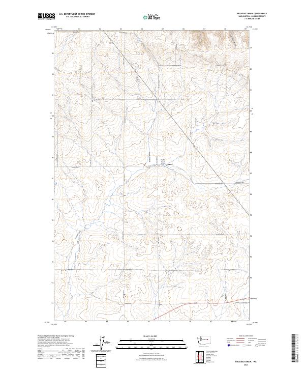
 1969 Govan1972 Print · USGSLincoln County wheat country is captured in the late sixties, centered on the railroad siding of Govan. Genealogists and historians can trace the landscape of the Big Bend through Grain Elevators, the Burlington Northern line, and local landmarks like Lewis Bridge.
 - 1983 Map of Coulee Dam
 1983 Coulee Dam1983 Print · USGSThe high plateau and deep coulees of central Washington are captured here in the early eighties, centered on the massive Franklin D Roosevelt Lake and the towns of Coulee Dam and Grand Coulee. Researchers can trace the Burlington Northern rail corridor through old stops at Govan and Mondovi or locate the historic Fort Spokane.2 unique versions available
 - 1989 Map of Wilbur
 1989 Wilbur1989 Print · USGSThe town of Wilbur and its surrounding Lincoln County ranch lands are documented here in the late eighties. Genealogists and local historians can locate the community Cem, trace the path of Goose Creek, and identify landmarks like the Wilbur Airport.
 - 1989 Map of Broadax Draw
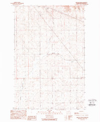 1989 Broadax Draw1989 Print · USGSThe high plateau of Lincoln County is documented here in the late eighties as a land of utility corridors and small outposts. Researchers can locate remote features like Hesseltine, Broadax Spring, and the private Landing Strip near Corbett.
 - 2023 Map of Broadax Draw, 2023 Print
 2023 Broadax Draw2023 Print · USGSLincoln County ranching country is documented here in the early twenty-first century, showing a landscape defined by draws and family-named roads. Trace rural landmarks like the Sheffels Ranch Airport and the waters of Broadax Spring.
 - 2023 Map of Govan, 2023 Print
 2023 Govan2023 Print · USGSThe settlement of Govan and its surrounding plateau are documented in this recent survey of Lincoln County. Researchers can trace rural property boundaries and water features like Fiddle Box Spring, Hole in the Wall Lake, and the path of Wilson Creek.
 - 2023 Map of Wilbur, 2023 Print
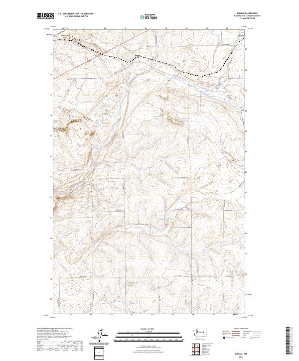
 2023 Wilbur2023 Print · USGSWilbur and the surrounding Lincoln County wheat country are captured here in the early twenty-first century. Researchers can trace family ties at the Wilbur Cemetery or explore the rural landscape around Bandys Lake and Sage Hen Draw.
End of results
Showing maps 1-14 of 14
Top cities near Wilbur
Frequently asked questions
- What are the different types of historical maps available for Wilbur?
- What is the oldest map of Wilbur?
- Where can I purchase historical maps of Wilbur for my home or office?
- Where can I download high-res historical maps of Wilbur?
- Are there historical topographic maps available for Wilbur?
- Is there historical aerial imagery available for Wilbur?
- Where are historical maps of Wilbur sourced from?