2020s Maps of Wilbur, Washington
Explore 3 historic maps of Wilbur from the 2020s. These maps offer a rare glimpse into what life looked like during the 2020s — showing old roads, neighborhoods, homes, and landmarks that have changed or disappeared over time.
Whether you're researching your family's past, planning a metal detecting trip, or studying how Wilbur's landscape evolved across the 2020s, these high-resolution maps are a powerful tool for exploring the history of this region.
- Focus on a specific era: All maps on this page are from the 2020s, giving you a focused view of this time period.
- See what’s changed: Compare century-old streets, trails, and buildings to today's modern landscape using overlays and satellite layers.
- Research with precision: Use these maps for genealogy, historical research, land use analysis, or educational projects.
- View, download, or print: Maps are fully viewable online in high resolution, and can be downloaded or printed for your own records.
Start exploring Wilbur's history through authentic maps from the 2020s. This is your window into the past.
Wilbur, WA maps
(3)- 2023 Map of Broadax Draw, 2023 Print
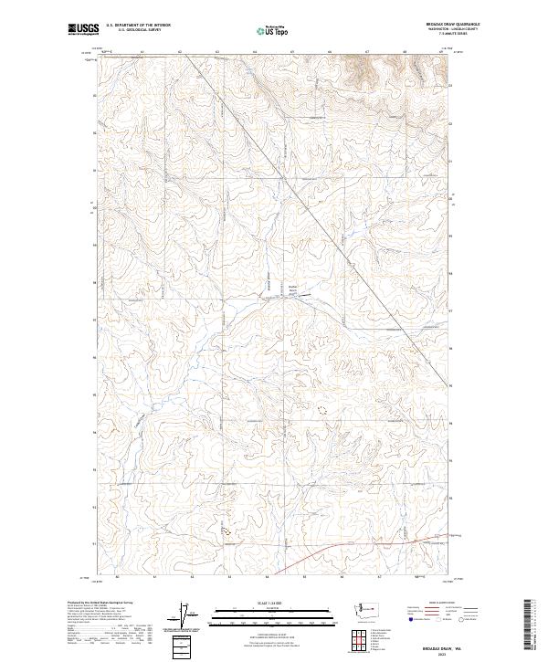 2023 Broadax Draw2023 Print · USGSLincoln County ranching country is documented here in the early twenty-first century, showing a landscape defined by draws and family-named roads. Trace rural landmarks like the Sheffels Ranch Airport and the waters of Broadax Spring.
 - 2023 Map of Govan, 2023 Print
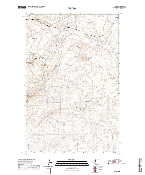 2023 Govan2023 Print · USGSThe settlement of Govan and its surrounding plateau are documented in this recent survey of Lincoln County. Researchers can trace rural property boundaries and water features like Fiddle Box Spring, Hole in the Wall Lake, and the path of Wilson Creek.
 - 2023 Map of Wilbur, 2023 Print
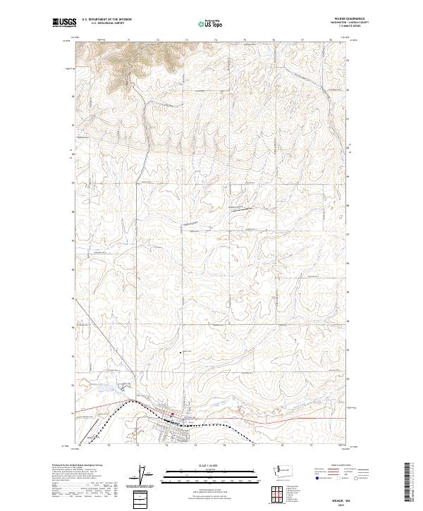 2023 Wilbur2023 Print · USGSWilbur and the surrounding Lincoln County wheat country are captured here in the early twenty-first century. Researchers can trace family ties at the Wilbur Cemetery or explore the rural landscape around Bandys Lake and Sage Hen Draw.
End of results
Showing maps 1-3 of 3
Top cities near Wilbur
Frequently asked questions
- What are the different types of historical maps available for Wilbur?
- What is the oldest map of Wilbur?
- Where can I purchase historical maps of Wilbur for my home or office?
- Where can I download high-res historical maps of Wilbur?
- Are there historical topographic maps available for Wilbur?
- Is there historical aerial imagery available for Wilbur?
- Where are historical maps of Wilbur sourced from?