Old Maps of Carlton, Washington for Genealogy
Trace your family roots with 12 historic maps of Carlton. These high-res maps reveal old neighborhoods, homesites, landmarks, and streets — helping you uncover where your ancestors lived and how the area evolved over time.
- Explore historic neighborhoods: Identify where your relatives may have lived in the 1800s or 1900s.
- Compare maps over time: Trace the changes in streets, buildings, and landmarks for multi-generational research.
- Perfect for genealogy & ancestry research: Used by family historians and researchers to map out lineage and migration.
These maps are an incredible resource for exploring your personal connection to Carlton's past.
Carlton, WA maps
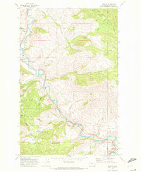
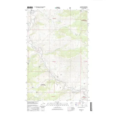
(12)- 1899 Map of Methow, 1963 Print
 1899 Methow1963 Print · USGSThe Methow Valley and its high-mountain tributaries appear here during the late nineteenth-century settlement period. Researchers can trace early river outposts like Winthrop and Twisp or locate family landmarks near Pearrygin Lake and Elbow Coulee.
 - 1901 Map of Methow
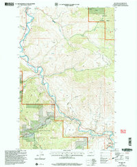
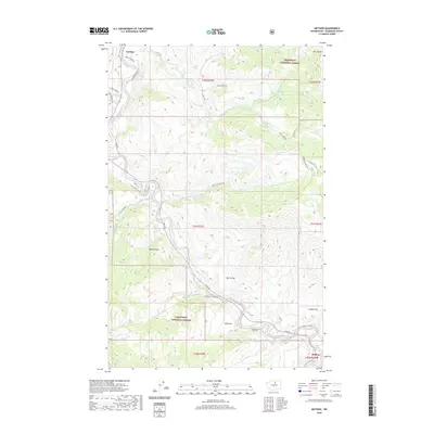
 1901 Methow1901 Print · USGSThe Methow Valley at the turn of the century was a frontier of early settlements and protected forest reserves. Genealogists and historians can trace the early footprints of Winthrop and Silver, or locate landmarks along Sawtooth Ridge and the shores of Lake Chelan.6 unique versions available
 - 1955 Map of Concrete, 1967 Print
 1955 Concrete1967 Print · USGSThe North Cascades in the mid-fifties reveal a landscape of deep glacier-fed lakes and riverside timber towns. You can trace the Great Northern rail lines through Granite Falls or locate remote outposts like Stehekin and Marblemount along the Skagit and Chelan waters.
 - 1958 Map of Concrete
 1958 Concrete1958 Print · USGSThe North Cascades and Skagit Valley are captured here in the late fifties, showing a landscape defined by glacier-carved peaks and river-bottom settlements. Genealogists and historians can locate remote mining sites like Holden Mine and mountain outposts such as Stehekin, Marblemount, and Mazama.2 unique versions available
 - 1962 Map of Concrete
 1962 Concrete1962 Print · USGSThe Northern Cascades in the early sixties reveal a landscape of high alpine peaks and deep river valleys before the modern park era. Genealogists and historians can trace rail-and-river towns like Concrete, Darrington, and Stehekin, alongside industry at the Holden Mine.
 - 1968 Map of Methow, 1972 Print
 1968 Methow1972 Print · USGSThe Methow Valley in the late 1960s was a landscape of riverside settlements and forest interior. Researchers can trace the river-centered economy through features like the Footbridge near Carlton and mining sites like the Mine near Cow Creek.
 - 2001 Map of Methow, 2004 Print
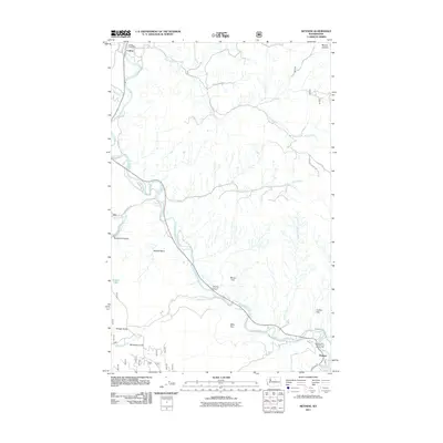
 2001 Methow2004 Print · USGSThe Methow River valley at the turn of the twenty-first century reveals a landscape of riverside settlements and forest lands. Genealogists and hikers can trace old routes near Carlton, locate the Prospect Mine, and find the river Footbridge at Methow.
 - 2011 Map of Methow, 2011 Print
 2011 Methow2011 Print · USGSCovers Carlton, including Methow, Okanogan County, and other nearby areas
 - 2014 Map of Methow, 2014 Print
 2014 Methow2014 Print · USGSCovers Carlton, including Methow, Okanogan County, and other nearby areas
 - 2017 Map of Methow, 2017 Print
 2017 Methow2017 Print · USGSCovers Carlton, including Methow, Okanogan County, and other nearby areas
 - 2020 Map of Methow, 2020 Print
 2020 Methow2020 Print · USGSCovers Carlton, including Methow, Okanogan County, and other nearby areas
 - 2023 Map of Methow, 2023 Print
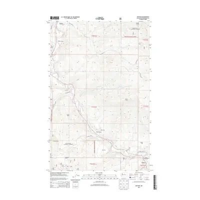
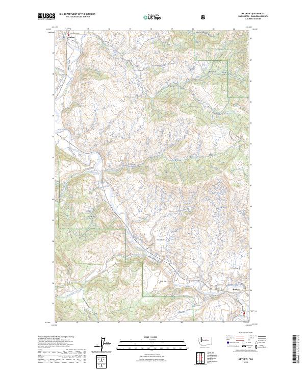 2023 Methow2023 Print · USGSThe Methow Valley in the early twenty-first century reveals a landscape shaped by river transport and forest management. Researchers can trace historic routes like Stage Coach Rd and find the small riverbank communities of Carlton and Methow.
End of results
Showing maps 1-12 of 12
Top cities near Carlton
Frequently asked questions
- What are the different types of historical maps available for Carlton?
- What is the oldest map of Carlton?
- Where can I purchase historical maps of Carlton for my home or office?
- Where can I download high-res historical maps of Carlton?
- Are there historical topographic maps available for Carlton?
- Is there historical aerial imagery available for Carlton?
- Where are historical maps of Carlton sourced from?