Old Maps of Disautel, Washington for Genealogy
Trace your family roots with 10 historic maps of Disautel. These high-res maps reveal old neighborhoods, homesites, landmarks, and streets — helping you uncover where your ancestors lived and how the area evolved over time.
- Explore historic neighborhoods: Identify where your relatives may have lived in the 1800s or 1900s.
- Compare maps over time: Trace the changes in streets, buildings, and landmarks for multi-generational research.
- Perfect for genealogy & ancestry research: Used by family historians and researchers to map out lineage and migration.
These maps are an incredible resource for exploring your personal connection to Disautel's past.
Disautel, WA maps
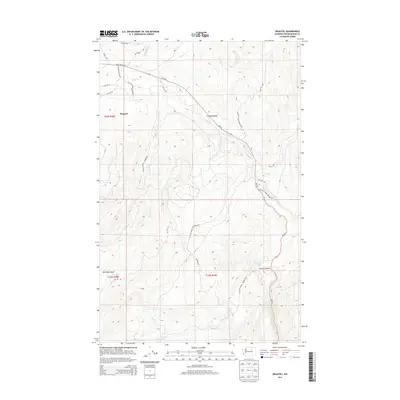
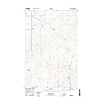
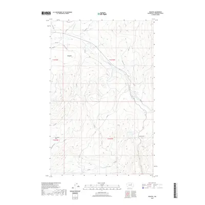
(10)- 1952 Map of Disautel, 1954 Print
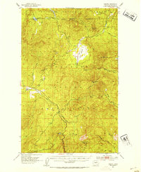 1952 Disautel1954 Print · USGSHigh in the Okanogan country during the early fifties, this area shows the intersection of the Colville Indian Reservation and federal forest lands. Researchers can locate the settlement of Disautel and trace old mountain routes past Moses Mountain and Crawfish Lake.3 unique versions available
 - 1954 Map of Okanogan, 1964 Print
 1954 Okanogan1964 Print · USGSNorth Central Washington’s interior comes into focus during the mid-fifties, showing the rise of the Columbia River reservoir system. Genealogists and historians can trace the Great Northern rail line and locate historical mining operations at the Mountain Lion Mine or Gold Hill Mine.2 unique versions available
 - 1958 Map of Okanogan
 1958 Okanogan1958 Print · USGSThe Okanogan River valley and the Colville Indian Reservation are shown here in the late fifties, during a period of established river and rail commerce. Researchers can trace the Great Northern line through Oroville or locate landmarks like the Knowlton School and Orient Ranger Station.
 - 1983 Map of Omak
 1983 Omak1983 Print · USGSIn the early 1980s, the Okanogan and Columbia river valleys served as a vital agricultural and timber hub. Researchers can trace family-named landmarks like Pearl Hill and Jackass Butte, alongside vanished mining history at the Red Shirt Mine.2 unique versions available
 - 1989 Map of Disautel
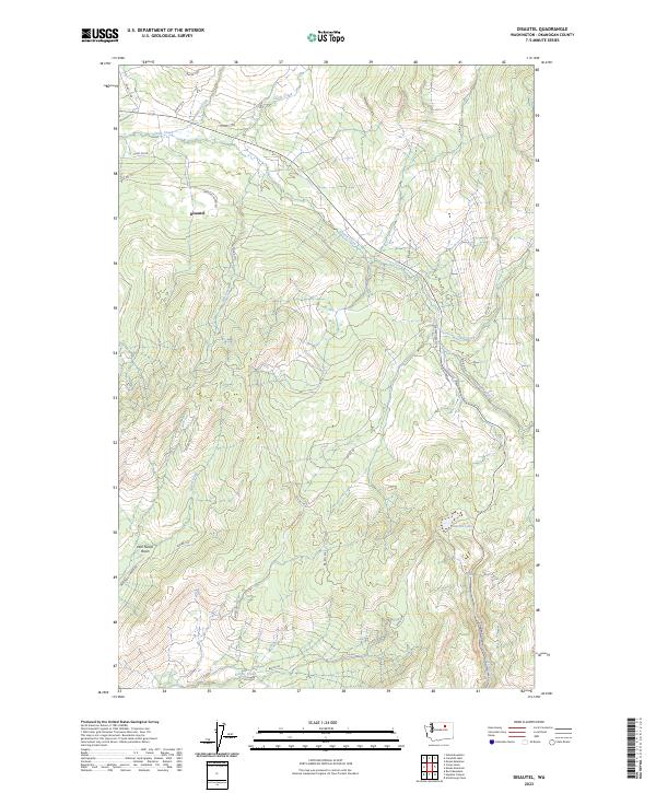
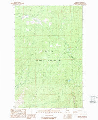 1989 Disautel1989 Print · USGSThe Colville Indian Reservation in the late 1980s reveals a high-country landscape of timber and creeks. Genealogists and historians can trace the small settlements of Disautel and Kartar or locate features like Summit Lake and Coyote Canyon.
 - 2011 Map of Disautel, 2011 Print
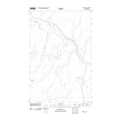 2011 Disautel2011 Print · USGSCovers Disautel, including Okanogan County, United States, and other nearby areas
 - 2014 Map of Disautel, 2014 Print
 2014 Disautel2014 Print · USGSCovers Disautel, including Okanogan County, United States, and other nearby areas
 - 2017 Map of Disautel, 2017 Print
 2017 Disautel2017 Print · USGSCovers Disautel, including Okanogan County, United States, and other nearby areas
 - 2020 Map of Disautel, 2020 Print
 2020 Disautel2020 Print · USGSCovers Disautel, including Okanogan County, United States, and other nearby areas
 - 2023 Map of Disautel, 2023 Print
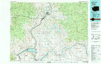
 2023 Disautel2023 Print · USGSDisautel and the surrounding creek basins of Okanogan County are captured here in the early twenty-first century. Researchers can trace the rugged network of BIA roads and family-named landmarks like Dan Nason Basin, Summit Lake, and Coyote Canyon.
End of results
Showing maps 1-10 of 10
Frequently asked questions
- What are the different types of historical maps available for Disautel?
- What is the oldest map of Disautel?
- Where can I purchase historical maps of Disautel for my home or office?
- Where can I download high-res historical maps of Disautel?
- Are there historical topographic maps available for Disautel?
- Is there historical aerial imagery available for Disautel?
- Where are historical maps of Disautel sourced from?