Old Maps of Twisp, Washington for Metal Detecting
Plan your next treasure hunt with 12 historic maps of Twisp. Find old homesites, ghost towns, trails, and gathering spots that may be lost to time — perfect for identifying promising metal detecting locations.
- Locate forgotten sites: Uncover places like long-lost settlements, abandoned rail lines, or gathering spots.
- Plan better hunts: Use map overlays combined with LiDAR or satellite views to narrow in on historically rich areas.
- Made for detectorists: Thousands of hobbyists use these maps to discover relics, coins, and hidden history.
Use these historic maps to boost your research and find new opportunities beneath the surface of Twisp.
Twisp, WA maps
(12)- 1899 Map of Methow, 1963 Print
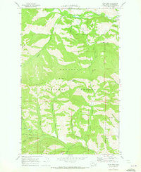
 1899 Methow1963 Print · USGSThe Methow Valley and its high-mountain tributaries appear here during the late nineteenth-century settlement period. Researchers can trace early river outposts like Winthrop and Twisp or locate family landmarks near Pearrygin Lake and Elbow Coulee.
 - 1901 Map of Methow
 1901 Methow1901 Print · USGSThe Methow Valley at the turn of the century was a frontier of early settlements and protected forest reserves. Genealogists and historians can trace the early footprints of Winthrop and Silver, or locate landmarks along Sawtooth Ridge and the shores of Lake Chelan.6 unique versions available
 - 1955 Map of Concrete, 1967 Print
 1955 Concrete1967 Print · USGSThe North Cascades in the mid-fifties reveal a landscape of deep glacier-fed lakes and riverside timber towns. You can trace the Great Northern rail lines through Granite Falls or locate remote outposts like Stehekin and Marblemount along the Skagit and Chelan waters.
 - 1958 Map of Concrete
 1958 Concrete1958 Print · USGSThe North Cascades and Skagit Valley are captured here in the late fifties, showing a landscape defined by glacier-carved peaks and river-bottom settlements. Genealogists and historians can locate remote mining sites like Holden Mine and mountain outposts such as Stehekin, Marblemount, and Mazama.2 unique versions available
 - 1962 Map of Concrete
 1962 Concrete1962 Print · USGSThe Northern Cascades in the early sixties reveal a landscape of high alpine peaks and deep river valleys before the modern park era. Genealogists and historians can trace rail-and-river towns like Concrete, Darrington, and Stehekin, alongside industry at the Holden Mine.
 - 1969 Map of Twisp West, 1973 Print
 1969 Twisp West1973 Print · USGSIn the late 1960s, the mountainous terrain west of Twisp was a landscape of active mining and forest service outposts. Researchers can trace historic access routes via Pack Trails and locate significant industrial sites like the Alder Mine and the Lookout Tower atop Lookout Mtn.2 unique versions available
 - 1969 Map of Twisp, 1973 Print
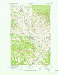 1969 Twisp1973 Print · USGSThe Methow Valley in the late sixties reveals a landscape of riverside settlements and upland mining claims. Genealogists can trace family names at Beaver Creek Cem or locate local landmarks like the Alder Mine and Allen Sch.
 - 1969 Map of Twisp East, 1973 Print
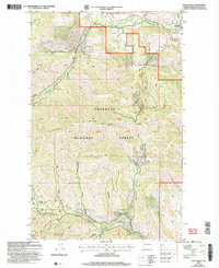
 1969 Twisp East1973 Print · USGSThe Methow Valley in the late sixties shows a landscape of mountain lookouts and river-bottom industry. Trace family roots at Twisp and the Beaver Creek Cem, or locate mining history at the Minnie Mine and various Gravel Pits.
 - 2001 Map of Twisp East, 2004 Print
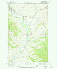
 2001 Twisp East2004 Print · USGSThe Methow River valley near Twisp is captured here at the turn of the millennium, showing a landscape defined by water management and mountain wilderness. Researchers can identify local landmarks like the Beaver Creek Cem, the Allen Sch, and the high-altitude Mount Leecher Lookout.
 - 2002 Map of Twisp West, 2006 Print
 2002 Twisp West2006 Print · USGSThe Okanogan high country was a hub of prospecting activity at the turn of the millennium, centered on the rugged drainages of the Methow Valley. Researchers can trace old mining claims and remote mountain terrain, from the Alder Mine to the heights of Lookout Mtn and Lookout Ridge.
 - 2023 Map of Twisp East, 2023 Print
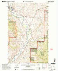
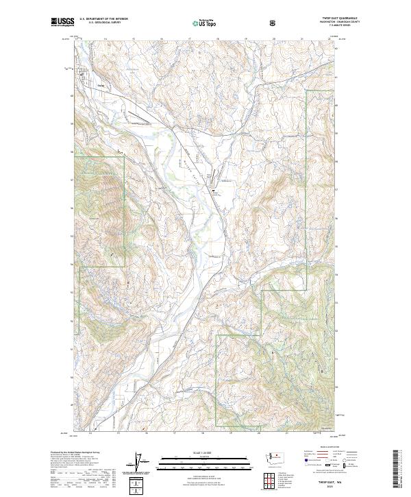 2023 Twisp East2023 Print · USGSThe town of Twisp and the Methow Valley appear in high detail during this contemporary era of the North Cascades. Researchers can trace rural cemetery locations like Beaver Creek Cem or navigate mountain heights from McClure Mtn to Mt Leecher.
 - 2023 Map of Twisp West, 2023 Print
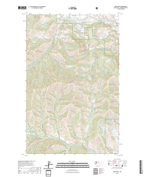 2023 Twisp West2023 Print · USGSThe Okanogan highlands near Twisp are documented in this recent survey, showing the expansion of mountain access and forest management. Researchers can trace the rugged network of Lookout Ridge Trl and the drainages of Libby Creek and Poorman Creek.
End of results
Showing maps 1-12 of 12
Top cities near Twisp
Frequently asked questions
- What are the different types of historical maps available for Twisp?
- What is the oldest map of Twisp?
- Where can I purchase historical maps of Twisp for my home or office?
- Where can I download high-res historical maps of Twisp?
- Are there historical topographic maps available for Twisp?
- Is there historical aerial imagery available for Twisp?
- Where are historical maps of Twisp sourced from?