Old Maps of Loomis, Washington for Genealogy
Trace your family roots with 12 historic maps of Loomis. These high-res maps reveal old neighborhoods, homesites, landmarks, and streets — helping you uncover where your ancestors lived and how the area evolved over time.
- Explore historic neighborhoods: Identify where your relatives may have lived in the 1800s or 1900s.
- Compare maps over time: Trace the changes in streets, buildings, and landmarks for multi-generational research.
- Perfect for genealogy & ancestry research: Used by family historians and researchers to map out lineage and migration.
These maps are an incredible resource for exploring your personal connection to Loomis's past.
Loomis, WA maps
(12)- 1938 Map of Cape Disappointment
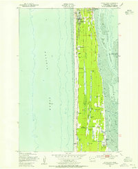
 1938 Cape Disappointment1938 Print · USGSThe Long Beach Peninsula in the late 1930s was a bustling landscape of oyster docks, coastal ranches, and military outposts. Genealogists can trace family holdings like the Loomis Ranch or find local landmarks including the Moby Dick Hotel and Fort Canby.
 - 1943 Map of Copalis Beach
 1943 Copalis Beach1943 Print · USGSThe Washington coast in the 1940s is detailed here from the Olympic Peninsula to the Columbia River. Trace old beach settlements like Moclips and Copalis Beach alongside landmarks like the Willapa Bay Lighthouse.
 - 1949 Map of Ocean Park, 1955 Print
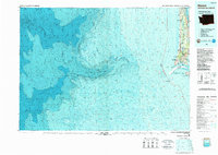
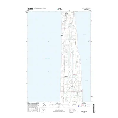
 1949 Ocean Park1955 Print · USGSThe Long Beach Peninsula in the late 1940s was a landscape of coastal ranches, marshes, and small seaside communities. Researchers can trace the legacy of local families and industry through the Loomis Ranch, the Old Railroad Grade, and the Ocean Park-Nahcotta Sch.3 unique versions available
 - 1951 Map of Copalis Beach
 1951 Copalis Beach1951 Print · USGSThe Olympic Peninsula's rugged coast and tribal lands are meticulously detailed in the early 1950s. Genealogists and historians can trace the foundations of coastal communities from Taholah to La Push or locate early markers like the James Island Lighthouse.
 - 1957 Map of Copalis Beach, 1968 Print
 1957 Copalis Beach1968 Print · USGSThe Washington coast during the late fifties reveals a landscape of tribal reservations and timber towns linked by the Northern Pacific RR. Trace family history and land patterns near Forks Cemetery, the shingle mill, or coastal landings like Taholah and Oysterville.2 unique versions available
 - 1963 Map of Copalis Beach
 1963 Copalis Beach1963 Print · USGSThe Washington coast in the early sixties reveals a landscape of massive timber reserves, indigenous lands, and quiet seaside villages. Genealogists and historians can trace the foundations of coastal life through sites like Lone Fir Cemetery, the Dismantled RR, and the historic oyster beds of Oysterville.
 - 1980 Map of Ilwaco, 1989 Print
 1980 Ilwaco1989 Print · USGSThe Washington-Oregon borderlands come into focus during the 1980s, revealing the coastal communities of the North Beach Peninsula and the mouth of the Columbia. Researchers can trace historical sites like Fort Canby State Park, locate the North Head Lighthouse, and explore the shoreline from Ocean Park to Ilwaco.
 - 2011 Map of Ocean Park, 2011 Print
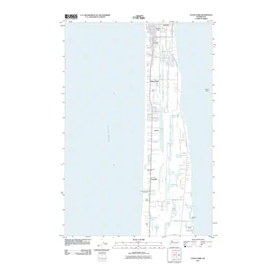 2011 Ocean Park2011 Print · USGSCovers Loomis, including Ocean Park, Klipsan Beach, and other nearby areas
 - 2014 Map of Ocean Park, 2014 Print
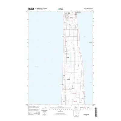 2014 Ocean Park2014 Print · USGSCovers Loomis, including Ocean Park, Klipsan Beach, and other nearby areas
 - 2017 Map of Ocean Park, 2017 Print
 2017 Ocean Park2017 Print · USGSCovers Loomis, including Ocean Park, Klipsan Beach, and other nearby areas
 - 2020 Map of Ocean Park, 2020 Print
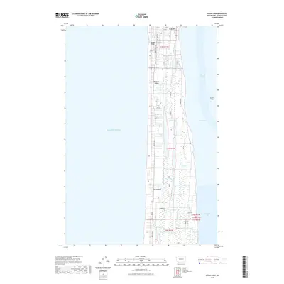 2020 Ocean Park2020 Print · USGSCovers Loomis, including Ocean Park, Klipsan Beach, and other nearby areas
 - 2023 Map of Ocean Park, 2023 Print
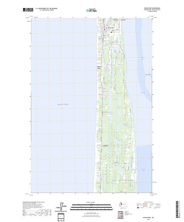 2023 Ocean Park2023 Print · USGSThe North Beach Peninsula in the 2020s remains a unique coastal landscape defined by the thin strip of land between the Pacific and Willapa Bay. Researchers can trace the residential layouts of Ocean Park, locate the Ocean Park Cemetery, or explore the interconnected waters of Loomis Lake and Cranberry Lake.
End of results
Showing maps 1-12 of 12
Top cities near Loomis
- Astoria historical maps
- South Bend historical maps
- Ocean Park historical maps
- Long Beach historical maps
- Ilwaco historical maps
Frequently asked questions
- What are the different types of historical maps available for Loomis?
- What is the oldest map of Loomis?
- Where can I purchase historical maps of Loomis for my home or office?
- Where can I download high-res historical maps of Loomis?
- Are there historical topographic maps available for Loomis?
- Is there historical aerial imagery available for Loomis?
- Where are historical maps of Loomis sourced from?