Old Maps of Eatonville, Washington for Academic Research
Study the evolution of Eatonville with 32 high-resolution historic maps. Whether you're teaching, researching, or modeling changes in land use, these maps provide essential visual documentation of urban, environmental, and geographic change.
- Analyze long-term change: Track patterns in development, transportation, and natural features.
- Ideal for environmental or urban studies: Support academic projects with primary historical map data.
- Use in the classroom or lab: Educators and researchers rely on these maps to bring historical context to life.
These maps are a powerful tool for teaching, research, and visualizing how Eatonville has changed over the decades.
Eatonville, WA maps
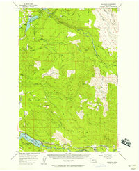
(32)- 1937 Map of Eatonville
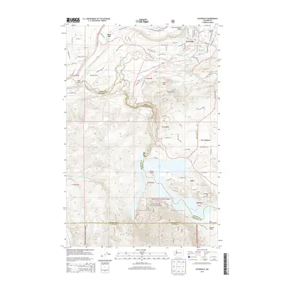
 1937 Eatonville1937 Print · USGSThe timber and mining corridors of Pierce and Lewis Counties are captured here in the mid-1930s. Genealogists and historians can trace the early footprints of Eatonville, locate the Ladd Mine, and follow the path of the Chicago Milwaukee St Paul and Pacific RR.3 unique versions available
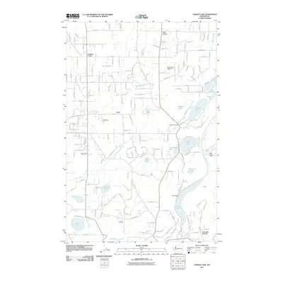
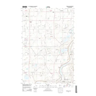
 - 1941 Map of Tanwax Lake
 1941 Tanwax Lake1941 Print · USGSPierce County was a busy corridor for timber and defense just before the war, as shown in this detailed 1941 survey. Genealogists and historians can locate Camp 1 Logging Camp, the old Lacamas School, and the winding Chicago Milwaukee St Paul and Pacific rail line.
 - 1944 Map of Ohop Valley
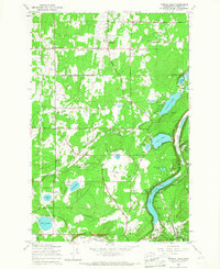
 1944 Ohop Valley1944 Print · USGSThe Ohop Valley and surrounding Pierce County timberlands are shown here during the mid-1940s, just as the region’s hydroelectric and forestry infrastructure was maturing. Genealogists and researchers can trace rural life through sites like the Grange Hall, Edgerton Sch, and the logging community at Clay City.
 - 1949 Map of Ohop Valley, 1958 Print
 1949 Ohop Valley1958 Print · USGSThe Ohop Valley area in the late 1940s was a hub of timber and rail, where the Milwaukee Road winds through the foothills. Genealogists can locate family landmarks like Truth School Cem, Edgerton School, and the settlement at Clay City.2 unique versions available
 - 1953 Map of Hoquiam
 1953 Hoquiam1953 Print · USGSSouthwest Washington in the early fifties shows a landscape shaped by timber, rail, and river commerce from the coast to the Cascades. Genealogists and historians can trace the development of timber towns like Ryderwood and the industrial hubs of Hoquiam and Kelso.2 unique versions available
 - 1956 Map of Kapowsin, 1958 Print
 1956 Kapowsin1958 Print · USGSPierce County’s timber and hydroelectric corridors are in clear view during the mid-fifties, from the rail lines at Kapowsin to the heights of The Divide. Researchers can trace the path of the Electron Flume Road or locate family sites at Neff Ranch and Voss Resort.3 unique versions available
 - 1957 Map of Hoquiam
 1957 Hoquiam1957 Print · USGSCoastal timber ports and inland rail hubs define Southwest Washington during the late fifties. Genealogists can trace early twentieth-century settlements like Bordeaux, Tono, and Cosmopolis alongside the expanding tracks of the Northern Pacific.
 - 1958 Map of Hoquiam, 1969 Print
 1958 Hoquiam1969 Print · USGSSouthwest Washington and the Columbia River estuary appear here in the mid-century, before major landscape shifts. Researchers can trace the rail lines of the Northern Pacific, locate the Fort Henness Site, or explore the Naselle Air Force Station.2 unique versions available
 - 1959 Map of Eatonville, 1967 Print
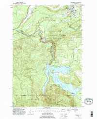
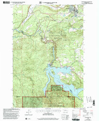
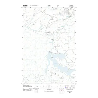
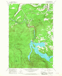 1959 Eatonville1967 Print · USGSEatonville and the Nisqually River valley are shown here during the late fifties, just as the regional hydroelectric and timber landscape reached its mid-century form. Researchers can trace the C M St P & P rail line, locate Alder Dam, and explore the University of Washington's Pack Demonstration Forest.2 unique versions available
 - 1959 Map of Tanwax Lake, 1967 Print
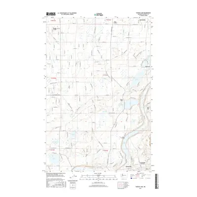
 1959 Tanwax Lake1967 Print · USGSPierce County’s lake-dotted landscape is frozen in the late 1950s, showing a rural community defined by family-named roads and timber interests. You can trace the Milwaukee Road rail line past Clay City or locate family roots near the Rainier Cem and Weyerhaeuser Sch.2 unique versions available
 - 1959 Map of Ohop Valley, 1968 Print
 1959 Ohop Valley1968 Print · USGSPierce County in the late fifties was a landscape of timber, hydroelectric power, and small timber towns. Researchers can trace the Milwaukee Road through Eatonville or locate family roots at the Benston Community Ch and Rainier Cem.
 - 1962 Map of Hoquiam
 1962 Hoquiam1962 Print · USGSSouthwest Washington in the late fifties is defined by the bustling timber ports of Hoquiam and the rail-linked commerce of the interior valleys. Genealogists and historians can trace the early footprints of settlements like Raymond and Pe Ell, or locate family sites at Grand Mound Cem and Odd Fellows Cem.
 - 1980 Map of Centralia
 1980 Centralia1980 Print · USGSThe rail and river corridors of southwestern Washington are captured here in the late twentieth century, showing the region's transition from resource extraction to managed forest land. Researchers can trace the industrial footprint of the Stoker Mine, the rails of the Union Pacific, and the early development of Centralia and Chehalis.
 - 1987 Map of Elbe
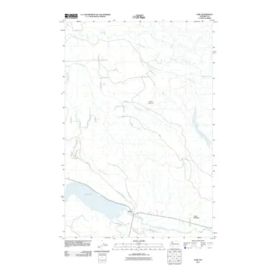
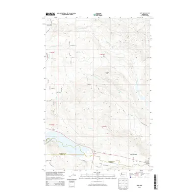
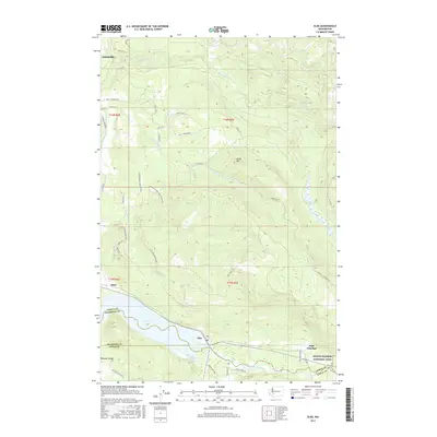
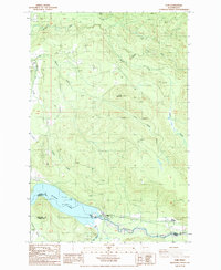 1987 Elbe1987 Print · USGSThe community of Elbe and the eastern end of Alder Lake are captured here during the late 1980s. Local researchers can trace the confluence of the Nisqually River and East Creek, or locate industrial sites like the many Borrow Pits and Park Junction.2 unique versions available
 - 1990 Map of Eatonville, 1995 Print
 1990 Eatonville1995 Print · USGSEatonville and the Nisqually River valley appear here in the final decade of the millennium, defined by heavy timber research and massive hydro projects. Genealogists and local historians can trace the development of Alder, locate the Swanson Airport, and explore the bounds of the Charles Lathrop Pack Experimental Forest.
 - 1990 Map of Tanwax Lake, 1995 Print
 1990 Tanwax Lake1995 Print · USGSPierce County’s lake country is captured here in the 1990s, showing a landscape defined by glacial waters and rural crossroads. Researchers can trace family roots at Rainier Cem or locate former industrial sites at Clay City and Eatonville Junction.
 - 1998 Map of Eatonville, 2003 Print
 1998 Eatonville2003 Print · USGSThe Nisqually River corridor is shown here as it appeared in the late nineties, defined by the hydroelectric developments at Alder Lake and La Grande Reservoir. Researchers can trace the timber and research history of the Charles Lathrop Pack Demonstration Forest or locate landmarks like the Pack Lookout Tower and Little Mashel Falls.
 - 2011 Map of Tanwax Lake, 2011 Print
 2011 Tanwax Lake2011 Print · USGSCovers Eatonville, including Graham, Clay City, and other nearby areas
 - 2011 Map of Elbe, 2011 Print
 2011 Elbe2011 Print · USGSCovers Eatonville, including Elbe, Pierce County, and other nearby areas
 - 2011 Map of Eatonville, 2011 Print
 2011 Eatonville2011 Print · USGSCovers Eatonville, including La Grande, Ohop Bob, and other nearby areas
 - 2013 Map of Elbe, 2013 Print
 2013 Elbe2013 Print · USGSCovers Eatonville, including Elbe, Pierce County, and other nearby areas
 - 2013 Map of Tanwax Lake, 2013 Print
 2013 Tanwax Lake2013 Print · USGSCovers Eatonville, including Graham, Clay City, and other nearby areas
 - 2014 Map of Eatonville, 2014 Print
 2014 Eatonville2014 Print · USGSCovers Eatonville, including La Grande, Ohop Bob, and other nearby areas
 - 2017 Map of Tanwax Lake, 2017 Print
 2017 Tanwax Lake2017 Print · USGSCovers Eatonville, including Graham, Clay City, and other nearby areas
 - 2017 Map of Elbe, 2017 Print
 2017 Elbe2017 Print · USGSCovers Eatonville, including Elbe, Pierce County, and other nearby areas
Showing maps 1-25 of 32
Top cities near Eatonville
- South Hill historical maps
- Spanaway historical maps
- Graham historical maps
- Frederickson historical maps
- Elk Plain historical maps
- Orting historical maps
See more
Frequently asked questions
- What are the different types of historical maps available for Eatonville?
- What is the oldest map of Eatonville?
- Where can I purchase historical maps of Eatonville for my home or office?
- Where can I download high-res historical maps of Eatonville?
- Are there historical topographic maps available for Eatonville?
- Is there historical aerial imagery available for Eatonville?
- Where are historical maps of Eatonville sourced from?