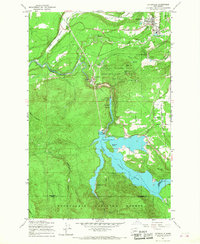
1959 Map of Eatonville
USGS Topo · Published 1967About this map
Eatonville serves as the primary hub in this late 1950s survey of south-central Pierce County, where the C M St P & P railroad snakes through the Mashel River valley. The map documents the hydroelectric infrastructure along the Nisqually River, including the Alder Dam and the expansive Alder Lake. This reservoir system, which submerged portions of the earlier landscape, is anchored by the settlement of Alder and includes landmarks like Bogucki Island and the La Grande Reservoir.
Find a feature on this map
47 named features on this map. Tap any name to fly to it.
Don’t see what you’re looking for? This feature index may not catch every label — zoom into the map to look around manually.
Map Details
Editions of this 1959 Eatonville Map
2 editions found
Other maps of this area

1937 · Eatonville
USGS Topo · 1:125,000

1941 · Tanwax Lake
USGS Topo · 1:62,500

1944 · Ohop Valley
USGS Topo · 1:62,500

1949 · Ohop Valley
USGS Topo · 1:62,500

1953 · Hoquiam
USGS Topo · 1:250,000

1956 · Mineral
USGS Topo · 1:62,500

1956 · Kapowsin
USGS Topo · 1:62,500

1957 · Hoquiam
USGS Topo · 1:250,000

1957 · Morton
USGS Topo · 1:62,500

1958 · Hoquiam
USGS Topo · 1:250,000