
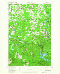
1949 Map of Ohop Valley
USGS Topo · Published 1958About this map
Eatonville serves as a central hub in this post-war landscape, situated near the confluence of the Mashel River and Ohop Creek. The surrounding territory reflects a complex mix of industrial forestry, military land use, and early hydropower development. To the south, the La Grande Dam and the nearby settlement of La Grande represent the era's infrastructure growth, while the Pack Demonstration Forest indicates the region's importance to academic and commercial timber management.
Find a feature on this map
79 named features on this map. Tap any name to fly to it.
Don’t see what you’re looking for? This feature index may not catch every label — zoom into the map to look around manually.
Map Details
Editions of this 1949 Ohop Valley Map
2 editions found
Other maps of this area

1897 · Tacoma
USGS Topo · 1:125,000

1900 · Tacoma
USGS Topo · 1:125,000

1916 · Chehalis
USGS Topo · 1:125,000

1937 · Eatonville
USGS Topo · 1:125,000

1940 · Anderson Island
USGS Topo · 1:62,500

1941 · Tanwax Lake
USGS Topo · 1:62,500

1941 · Tacoma South
USGS Topo · 1:62,500

1942 · Lake Tapps
USGS Topo · 1:62,500

1943 · Willapa
USGS Topo · 1:62,500

1944 · Lake Tapps
USGS Topo · 1:62,500