Old Maps of Concrete, Washington for Metal Detecting
Plan your next treasure hunt with 21 historic maps of Concrete. Find old homesites, ghost towns, trails, and gathering spots that may be lost to time — perfect for identifying promising metal detecting locations.
- Locate forgotten sites: Uncover places like long-lost settlements, abandoned rail lines, or gathering spots.
- Plan better hunts: Use map overlays combined with LiDAR or satellite views to narrow in on historically rich areas.
- Made for detectorists: Thousands of hobbyists use these maps to discover relics, coins, and hidden history.
Use these historic maps to boost your research and find new opportunities beneath the surface of Concrete.
Concrete, WA maps
(21)- 1909 Map of Mt Baker
 1909 Mt Baker1909 Print · USGSThe North Cascades were undergoing a transformation into an industrial frontier during the first decade of the twentieth century. Researchers can trace early railroad lines like the Great Northern and identify vanished logging or mining sites such as Morovits Ranch and the Excelsior Power Plant.3 unique versions available
 - 1915 Map of Mt. Baker, 1925 Print
 1915 Mt. Baker1925 Print · USGSUpper Whatcom and Skagit counties are seen here in the early twentieth century as railroads and mines began to pierce the wilderness. Genealogists and historians can locate early homesteads like Morovits Ranch, the Lone Jack Mine, and the route of the Great Northern railroad.3 unique versions available
 - 1952 Map of Lake Shannon, 1953 Print
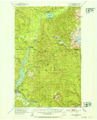 1952 Lake Shannon1953 Print · USGSSkagit County in the early fifties shows a rugged mountain landscape being transformed by hydroelectric power and the timber industry. You can trace the Great Northern rail line through Concrete or locate remote landmarks like the Morovitz Ranch and Faber Ferry.3 unique versions available
 - 1952 Map of Hamilton, 1954 Print
 1952 Hamilton1954 Print · USGSThe Skagit River valley was a bustling corridor of rail and river industry in the early fifties, anchored by the towns of Hamilton and Concrete. Genealogists and historians can trace the GREAT NORTHERN line through Birdsview, find the local High School, or locate the Cem and Dalles Bridge.3 unique versions available
 - 1955 Map of Concrete, 1967 Print
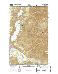
 1955 Concrete1967 Print · USGSThe North Cascades in the mid-fifties reveal a landscape of deep glacier-fed lakes and riverside timber towns. You can trace the Great Northern rail lines through Granite Falls or locate remote outposts like Stehekin and Marblemount along the Skagit and Chelan waters.
 - 1958 Map of Concrete
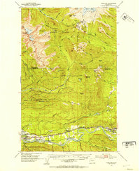
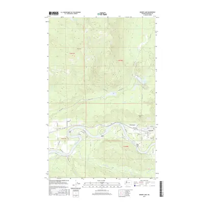
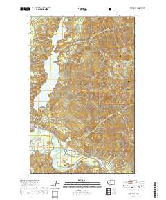
 1958 Concrete1958 Print · USGSThe North Cascades and Skagit Valley are captured here in the late fifties, showing a landscape defined by glacier-carved peaks and river-bottom settlements. Genealogists and historians can locate remote mining sites like Holden Mine and mountain outposts such as Stehekin, Marblemount, and Mazama.2 unique versions available
 - 1962 Map of Concrete
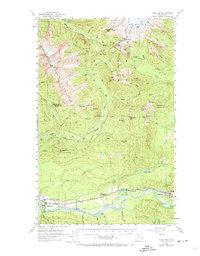
 1962 Concrete1962 Print · USGSThe Northern Cascades in the early sixties reveal a landscape of high alpine peaks and deep river valleys before the modern park era. Genealogists and historians can trace rail-and-river towns like Concrete, Darrington, and Stehekin, alongside industry at the Holden Mine.
 - 1973 Map of Hamilton, 1974 Print
 1973 Hamilton1974 Print · USGSThe Skagit River valley in the early fifties shows a bustling industrial corridor shaped by rail and timber. Researchers can trace the Northern Great Railway through Hamilton, find the old High School in Concrete, or locate the Birdsview Siding.2 unique versions available
 - 1979 Map of Mt. Baker, 1980 Print
 1979 Mt. Baker1980 Print · USGSThe North Cascades in the late 1970s are defined here by high-altitude glaciers and the industrial river valleys of the Skagit. Researchers can trace the rail corridors of the Burlington Northern Railroad and locate mining history at Red Mountain Mine and Silver Lake Mine.
 - 1989 Map of Lake Shannon
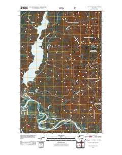
 1989 Lake Shannon1989 Print · USGSUpper Skagit County in the late 1980s reveals a landscape defined by hydro-electric power and timber heritage. Researchers can trace the riverfront at Concrete, find the Sauk (Site), and locate Baker Dam at the base of Lake Shannon.
 - 1989 Map of Grandy Lake
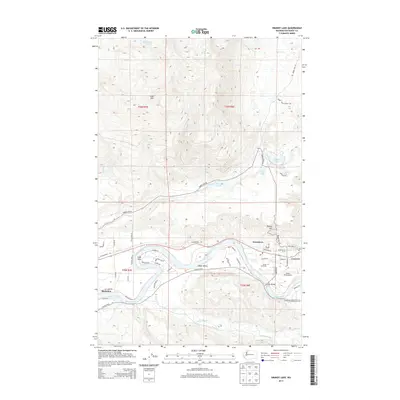
 1989 Grandy Lake1989 Print · USGSThe Skagit River valley in the late eighties shows a landscape defined by riverside settlements and mountain lakes. Researchers can trace the development of Concrete and Birdsview, locate the old Cem, or explore the environs of Lake Tyee.
 - 2011 Map of Grandy Lake, 2011 Print
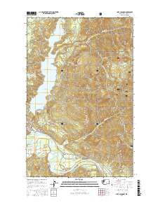
 2011 Grandy Lake2011 Print · USGSCovers Concrete, including Grassmere, Skagit County, and other nearby areas
 - 2011 Map of Lake Shannon, 2011 Print
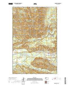
 2011 Lake Shannon2011 Print · USGSCovers Concrete, including Van Horn, Skagit County, and other nearby areas
 - 2014 Map of Grandy Lake, 2014 Print
 2014 Grandy Lake2014 Print · USGSCovers Concrete, including Grassmere, Skagit County, and other nearby areas
 - 2014 Map of Lake Shannon, 2014 Print
 2014 Lake Shannon2014 Print · USGSCovers Concrete, including Van Horn, Skagit County, and other nearby areas
 - 2017 Map of Grandy Lake, 2017 Print
 2017 Grandy Lake2017 Print · USGSCovers Concrete, including Grassmere, Skagit County, and other nearby areas
 - 2017 Map of Lake Shannon, 2017 Print
 2017 Lake Shannon2017 Print · USGSCovers Concrete, including Van Horn, Skagit County, and other nearby areas
 - 2020 Map of Grandy Lake, 2020 Print
 2020 Grandy Lake2020 Print · USGSCovers Concrete, including Grassmere, Skagit County, and other nearby areas
 - 2020 Map of Lake Shannon, 2020 Print
 2020 Lake Shannon2020 Print · USGSCovers Concrete, including Van Horn, Skagit County, and other nearby areas
 - 2023 Map of Grandy Lake, 2023 Print
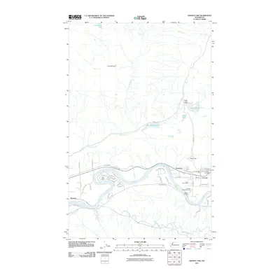
 2023 Grandy Lake2023 Print · USGSThe Skagit River corridor and the town of Concrete are shown here in the early 2020s, capturing the modern layout of this historic timber and river gateway. Researchers can trace local landmarks like Mears Field, Forest Park Cem, and the community of Grassmere.
 - 2023 Map of Lake Shannon, 2023 Print
 2023 Lake Shannon2023 Print · USGSThe northern Skagit Valley comes to life in this recent survey, showcasing the riverside town of Concrete and the expansive Lake Shannon. Researchers can trace local landmarks like Jackman Ridge, the small settlement of Van Horn, and the protected Skagit Wild and Scenic River.
End of results
Showing maps 1-21 of 21
Frequently asked questions
- What are the different types of historical maps available for Concrete?
- What is the oldest map of Concrete?
- Where can I purchase historical maps of Concrete for my home or office?
- Where can I download high-res historical maps of Concrete?
- Are there historical topographic maps available for Concrete?
- Is there historical aerial imagery available for Concrete?
- Where are historical maps of Concrete sourced from?