1950s Maps of Thurston County, Washington
Explore 28 historic maps of Thurston County from the 1950s. These maps offer a rare glimpse into what life looked like during the 1950s — showing old roads, neighborhoods, homes, and landmarks that have changed or disappeared over time.
Whether you're researching your family's past, planning a metal detecting trip, or studying how Thurston County's landscape evolved across the 1950s, these high-resolution maps are a powerful tool for exploring the history of this region.
- Focus on a specific era: All maps on this page are from the 1950s, giving you a focused view of this time period.
- See what’s changed: Compare century-old streets, trails, and buildings to today's modern landscape using overlays and satellite layers.
- Research with precision: Use these maps for genealogy, historical research, land use analysis, or educational projects.
- View, download, or print: Maps are fully viewable online in high resolution, and can be downloaded or printed for your own records.
Start exploring Thurston County's history through authentic maps from the 1950s. This is your window into the past.
Thurston County, WA maps
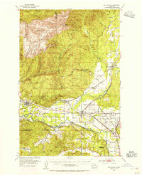
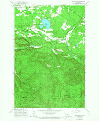
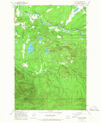
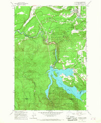
(28)- 1953 Map of Hoquiam
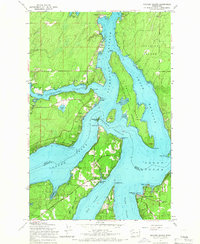
 1953 Hoquiam1953 Print · USGSSouthwest Washington in the early fifties shows a landscape shaped by timber, rail, and river commerce from the coast to the Cascades. Genealogists and historians can trace the development of timber towns like Ryderwood and the industrial hubs of Hoquiam and Kelso.2 unique versions available
 - 1953 Map of Rochester, 1955 Print
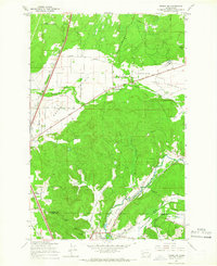
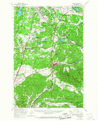
 1953 Rochester1955 Print · USGSThurston and Lewis counties in the early fifties reveal a dense network of timberlands and river-bottom farms. Genealogists can locate the Finnish Cem and Grand Mound Cem, or trace the Fort Henness Site and the vanished logging community of Bordeaux.3 unique versions available
 - 1953 Map of Shelton, 1956 Print
 1953 Shelton1956 Print · USGSThe Mason County waterfront and its timbered interior come alive in this mid-century survey of the inlets surrounding Shelton. Trace the legacy of rural education and military history at Bordeaux Sch, New Kamilche, and the Naval Auxiliary Air Station.2 unique versions available
 - 1956 Map of Kapowsin, 1958 Print
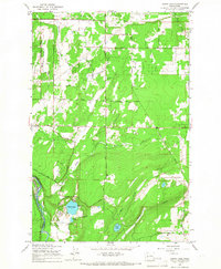
 1956 Kapowsin1958 Print · USGSPierce County’s timber and hydroelectric corridors are in clear view during the mid-fifties, from the rail lines at Kapowsin to the heights of The Divide. Researchers can trace the path of the Electron Flume Road or locate family sites at Neff Ranch and Voss Resort.3 unique versions available
 - 1957 Map of Hoquiam
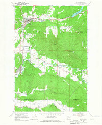
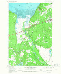
 1957 Hoquiam1957 Print · USGSCoastal timber ports and inland rail hubs define Southwest Washington during the late fifties. Genealogists can trace early twentieth-century settlements like Bordeaux, Tono, and Cosmopolis alongside the expanding tracks of the Northern Pacific.
 - 1958 Map of Seattle, 1966 Print
 1958 Seattle1966 Print · USGSThe Puget Sound region in the mid-fifties showcases a balance of urban growth and Olympic wilderness. Trace the industrial waterfronts of Tacoma, old naval facilities like Keyport Naval Res, and mountain peaks like Mount Constance.3 unique versions available
 - 1958 Map of Hoquiam, 1969 Print
 1958 Hoquiam1969 Print · USGSSouthwest Washington and the Columbia River estuary appear here in the mid-century, before major landscape shifts. Researchers can trace the rail lines of the Northern Pacific, locate the Fort Henness Site, or explore the Naselle Air Force Station.2 unique versions available
 - 1959 Map of Mc Neil Island, 1966 Print
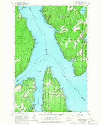
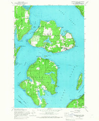 1959 Mc Neil Island1966 Print · USGSThe South Puget Sound islands appear here in the late fifties, dominated by the sprawling infrastructure of the Mc Neil Island (Federal Penitentiary). Researchers can trace historical routes like the Steilacoom Ferry or locate the Hillcrest Cem and Anderson Island Cem.5 unique versions available
 - 1959 Map of Squaxin Island, 1966 Print
 1959 Squaxin Island1966 Print · USGSThe southern reaches of Puget Sound come alive in the late fifties, showing the intricate island and inlet geography of Mason and Thurston counties. Researchers can trace local landmarks like the Boston Harbor Sch, the Squaxin Island Indian Reservation, and the Marine RR at Arcadia.4 unique versions available
 - 1959 Map of McKenna, 1966 Print
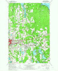
 1959 McKenna1966 Print · USGSIn the Pierce and Thurston county borderlands during the late fifties, the Nisqually River valley anchors a landscape of military training and prairie farming. Genealogists and historians can trace rail lines and early road networks through Yelm, McKenna, and the Grange Hall at Smith Prairie.3 unique versions available
 - 1959 Map of Maytown, 1966 Print
 1959 Maytown1966 Print · USGSThurston County's prairie and timber lands are seen here in the late fifties, where rail and river networks converge. Genealogists and local researchers can trace family landmarks like the Schmidt Sch, the South Union Church, and the rural station at Belmore.3 unique versions available
 - 1959 Map of Vail, 1966 Print
 1959 Vail1966 Print · USGSThurston and Lewis counties come into focus in the late fifties as logging operations shape the terrain. You can trace the complex Logging Railroad and Mulqueen Railroad lines that connect Vail to timber stands at Baumgard Hill.2 unique versions available
 - 1959 Map of Lake Lawrence, 1966 Print
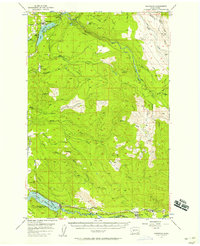
 1959 Lake Lawrence1966 Print · USGSThurston County’s timber and farming lands are captured here in the late fifties, showing the area as the logging economy shaped the landscape. Genealogists and researchers can locate family sites like Reichel Ranch and the Roundtree Cabin or trace the path of the Logging Railroad.2 unique versions available
 - 1959 Map of Tenino SW, 1966 Print
 1959 Tenino SW1966 Print · USGSThe prairies of southern Thurston County meet the coal-rich hills of the Lewis County line during the mid-century. Genealogists and industrial historians can trace the paths of the Northern Pacific Railroad and locate family-named sites like the Monarch Mine, Stoker Mine, or Bucoda.2 unique versions available
 - 1959 Map of Tumwater, 1966 Print
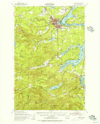
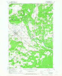
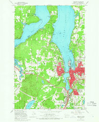 1959 Tumwater1966 Print · USGSMid-century Olympia and Tumwater are documented here just as the post-war era transformed the South Sound. Genealogists and local historians can trace family locations near the State Capitol, McLane Sch, and the rail lines of the Northern Pacific.6 unique versions available
 - 1959 Map of Weir Prairie, 1966 Print
 1959 Weir Prairie1966 Print · USGSThurston County’s landscape in the late fifties is a blend of heavy military training grounds and a busy rural rail corridor. Genealogists can trace family footprints at Burnham Ranch, the local Cem, or follow the twin lines of the Great Northern and Chicago Milwaukee St Paul and Pacific railroads.3 unique versions available
 - 1959 Map of Lacey, 1966 Print
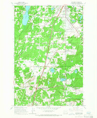
 1959 Lacey1966 Print · USGSThurston County’s transition from timbered prairies to suburban communities is captured here in the late fifties as Lacey and Olympia expanded. Genealogists and local historians can trace the grounds of St Martins College and find vanished landmarks like the Drive-in Theater or Union Mill.6 unique versions available
 - 1959 Map of Bald Hill, 1966 Print
 1959 Bald Hill1966 Print · USGSIn the late fifties, the timberlands of Thurston County were defined by the winding Nisqually and Deschutes rivers. Genealogists and historians can trace the rural infrastructure of the era, from the Lackamas Sch to Deschutes Falls and Fossil Rock.2 unique versions available
 - 1959 Map of Bucoda, 1966 Print
 1959 Bucoda1966 Print · USGSThurston and Lewis Counties are captured here in the late fifties as a hub of rail activity and river valley industry. Researchers can trace the path of the Great Northern railroad, locate the Black Prince Mine, or find the Oregon Trail Monument.3 unique versions available
 - 1959 Map of Longbranch, 1966 Print
 1959 Longbranch1966 Print · USGSThe South Puget Sound shoreline comes alive in the late fifties, showcasing the maritime communities of Longbranch and Ballow before modern development. Genealogists and historians can trace local landmarks like Evergreen Sch, the Lighthouse at Johnson Point, and the docks of Filucy Bay.3 unique versions available
 - 1959 Map of East Olympia, 1966 Print
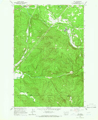
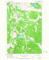 1959 East Olympia1966 Print · USGSThurston County’s rail-and-prairie landscape is captured in the late fifties, showing a vital crossroads of major Pacific Northwest rail lines. Genealogists and historians can trace the tracks and local hubs like East Olympia, Offutt Lake, and Kellys Korner.3 unique versions available
 - 1959 Map of Eatonville, 1967 Print
 1959 Eatonville1967 Print · USGSEatonville and the Nisqually River valley are shown here during the late fifties, just as the regional hydroelectric and timber landscape reached its mid-century form. Researchers can trace the C M St P & P rail line, locate Alder Dam, and explore the University of Washington's Pack Demonstration Forest.2 unique versions available
 - 1959 Map of Tenino, 1967 Print
 1959 Tenino1967 Print · USGSSouthern Thurston County's river-and-rail corridor is captured here during the late fifties, showing the industrial connection between the coal mines and the valley towns. Genealogists and historians can trace family-named sites like Kellys Korner or locate old community hubs such as Grange Hall and the settlement of Tono.
 - 1959 Map of Harts Lake, 1967 Print
 1959 Harts Lake1967 Print · USGSPierce County in the late fifties was a blend of military training grounds and rural river-valley life. Genealogists and historians can trace the community around the Lacamas Sch, identify the Grange Hall, and locate mid-century industrial landmarks like the Centralia Dam.3 unique versions available
 - 1959 Map of Nisqually, 1967 Print
 1959 Nisqually1967 Print · USGSThe Nisqually River delta and the northern reaches of the Fort Lewis Military Reservation are captured here during a period of steady military and coastal development. Genealogists and historians can trace family-named landmarks like Foster Hill and Hoffman Hill or locate early infrastructure at Nisqually Station and Dupont.6 unique versions available
Showing maps 1-25 of 28
Top cities of Thurston County
- Olympia historical maps
- Lacey historical maps
- Tumwater historical maps
- Yelm historical maps
- Grand Mound historical maps
- North Yelm historical maps
See more
Frequently asked questions
- What are the different types of historical maps available for Thurston County?
- What is the oldest map of Thurston County?
- Where can I purchase historical maps of Thurston County for my home or office?
- Where can I download high-res historical maps of Thurston County?
- Are there historical topographic maps available for Thurston County?
- Is there historical aerial imagery available for Thurston County?
- Where are historical maps of Thurston County sourced from?