2000s (21st Century) Maps of Deer Cove, Yakima County
Explore 6 historic maps of Deer Cove from the 2000s (21st Century). These maps offer a rare glimpse into what life looked like during the 2000s — showing old roads, neighborhoods, homes, and landmarks that have changed or disappeared over time.
Whether you're researching your family's past, planning a metal detecting trip, or studying how Deer Cove's landscape evolved across the 2000s, these high-resolution maps are a powerful tool for exploring the history of this region.
- Focus on a specific era: All maps on this page are from the 2000s, giving you a focused view of this time period.
- See what’s changed: Compare century-old streets, trails, and buildings to today's modern landscape using overlays and satellite layers.
- Research with precision: Use these maps for genealogy, historical research, land use analysis, or educational projects.
- View, download, or print: Maps are fully viewable online in high resolution, and can be downloaded or printed for your own records.
Start exploring Deer Cove's history through authentic maps from the 2000s. This is your window into the past.
Deer Cove, Yakima County maps
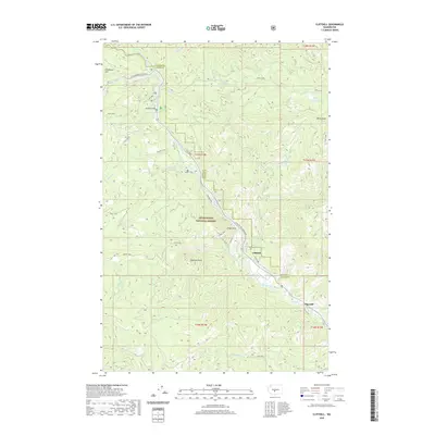
(6)- 2000 Map of Cliffdell, 2001 Print
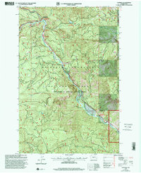 2000 Cliffdell2001 Print · USGSThe Naches River valley in the Central Cascades is captured here at the end of the century, showing a landscape defined by mountain recreation and small riverside settlements. Researchers can trace the grounds of Camp Roganunda, find the Peterson Cem, and locate numerous sites like Sawmill Flat Campground.
 - 2011 Map of Cliffdell, 2011 Print
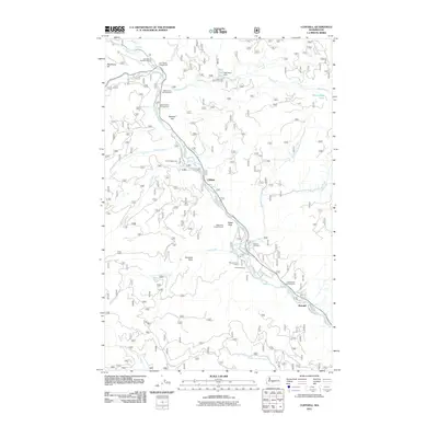 2011 Cliffdell2011 Print · USGSCovers Deer Cove, including Pine Cliffs, Cliffdell, and other nearby areas
 - 2014 Map of Cliffdell, 2014 Print
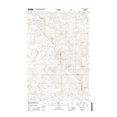 2014 Cliffdell2014 Print · USGSCovers Deer Cove, including Pine Cliffs, Cliffdell, and other nearby areas
 - 2017 Map of Cliffdell, 2017 Print
 2017 Cliffdell2017 Print · USGSCovers Deer Cove, including Pine Cliffs, Cliffdell, and other nearby areas
 - 2020 Map of Cliffdell, 2020 Print
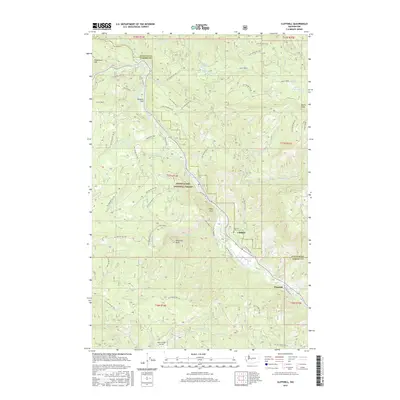
 2020 Cliffdell2020 Print · USGSCovers Deer Cove, including Pine Cliffs, Cliffdell, and other nearby areas
 - 2023 Map of Cliffdell, 2023 Print
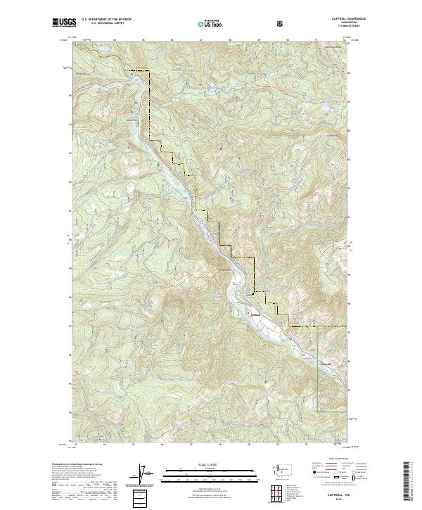 2023 Cliffdell2023 Print · USGSCliffdell and the Naches River canyon are documented here in the early 2020s on the Yakima and Kittitas county line. Genealogists and hikers can trace local landmarks like Peterson Cem, the Sawmill Flat settlement, and Edgar Rock.
End of results
Showing maps 1-6 of 6
Frequently asked questions
- What are the different types of historical maps available for Deer Cove?
- What is the oldest map of Deer Cove?
- Where can I purchase historical maps of Deer Cove for my home or office?
- Where can I download high-res historical maps of Deer Cove?
- Are there historical topographic maps available for Deer Cove?
- Is there historical aerial imagery available for Deer Cove?
- Where are historical maps of Deer Cove sourced from?