1950s Maps of Barbour County, West Virginia
Explore 12 historic maps of Barbour County from the 1950s. These maps offer a rare glimpse into what life looked like during the 1950s — showing old roads, neighborhoods, homes, and landmarks that have changed or disappeared over time.
Whether you're researching your family's past, planning a metal detecting trip, or studying how Barbour County's landscape evolved across the 1950s, these high-resolution maps are a powerful tool for exploring the history of this region.
- Focus on a specific era: All maps on this page are from the 1950s, giving you a focused view of this time period.
- See what’s changed: Compare century-old streets, trails, and buildings to today's modern landscape using overlays and satellite layers.
- Research with precision: Use these maps for genealogy, historical research, land use analysis, or educational projects.
- View, download, or print: Maps are fully viewable online in high resolution, and can be downloaded or printed for your own records.
Start exploring Barbour County's history through authentic maps from the 1950s. This is your window into the past.
Barbour County, WV maps
(12)- 1952 Map of Cumberland
 1952 Cumberland1952 Print · USGSThe Potomac Highlands and the Shenandoah Valley are revealed in this early 1950s survey of the Appalachian interior. Researchers can trace the river-and-rail corridors connecting Cumberland, Winchester, and the recreational waters of Deep Creek Lake.
 - 1954 Map of Charleston
 1954 Charleston1954 Print · USGSWest Virginia’s industrial heart and mountain highlands are captured here during the mid-fifties, centered on the capital city. Researchers can trace historic river-and-rail corridors along the Kanawha River and locate remote peaks within the Monongahela National Forest.
 - 1956 Map of Cumberland, 1966 Print
 1956 Cumberland1966 Print · USGSThe tri-state Highlands in the mid-1950s show a landscape shaped by coal, timber, and the massive presence of the Baltimore & Ohio RR. Researchers can trace the industrial corridor from Cumberland through the Allegheny Mountains to mountain retreats like Deep Creek Lake.6 unique versions available
 - 1956 Map of Clarksburg, 1966 Print
 1956 Clarksburg1966 Print · USGSThe Ohio River valley and the industrial heart of West Virginia are seen here in the mid-1950s as rail and river commerce thrived. Researchers can trace historic transport lines like the Baltimore and Ohio RR and locate ancestral homes in Clarksburg, Moundsville, or Parkersburg.2 unique versions available
 - 1956 Map of Charlottesville, 1966 Print
 1956 Charlottesville1966 Print · USGSThe Shenandoah Valley and Blue Ridge are captured in detail during the mid-1960s as the modern interstate system began to emerge. Genealogists and historians can trace rail-connected hubs like Waynesboro or follow the river paths of the Rapidan River and Rivanna River.4 unique versions available
 - 1957 Map of Cumberland
 1957 Cumberland1957 Print · USGSThe Potomac River valley and the ridges of the Allegheny Front define this mid-century landscape at the intersection of Maryland, West Virginia, and Pennsylvania. Trace the steam-era rail lines of the Baltimore and Ohio RR or locate rural landmarks like St Stephens Church and Stony River Dam.
 - 1957 Map of Charleston, 1966 Print
 1957 Charleston1966 Print · USGSMid-century West Virginia unfolds along the industrial Kanawha River valley and into the high Allegheny Mountains. Genealogists and historians can trace the vital rail lines of the Chesapeake and Ohio and locate riverside settlements from Saint Albans to Buckhannon.3 unique versions available
 - 1958 Map of Charleston
 1958 Charleston1958 Print · USGSMid-century West Virginia is defined here by the industrial corridor of the Kanawha River and the high ridges of the Allegheny Mountains. Researchers can trace the rail networks of the New York Central or locate remote highland communities like Pickens and Hillsboro.
 - 1958 Map of Nestorville, 1960 Print
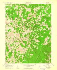
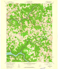
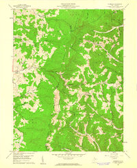
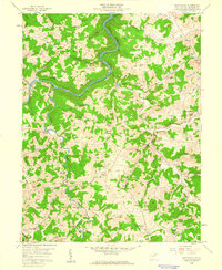 1958 Nestorville1960 Print · USGSBarbour County in the late fifties was a landscape of tucked-away settlements and winding river valleys before widespread modernization. Researchers can trace the heritage of the Tygart Valley through landmarks like Valley Furnace, Clemtown, and the remote Central Chapel Ch.2 unique versions available
 - 1958 Map of Fellowsville, 1960 Print
 1958 Fellowsville1960 Print · USGSIn the late 1950s, the rural hills of Preston County were connected by the George Washington Highway and a web of valley roads. Genealogists can trace family footprints through sites like Sigley Sch, Nazareth Cem, and the village of Fellowsville.3 unique versions available
 - 1958 Map of Thornton, 1960 Print
 1958 Thornton1960 Print · USGSTaylor and Preston Counties are shown in the late fifties as coal mining and rail transport shaped the local economy. Genealogists can trace family names and small-town roots through Knottsville, Bethany Ch, and the Mt View Sch near the Tygart Reservoir.4 unique versions available
 - 1959 Map of Colebank, 1961 Print
 1959 Colebank1961 Print · USGSThe West Virginia highlands near the triple-county corner of Barbour, Preston, and Tucker are captured here in the late fifties. Researchers can trace rural life through numerous mountain schools and churches like Union Chapel and Murphy Sch, alongside the industrial presence of gas wells and the Valley Furnace settlement.4 unique versions available
End of results
Showing maps 1-12 of 12
Top cities of Barbour County
Frequently asked questions
- What are the different types of historical maps available for Barbour County?
- What is the oldest map of Barbour County?
- Where can I purchase historical maps of Barbour County for my home or office?
- Where can I download high-res historical maps of Barbour County?
- Are there historical topographic maps available for Barbour County?
- Is there historical aerial imagery available for Barbour County?
- Where are historical maps of Barbour County sourced from?