Old Maps of Boone County, West Virginia
Explore 156 old maps of Boone County, spanning from 1891 to today. These high-resolution historic maps reveal how streets, neighborhoods, landmarks, and natural features evolved over time — perfect for genealogy, metal detecting, research, and local history exploration.
What you can do with these maps:
- See how Boone County changed over time: Compare historical maps to modern-day views to trace roads, homesites, rail lines & more.
- View detailed metadata: Each map includes creators, publishers, year, scale, and archive source.
- Overlay maps with satellite & LiDAR: Visualize the past alongside modern tools to explore terrain & human change.
- Trusted historical sources: Maps sourced from the USGS, Library of Congress, and other archives.
- Access maps your way: View online, download high-res files, or order prints for personal or research use.
Start exploring old maps of Boone County to uncover forgotten places, hidden landmarks, and the deep history beneath your feet.
Boone County, WV maps
(156)- 1891 Map of Oceana
 1891 Oceana1891 Print · USGSSouthern West Virginia in the late nineteenth century was a world of deep valleys and isolated mountain settlements. Genealogists and historians can trace early family sites along the Guyandotte River near Oceana, Logan C.H., and Whites Mills.
 - 1891 Map of Raleigh
 1891 Raleigh1891 Print · USGSRaleigh County and the New River Gorge are captured in the late nineteenth century during the initial rise of the coal industry. Genealogists can trace family holdings along Paint Creek or locate early river settlements such as Quinnimont and Fire Creek.
 - 1893 Map of Oceana
 1893 Oceana1893 Print · USGSSouthern West Virginia’s rugged coal country is captured here in the late nineteenth century, showing a landscape of deep hollows and high ridges. Researchers can trace ancestral homes and early industry at Logan C.H., Whites Mills, and Jarrold's Valley.
 - 1897 Map of Kanawha Falls
 1897 Kanawha Falls1897 Print · USGSWest Virginia's river valleys and burgeoning industrial corridors are captured here in the late nineteenth century. You can trace the early rail networks and riverside settlements such as Montgomery, Clendenin, and the river engineering at Lock 2.
 - 1897 Map of Raleigh
 1897 Raleigh1897 Print · USGSThe New River Gorge area at the height of the coal and rail boom comes to life on this late nineteenth-century sheet. Genealogists and historians can trace riverside rail stops like Thurmond and Glenjean, or explore the high-plateau settlement at Marshes P.O. (Trap Hill).
 - 1898 Map of Oceana
 1898 Oceana1898 Print · USGSSouthern West Virginia in the late nineteenth century remains a landscape of isolated mountain settlements and complex river drainages. Genealogists can trace early homesteads and family-named landmarks near Oceana, Pineville, and Baileysville before the rise of the modern coal industry.4 unique versions available
 - 1899 Map of Charleston
 1899 Charleston1899 Print · USGSWest Virginia's capital and the surrounding coalfields are documented here during the late nineteenth-century industrial boom. Researchers can trace early mining operations at the Graham Mines and follow pioneer rail lines like the Winifrede R. R. through the rugged river hollows.6 unique versions available
 - 1900 Map of Kanawha Falls
 1900 Kanawha Falls1900 Print · USGSThe Kanawha and Elk rivers converge here at the turn of the century as the coal and rail industries were rapidly transforming the West Virginia landscape. Genealogists and historians can trace riverside settlements like Montgomery and Coalburg or follow the paths of the Chesapeake and Ohio RR and early river navigation at Lock 2.
 - 1901 Map of Kanawha Falls
 1901 Kanawha Falls1901 Print · USGSWest Virginia's coal and rail heartland is captured here at the end of the nineteenth century, as river navigation and railroads transformed the Kanawha Valley. Genealogists and historians can trace the early footprints of Montgomery, find family sites near Kanawha Falls, and locate landmarks like Hawks Nest or Powellton.3 unique versions available
 - 1902 Map of Raleigh
 1902 Raleigh1902 Print · USGSRaleigh County and the New River Gorge were entering their industrial peak when this survey was conducted in the late nineteenth century. Researchers can trace the early rail network of the CHESAPEAKE AND OHIO RR through booming towns like Thurmond, Beury, and East Sewell.3 unique versions available
 - 1908 Map of Montgomery
 1908 Montgomery1908 Print · USGSWest Virginia's industrial heartland is revealed in the early twentieth century as a dense network of coal towns and river locks. Trace the rail-and-river economy through Cabin Creek Junction, the Wheeler Islands, and the namesake town of Montgomery.
 - 1909 Map of Peytona
 1909 Peytona1909 Print · USGSBoone and Kanawha Counties are shown here during a period of industrial expansion along the river forks and mountain ridges. Researchers can trace early railroad sidings and post offices at Winifrede Jct, Lewiston PO, and the riverside community of Peytona.
 - 1910 Map of Bald Knob
 1910 Bald Knob1910 Print · USGSSouthern West Virginia in the early twentieth century was a landscape of remote mountain gaps and emerging rail corridors. Genealogists and historians can trace early settlements like Jarrolds Valley and Van, or locate historic crossing points like Walnut Gap and Indian Gap.2 unique versions available
 - 1910 Map of Montgomery
 1910 Montgomery1910 Print · USGSThe industrial corridor of the Kanawha Valley is seen here in the early 1900s, defined by the river and the competing rail lines of the era. Genealogists and historians can trace the foundations of coal-field communities at Paint Creek Junction, Coalburg, and Pratt PO.3 unique versions available
 - 1911 Map of Marshes
 1911 Marshes1911 Print · USGSRaleigh County and the surrounding highlands are shown just after the turn of the century, when mountain life centered on isolated creek hollows. Genealogists can trace family footprints through dozens of rural landmarks like Meadow Inn School, Matville P O, and Peachtree School.
 - 1911 Map of Peytona
 1911 Peytona1911 Print · USGSSouthern West Virginia’s coal and rail landscape is captured here in the decade before the Great War, centered on the winding Coal River. Researchers can trace the early rail hubs and hollows including Winifrede, Peytona, and the vanished Lewiston PO.3 unique versions available
 - 1911 Map of Madison
 1911 Madison1911 Print · USGSBoone and Lincoln counties appear here in the early twentieth century as the rail network began to reshape the coal-bearing valleys. Researchers can trace early infrastructure through the Chesapeake and Ohio line and settlements like Madison, Uneeda, and Danville.2 unique versions available
 - 1912 Map of Bald Knob
 1912 Bald Knob1912 Print · USGSBoone County and the surrounding coalfields are captured in the early twentieth century as rail lines began to penetrate the deep Appalachian hollows. Genealogists and historians can trace early settlements at Whitesville, Jarrolds Valley, and Gordon alongside the growing C. and O. R. R. line.3 unique versions available
 - 1913 Map of Logan
 1913 Logan1913 Print · USGSThe West Virginia coalfields are seen here during their early industrial expansion in the years before the Great War. Genealogists and researchers can trace family landmarks and rail-side settlements like Logan, Pecks Mill, and Ethel along the Guyandot River.3 unique versions available
 - 1914 Map of Eccles
 1914 Eccles1914 Print · USGSRaleigh County's mountain settlements and coal-country railways are captured here in the early twentieth century. Researchers can trace the heritage of rural communities through dozens of schoolhouses like White Rose School and local landmarks such as Meadow Inn or the Trap Hill Marshes PO.2 unique versions available
 - 1926 Map of Logan, 1963 Print
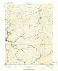 1926 Logan1963 Print · USGSWest Virginia's southern coalfields are shown here in the mid-1920s, a period of intense industrial and rail development along the Guyandotte River. Researchers can trace the development of coal camps and local schools, from Pecks Mill and Clothier to the Crooked Creek School and Five Block Macneer PO.
 - 1928 Map of Logan
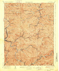 1928 Logan1928 Print · USGSThe Guyandotte River valley and the southern coalfields are shown in detail during the late twenties. Genealogists can trace family homes near rural landmarks like Isom School, Pecks Mill, and the many station stops along the Chesapeake and Ohio railroad.3 unique versions available
 - 1928 Map of Bald Knob, 1956 Print
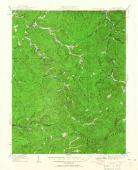 1928 Bald Knob1956 Print · USGSBoone, Logan, and Raleigh counties are mapped here in the late twenties at the height of the coal-rail boom. You can trace early industrial rail lines like the Chesapeake and Ohio and locate vanished local landmarks like Bothwell Sch and Jackson (Bim PO).
 - 1928 Map of Montgomery, 1963 Print
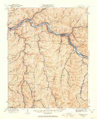 1928 Montgomery1963 Print · USGSIn the late 1920s, the Kanawha River valley was a dense network of rail and industry reaching deep into the Fayette and Kanawha hills. Genealogists and historians can trace rail stops like Hollygrove Sta and industrial sites like the Pure Oil Refinery.
 - 1929 Map of Eccles, 1956 Print
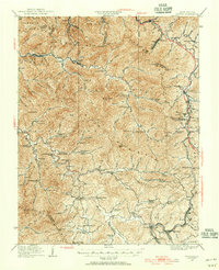 1929 Eccles1956 Print · USGSRaleigh and Fayette counties are captured here just before the Great Depression, showing a landscape defined by coal ridges and rural schoolhouses. Researchers can trace the roots of families near Eccles, Matville Church, and Lick Fork School.
Showing maps 1-25 of 156
Top cities of Boone County
Frequently asked questions
- What are the different types of historical maps available for Boone County?
- What is the oldest map of Boone County?
- Where can I purchase historical maps of Boone County for my home or office?
- Where can I download high-res historical maps of Boone County?
- Are there historical topographic maps available for Boone County?
- Is there historical aerial imagery available for Boone County?
- Where are historical maps of Boone County sourced from?