Old Maps of Clay County, West Virginia for Metal Detecting
Plan your next treasure hunt with 119 historic maps of Clay County. Find old homesites, ghost towns, trails, and gathering spots that may be lost to time — perfect for identifying promising metal detecting locations.
- Locate forgotten sites: Uncover places like long-lost settlements, abandoned rail lines, or gathering spots.
- Plan better hunts: Use map overlays combined with LiDAR or satellite views to narrow in on historically rich areas.
- Made for detectorists: Thousands of hobbyists use these maps to discover relics, coins, and hidden history.
Use these historic maps to boost your research and find new opportunities beneath the surface of Clay County.
Clay County, WV maps
(119)- 1889 Map of Nicholas
 1889 Nicholas1889 Print · USGSNicholas County and parts of the surrounding highlands are documented here in the late nineteenth century. Genealogists can trace family landmarks and river life through recorded sites like Carnifax Ferry, Beaver Mills, and Mt. Nebo.
 - 1891 Map of Nicholas
 1891 Nicholas1891 Print · USGSNicholas County and the surrounding highlands are captured here in the late nineteenth century, when mountain life depended on a network of river crossings. Genealogists can trace family roots through sites like Nicholas C.h., Hookersville, and early river crossings such as Carnifax Ferry.
 - 1893 Map of Sutton
 1893 Sutton1893 Print · USGSCentral West Virginia at the end of the nineteenth century was a world of river-bottom settlements and high mountain ridges. Genealogists can locate family-named landmarks like Bealls Mills, Hickory Knob, and the riverside town of Sutton.3 unique versions available
 - 1897 Map of Kanawha Falls
 1897 Kanawha Falls1897 Print · USGSWest Virginia's river valleys and burgeoning industrial corridors are captured here in the late nineteenth century. You can trace the early rail networks and riverside settlements such as Montgomery, Clendenin, and the river engineering at Lock 2.
 - 1900 Map of Kanawha Falls
 1900 Kanawha Falls1900 Print · USGSThe Kanawha and Elk rivers converge here at the turn of the century as the coal and rail industries were rapidly transforming the West Virginia landscape. Genealogists and historians can trace riverside settlements like Montgomery and Coalburg or follow the paths of the Chesapeake and Ohio RR and early river navigation at Lock 2.
 - 1901 Map of Nicholas
 1901 Nicholas1901 Print · USGSCentral West Virginia's river valleys and high ridges are shown here at the turn of the century as the timber industry expanded. Genealogists can trace family landmarks and river crossings like Camden on Gauley, Wainville P.O., and Bays Ferry Ford.3 unique versions available
 - 1901 Map of Kanawha Falls
 1901 Kanawha Falls1901 Print · USGSWest Virginia's coal and rail heartland is captured here at the end of the nineteenth century, as river navigation and railroads transformed the Kanawha Valley. Genealogists and historians can trace the early footprints of Montgomery, find family sites near Kanawha Falls, and locate landmarks like Hawks Nest or Powellton.3 unique versions available
 - 1906 Map of Otter, 1961 Print
 1906 Otter1961 Print · USGSCentral West Virginia at the start of the twentieth century shows a landscape of deep hollows and high ridges before modern highways. Researchers can trace early settlements and family homesteads near Ivydale, Newton, and the remote Redhouse Siding along the Elk River.
 - 1907 Map of Otter
 1907 Otter1907 Print · USGSCentral West Virginia at the turn of the century shows a landscape defined by its river valleys and new industrial rails. Genealogists can trace family homes near Newton, Linden, and Minnora, or follow the path of the Coal and Coke R R through Ivydale.3 unique versions available
 - 1907 Map of Clendenin, 1962 Print
 1907 Clendenin1962 Print · USGSThe Elk River valley and its steep ridge-and-hollow terrain are captured here in the early 1900s as railroads expanded into the coalfields. Trace old river crossings at Jarretts Ford or locate remote hillside settlements like Putney, Quick, and Kendalia.2 unique versions available
 - 1908 Map of Clay
 1908 Clay1908 Print · USGSThe river and rail network of central West Virginia dominates this territory at the start of the century. Trace early Appalachian settlement patterns through the COAL AND COKE RR and rural landmarks like Rosetta School and Big Sycamore Eldorado PO.2 unique versions available
 - 1908 Map of Gassaway
 1908 Gassaway1908 Print · USGSCentral West Virginia at the height of the early rail era reveals a landscape of isolated hill settlements and river industry. Genealogists can trace early homesteads and rail stops like Gassaway, Strange Creek, and the many family-named peaks like Davis Knob.
 - 1909 Map of Clendenin
 1909 Clendenin1909 Print · USGSKanawha County’s rugged river corridors and rail-linked mining towns are captured here in the first decade of the twentieth century. Genealogists and historians can trace family locations near Jarretts Ford, Dry Ridge School, and the remote settlement of Blakeley.5 unique versions available
 - 1910 Map of Clay
 1910 Clay1910 Print · USGSWest Virginia's coal and timber country comes alive in this survey of the Elk River valley just after the turn of the century. Genealogists and historians can trace the early rail networks of the Coke and Coke RR and locate vanished rural hubs like Yankee Dam PO and Triplett School.3 unique versions available
 - 1910 Map of Gassaway
 1910 Gassaway1910 Print · USGSBraxton County at the peak of its rail-and-river era is captured here, centered on the growing industrial hub of Gassaway. Genealogists and historians can trace early post offices and settlements like Villa Nova Duck PO, Strange Creek, and the Coal and Coke Ry corridor.3 unique versions available
 - 1913 Map of Summersville
 1913 Summersville1913 Print · USGSNicholas County and its rural crossroads are documented here in the early twentieth century, showing a network of mountain communities and schools. Researchers can locate family landmarks and early infrastructure like Persinger Ford, Beulah Church, and the Lone Star School.3 unique versions available
 - 1915 Map of Summersville
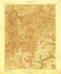 1915 Summersville1915 Print · USGSNicholas County at the start of the Great War was a landscape of high ridges and isolated mountain hollows. Genealogists can locate family homesteads near numerous local institutions like Eberly School or trace old river crossings at Persinger Ford.3 unique versions available
 - 1954 Map of Charleston
 1954 Charleston1954 Print · USGSWest Virginia’s industrial heart and mountain highlands are captured here during the mid-fifties, centered on the capital city. Researchers can trace historic river-and-rail corridors along the Kanawha River and locate remote peaks within the Monongahela National Forest.
 - 1957 Map of Clendenin, 1959 Print
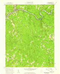 1957 Clendenin1959 Print · USGSCentered on the Elk River in the late 1950s, this area shows a dense network of gas wells and mountain communities. Researchers can locate dozens of family-named hollows, rural schools like Valley View Sch, and the Sybial PO at Reamer.2 unique versions available
 - 1957 Map of Mammoth, 1959 Print
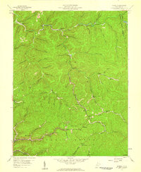 1957 Mammoth1959 Print · USGSThe coalfields of Kanawha County are shown in detail during the late 1950s, revealing a landscape of steep hollows and industrial rail lines. Genealogists and historians can trace family roots through sites like Morris Memorial Ch, Spangler Sch, and the mining settlements of Mammoth and Blakeley.3 unique versions available
 - 1957 Map of Charleston, 1966 Print
 1957 Charleston1966 Print · USGSMid-century West Virginia unfolds along the industrial Kanawha River valley and into the high Allegheny Mountains. Genealogists and historians can trace the vital rail lines of the Chesapeake and Ohio and locate riverside settlements from Saint Albans to Buckhannon.3 unique versions available
 - 1958 Map of Charleston
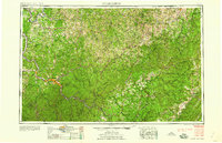 1958 Charleston1958 Print · USGSMid-century West Virginia is defined here by the industrial corridor of the Kanawha River and the high ridges of the Allegheny Mountains. Researchers can trace the rail networks of the New York Central or locate remote highland communities like Pickens and Hillsboro.
 - 1961 Map of Charleston
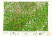 1961 Charleston1961 Print · USGSWest Virginia's capital region and the highlands to the east are shown in detail during the early sixties. Genealogists and historians can trace rail networks like the Baltimore and Ohio RR and find early state parks such as Watoga State Park.
 - 1965 Map of Herold, 1967 Print
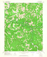 1965 Herold1967 Print · USGSBraxton and Nicholas Counties appear here in the mid-1960s, showing a landscape defined by the serpentining Birch River and rugged ridge-top settlements. Genealogists can locate family landmarks like Cox Cemetery, Row Bill Sch, and several rural churches including Eureka Ch.2 unique versions available
 - 1965 Map of Strange Creek, 1967 Print
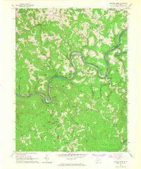 1965 Strange Creek1967 Print · USGSThe Elk River valley at the Braxton and Clay county line is captured here in the mid-1960s during a period of active natural gas extraction. Researchers can locate small mountain communities and family landmarks such as Strange Creek, Villanova Ch, and the Flat Fork School.2 unique versions available
Showing maps 1-25 of 119
Top cities of Clay County
Frequently asked questions
- What are the different types of historical maps available for Clay County?
- What is the oldest map of Clay County?
- Where can I purchase historical maps of Clay County for my home or office?
- Where can I download high-res historical maps of Clay County?
- Are there historical topographic maps available for Clay County?
- Is there historical aerial imagery available for Clay County?
- Where are historical maps of Clay County sourced from?