Old Maps of Needmore, West Virginia for Academic Research
Study the evolution of Needmore with 18 high-resolution historic maps. Whether you're teaching, researching, or modeling changes in land use, these maps provide essential visual documentation of urban, environmental, and geographic change.
- Analyze long-term change: Track patterns in development, transportation, and natural features.
- Ideal for environmental or urban studies: Support academic projects with primary historical map data.
- Use in the classroom or lab: Educators and researchers rely on these maps to bring historical context to life.
These maps are a powerful tool for teaching, research, and visualizing how Needmore has changed over the decades.
Needmore, WV maps
(18)- 1891 Map of Romney, 1897 Print
 1891 Romney1897 Print · USGSHampshire, Hardy, and Mineral counties are captured here in the 1880s as the river valleys were transitioning from frontier outposts to connected industrial hubs. Genealogists and historians can trace family locations near Capon Iron Works, Adams Mill, and the many hamlets along Patterson Creek.5 unique versions available
 - 1920 Map of Moorefield, 1958 Print
 1920 Moorefield1958 Print · USGSHardy and Hampshire Counties come alive in the 1920s as the Baltimore and Ohio RR winds through the Trough. Genealogists can locate family homesteads near dozens of rural landmarks like Old Pine Church, Sector PO, and the Hines School.2 unique versions available
 - 1921 Map of Moorefield
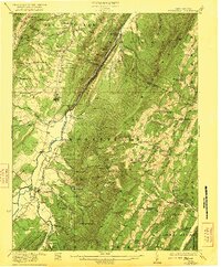
 1921 Moorefield1921 Print · USGSHardy and Hampshire counties come to life in the early 1920s as mountain settlements like Needmore and Oldfields cluster along the river gaps. Researchers can locate dozens of vanished rural schoolhouses and churches, from Thrasher Spring School to Old Pine Church.2 unique versions available
 - 1922 Map of Moorefield
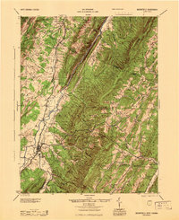
 1922 Moorefield1922 Print · USGSHardy and Hampshire counties come into focus in the early 1920s as the river-and-rail economy defined the Potomac Highlands. Genealogists can trace family names through landmarks like Potter Spring Knob and rural centers such as Old Pine Church and Globe PO.2 unique versions available
 - 1945 Map of Moorefield
 1945 Moorefield1945 Print · USGSHardy and Hampshire counties at the close of World War II reveal a landscape defined by the Potomac river-and-rail economy. Genealogists can locate family landmarks like Reynolds Gap and rural centers such as Old Pine Ch and Bethel Sch.
 - 1948 Map of Cumberland
 1948 Cumberland1948 Print · USGSMid-century Appalachia and the Shenandoah Valley are shown in detail, documenting the industrial and transportation hubs of the tri-state area. Genealogists can trace family roots through settlements like Double Tollgate and Bunker Hill or along the Baltimore & Ohio RR.3 unique versions available
 - 1952 Map of Cumberland
 1952 Cumberland1952 Print · USGSThe Potomac Highlands and the Shenandoah Valley are revealed in this early 1950s survey of the Appalachian interior. Researchers can trace the river-and-rail corridors connecting Cumberland, Winchester, and the recreational waters of Deep Creek Lake.
 - 1956 Map of Cumberland, 1966 Print
 1956 Cumberland1966 Print · USGSThe tri-state Highlands in the mid-1950s show a landscape shaped by coal, timber, and the massive presence of the Baltimore & Ohio RR. Researchers can trace the industrial corridor from Cumberland through the Allegheny Mountains to mountain retreats like Deep Creek Lake.6 unique versions available
 - 1957 Map of Cumberland
 1957 Cumberland1957 Print · USGSThe Potomac River valley and the ridges of the Allegheny Front define this mid-century landscape at the intersection of Maryland, West Virginia, and Pennsylvania. Trace the steam-era rail lines of the Baltimore and Ohio RR or locate rural landmarks like St Stephens Church and Stony River Dam.
 - 1961 Map of Cumberland
 1961 Cumberland1961 Print · USGSThe tri-state highlands of Maryland, West Virginia, and Pennsylvania are shown in the mid-twentieth century as a complex landscape of ridges and river valleys. Researchers can trace the winding Potomac River and find old rail-and-river towns like Cumberland, Keyser, and Morgantown.
 - 1962 Map of Cumberland
 1962 Cumberland1962 Print · USGSThe central Appalachians meet at the height of the mid-century industrial era, showing the rugged topography between Morgantown and Winchester. Genealogists can trace family lands near Fort Necessity or along the vital Baltimore & Ohio RR corridors.
 - 1970 Map of Needmore, 1973 Print
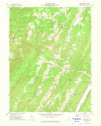 1970 Needmore1973 Print · USGSHardy County in the early seventies shows a landscape of steep Appalachian ridges and tight-knit valley communities. Genealogists and hikers can trace the foundations of Bean Settlement and Needmore, or locate rural landmarks like Pine Grove Ch and Asbury Ch.
 - 1983 Map of Winchester, 1985 Print
 1983 Winchester1985 Print · USGSThe northern Shenandoah Valley and the rugged West Virginia borderlands are captured here in the early eighties. Researchers can trace the rail networks of the B & O RR and find local landmarks like Potomac State College, Three Churches, and the Old Iron Furnace.3 unique versions available
 - 2011 Map of Needmore, 2011 Print
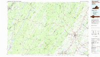
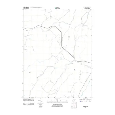 2011 Needmore2011 Print · USGSCovers Needmore, including Bean Settlement, Hardy County, and other nearby areas
 - 2014 Map of Needmore, 2014 Print
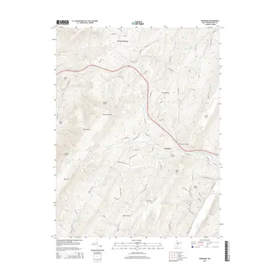 2014 Needmore2014 Print · USGSCovers Needmore, including Bean Settlement, Hardy County, and other nearby areas
 - 2016 Map of Needmore, 2016 Print
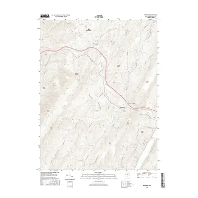 2016 Needmore2016 Print · USGSCovers Needmore, including Bean Settlement, Hardy County, and other nearby areas
 - 2019 Map of Needmore, 2019 Print
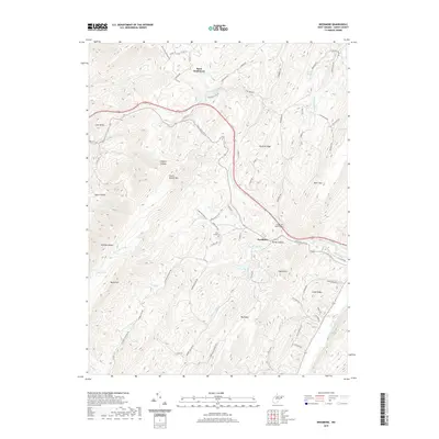 2019 Needmore2019 Print · USGSCovers Needmore, including Bean Settlement, Hardy County, and other nearby areas
 - 2023 Map of Needmore, 2023 Print
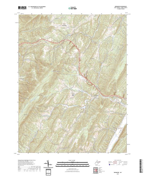 2023 Needmore2023 Print · USGSHardy County’s ridgelines and valley roads are captured here in the contemporary era, showing how the landscape dictates mountain life. Genealogists and local historians can locate Bean Settlement, Pine Grove Cem, and Needmore along the old routes of the South Branch Mountain range.
End of results
Showing maps 1-18 of 18
Top cities near Needmore
Frequently asked questions
- What are the different types of historical maps available for Needmore?
- What is the oldest map of Needmore?
- Where can I purchase historical maps of Needmore for my home or office?
- Where can I download high-res historical maps of Needmore?
- Are there historical topographic maps available for Needmore?
- Is there historical aerial imagery available for Needmore?
- Where are historical maps of Needmore sourced from?