1960s Maps of Harrison County, West Virginia
Explore 14 historic maps of Harrison County from the 1960s. These maps offer a rare glimpse into what life looked like during the 1960s — showing old roads, neighborhoods, homes, and landmarks that have changed or disappeared over time.
Whether you're researching your family's past, planning a metal detecting trip, or studying how Harrison County's landscape evolved across the 1960s, these high-resolution maps are a powerful tool for exploring the history of this region.
- Focus on a specific era: All maps on this page are from the 1960s, giving you a focused view of this time period.
- See what’s changed: Compare century-old streets, trails, and buildings to today's modern landscape using overlays and satellite layers.
- Research with precision: Use these maps for genealogy, historical research, land use analysis, or educational projects.
- View, download, or print: Maps are fully viewable online in high resolution, and can be downloaded or printed for your own records.
Start exploring Harrison County's history through authentic maps from the 1960s. This is your window into the past.
Harrison County, WV maps
(14)- 1960 Map of Century, 1961 Print
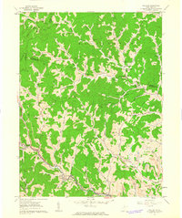
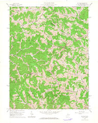
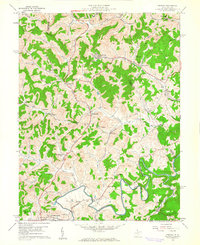 1960 Century1961 Print · USGSBarbour and Upshur counties are shown here at the height of the mid-century coal era. Genealogists can locate family sites like the Rohrbough Cem, rural schoolhouses such as Kesling Sch, and coal company towns like Century No 2.3 unique versions available
 - 1960 Map of Wolf Summit, 1962 Print
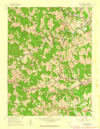 1960 Wolf Summit1962 Print · USGSCentral Harrison County in the early sixties remains a hub of rail and mining activity. Genealogists and historians can trace family locations through Olive Cem, the County Infirmary, and settlements like Wolf Summit or Sardis.2 unique versions available
 - 1960 Map of Shinnston, 1962 Print
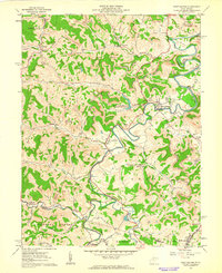
 1960 Shinnston1962 Print · USGSMid-century West Virginia coal country comes into sharp focus here, showing the river-and-rail economy along the West Fork River. Researchers can trace early infrastructure and family landmarks, from Sturms Mill to the Hess Cem and Tavebaugh Chapel.3 unique versions available
 - 1960 Map of Rosemont, 1962 Print
 1960 Rosemont1962 Print · USGSTaylor and Harrison counties reflect a mid-century industrial peak as the coal-and-rail economy defined the hollows. Genealogists can trace family landmarks like Harmony Grove Ch, Old Side Cem, and the mining settlements of Rosemont and Baileytown.3 unique versions available
 - 1960 Map of Wallace, 1963 Print
 1960 Wallace1963 Print · USGSHarrison and Marion counties are shown here in the early 1960s, a landscape defined by small hollows and industrial extraction. Trace family roots and local history at Jimtown, the Elizabeth Mason Memorial Park, and numerous family burial grounds like Boggess Cem.2 unique versions available
 - 1961 Map of Clarksburg
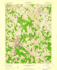
 1961 Clarksburg1961 Print · USGSThe mid-century industrial and river landscapes of West Virginia and Ohio are detailed here, centered on the Ohio River. Researchers can trace the Baltimore and Ohio rail lines connecting towns like Parkersburg, Clarksburg, and Monongah.
 - 1961 Map of Mount Clare, 1962 Print
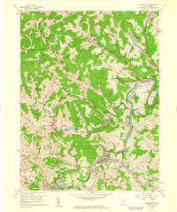
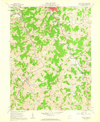 1961 Mount Clare1962 Print · USGSHarrison County in the early sixties showcases a landscape of coal tipples and country churches during the peak of the West Fork River valley's industrial era. Researchers can trace family history at Floral Hills Memorial Gardens or explore rail hubs like Mount Clare.3 unique versions available
 - 1961 Map of Berlin, 1962 Print
 1961 Berlin1962 Print · USGSWest Virginia's Lewis County uplands come alive in this early 1960s survey, showing the deep-cut valleys and ridgeline settlements of the era. Genealogists and historians can trace family locations near Berlin, the Reger Cem, and rural centers like the Buckhannon Run Ch.2 unique versions available
 - 1961 Map of Brownton, 1962 Print
 1961 Brownton1962 Print · USGSCoal mining and rail commerce define the Barbour County landscape in the early sixties. Researchers can trace the Baltimore and Ohio line through Brownton or locate local landmarks like the Covered Bridge and Green Hill Ch.3 unique versions available
 - 1961 Map of Weston, 1962 Print
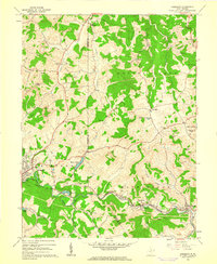
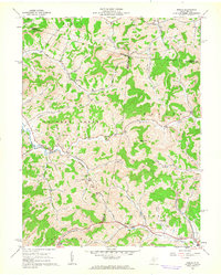
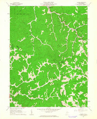
 1961 Weston1962 Print · USGSWeston and the West Fork River valley are captured here in the early sixties as the regional rail economy and local industry shaped the hills of Lewis County. Researchers can locate family landmarks like Jackson Mill, the sprawling Weston State Hospital, and country burials such as Bush Cem.3 unique versions available
 - 1961 Map of West Milford, 1962 Print
 1961 West Milford1962 Print · USGSHarrison and Lewis Counties come alive in the early sixties as a landscape of river valleys and ridgeline industry. Genealogists and historians can trace family locations near West Milford, the Kobergard Sch, or the many Strip Mines and Oil Wells that defined the era.2 unique versions available
 - 1961 Map of Folsom, 1963 Print
 1961 Folsom1963 Print · USGSWetzel and Harrison counties are shown during the early 1960s, a period when the valley floors were dominated by the Baltimore and Ohio Railroad and the energy industry. Genealogists can locate family sites like Morgan Cem and McIntire Fork Cem or trace the rural settlements of Hartzel and Smithfield.2 unique versions available
 - 1961 Map of Salem, 1963 Print
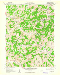
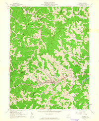 1961 Salem1963 Print · USGSHarrison County's valley floor and ridge-top settlements are captured here in the early sixties as the railroad and gas industry shaped the landscape. Genealogists can locate family landmarks like Smith Chapel, Harden Sch, and the K of P Cem.2 unique versions available
 - 1964 Map of Big Isaac, 1966 Print
 1964 Big Isaac1966 Print · USGSHarrison and Doddridge counties were centers of rural industry in the mid-1960s, defined by the gas and oil economy. Researchers can trace family sites near Big Isaac and Kincheloe or locate community centers like Morris Chapel and Greenbrier Sch.2 unique versions available
End of results
Showing maps 1-14 of 14
Top cities of Harrison County
- Clarksburg historical maps
- Bridgeport historical maps
- Shinnston historical maps
- Salem historical maps
- Stonewood historical maps
- Nutter Fort historical maps
See more
Frequently asked questions
- What are the different types of historical maps available for Harrison County?
- What is the oldest map of Harrison County?
- Where can I purchase historical maps of Harrison County for my home or office?
- Where can I download high-res historical maps of Harrison County?
- Are there historical topographic maps available for Harrison County?
- Is there historical aerial imagery available for Harrison County?
- Where are historical maps of Harrison County sourced from?