Old Maps of Harrison County, West Virginia for Academic Research
Study the evolution of Harrison County with 115 high-resolution historic maps. Whether you're teaching, researching, or modeling changes in land use, these maps provide essential visual documentation of urban, environmental, and geographic change.
- Analyze long-term change: Track patterns in development, transportation, and natural features.
- Ideal for environmental or urban studies: Support academic projects with primary historical map data.
- Use in the classroom or lab: Educators and researchers rely on these maps to bring historical context to life.
These maps are a powerful tool for teaching, research, and visualizing how Harrison County has changed over the decades.
Harrison County, WV maps
(115)- 1902 Map of Clarksburg
 1902 Clarksburg1902 Print · USGSNorth-central West Virginia at the opening of the twentieth century was a bustling network of river-towns and turnpikes. Genealogists can trace family roots through coal-and-rail hubs like Shinnston and Lumberport or rural landmarks such as Sturms Mill and Pinnickinnick Mt.3 unique versions available
 - 1902 Map of Fairmont
 1902 Fairmont1902 Print · USGSMarion and Taylor Counties were hubs of coal and transit at the opening of the twentieth century, as the rail lines followed the winding rivers. Genealogists can trace early family settlements and work sites from the Tyrconnell Mines to rural Nebo Church and Boothsville.4 unique versions available
 - 1904 Map of Philippi
 1904 Philippi1904 Print · USGSBarbour and Upshur counties are shown during a period of coal-driven growth and rural stability just after the turn of the century. Trace the early industrial footprints of Berryburg and Century, or locate family landmarks like Peter's Mill and the Burnersville Volga P.O..2 unique versions available
 - 1904 Map of Weston
 1904 Weston1904 Print · USGSWest Virginia's Lewis and Harrison counties at the start of the century show a region shaped by coal and steam. Genealogists and historians can trace family roots through early settlements like Jane Lew, identify operations at Lynch Mines, and locate the Dovener P.O. Dean.2 unique versions available
 - 1904 Map of Vadis
 1904 Vadis1904 Print · USGSLewis and Doddridge counties appear here at the start of the twentieth century, showing a landscape shaped by narrow creek valleys and small upland farms. Genealogists can trace family footprints in historic settlements like Vadis, Freemansburg, and St.Clare.2 unique versions available
 - 1905 Map of Centerpoint
 1905 Centerpoint1905 Print · USGSWest Virginia's heartland at the peak of the railroad era is meticulously charted here, revealing a dense network of ridge-top settlements and valley post offices. Trace the paths of the Baltimore and Ohio RR through Salem and locate lost landmarks like Eagle Mills, Jockeycamp, and Big Battle.3 unique versions available
 - 1910 Map of Clarksburg, 1920 Print
 1910 Clarksburg1920 Print · USGSClay County at the dawn of the twentieth century was a landscape of river-bend railroads and high mountain hollows. Genealogists can trace family footprints through rural post offices like Angeline PO, valley schools such as Triplett School, and rail stops at Dundon and Clay Courthouse Station.
 - 1923 Map of Fairmont, 1956 Print
 1923 Fairmont1956 Print · USGSMarion and Taylor counties are shown during the height of their rail and coal era in the early twentieth century. Researchers can trace family origins through dozens of named landmarks like Jane Memorial Church, T McConnell Mines, and the river crossing at Benton Ferry.2 unique versions available
 - 1923 Map of Clarksburg, 1959 Print
 1923 Clarksburg1959 Print · USGSHarrison and Marion counties appear in the 1920s as a landscape of coal mines and mountain schoolhouses. Trace family roots at Bethel Church or Annabelle, and locate old industrial sites like Cook Mine and Straus Mill along the rivers.
 - 1924 Map of Centerpoint, 1957 Print
 1924 Centerpoint1957 Print · USGSDoddridge and Harrison counties are shown here in the mid-1920s, when small-town life revolved around the railroad and local schoolhouses. Genealogists can locate family homesteads near landmarks like Alvy P O Stringtown, Smithton Smithburg Sta, and Fairview Church.2 unique versions available
 - 1925 Map of Clarksburg
 1925 Clarksburg1925 Print · USGSHarrison County in the mid-twenties is a bustling corridor of coal mining and rail activity centered on the West Fork River. Genealogists can trace family roots through dozens of named rural schools like Lower Davisson Run School or locate vanished industrial sites like Ocean Mine and Sturms Mill.3 unique versions available
 - 1925 Map of Centerpoint
 1925 Centerpoint1925 Print · USGSDoddridge and Harrison counties are shown here in the mid-1920s, highlighting a landscape of deep hollows and ridge-top farms. Researchers can trace the Baltimore and Ohio rail line through Salem or find small rural landmarks like Victory Church and Lima PO.4 unique versions available
 - 1925 Map of Philippi, 1954 Print
 1925 Philippi1954 Print · USGSIn the mid-1920s, the Tygart River valley was a busy corridor of coal settlements and river commerce. Genealogists can locate family homesteads near vanished landmarks like Brownton PO, Pigtail School, and the Electric Line near Galloway.
 - 1925 Map of Vadis, 1981 Print
 1925 Vadis1981 Print · USGSCentral West Virginia's highlands in the mid-twenties reveal a landscape of hollows and ridges dotted with one-room schoolhouses and country parishes. Genealogists can trace family roots through numerous sites like St Marys Church, Vadis, and Lower Walnut School.
 - 1926 Map of Fairmont
 1926 Fairmont1926 Print · USGSMarion and Taylor counties are shown during the mid-twenties when coal mining and the rail industry shaped the river valleys. Researchers can locate vanished landmarks like the Tyrconnell Mines and community centers such as Pruntytown and Mt Zion Church.3 unique versions available
 - 1926 Map of Weston
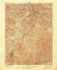 1926 Weston1926 Print · USGSWeston and the West Fork River valley are captured in the mid-twenties as the rail-and-river economy flourished. Genealogists and researchers can trace family-named sites like Jackson Mill, Romines Mills, and the Broad Run Church.4 unique versions available
 - 1927 Map of Vadis
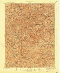 1927 Vadis1927 Print · USGSWest Virginia's central highlands are shown here in the mid-1920s, a landscape defined by isolated farmsteads and valley-bottom settlements. Genealogists and historians can trace dozens of rural school sites and landmarks like St Boniface Church, Alum Bridge, and Freemansburg.2 unique versions available
 - 1928 Map of Philippi
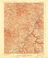 1928 Philippi1928 Print · USGSBarbour County is shown here in the mid-twenties as the Baltimore and Ohio railroad connected river towns and coal camps. Researchers can trace ancestral roots through dozens of local landmarks like Adaland, Rangoon PO, and the Pleasant Grove Church.2 unique versions available
 - 1949 Map of Clarksburg
 1949 Clarksburg1949 Print · USGSThe upper Ohio River valley and the industrial heart of West Virginia come into focus during this post-war period. Genealogists and researchers can trace the rail corridors of the Baltimore and Ohio and locate centers like Fairmont, Grafton, and Waynesburg.
 - 1956 Map of Clarksburg, 1966 Print
 1956 Clarksburg1966 Print · USGSThe Ohio River valley and the industrial heart of West Virginia are seen here in the mid-1950s as rail and river commerce thrived. Researchers can trace historic transport lines like the Baltimore and Ohio RR and locate ancestral homes in Clarksburg, Moundsville, or Parkersburg.2 unique versions available
 - 1958 Map of Clarksburg, 1960 Print
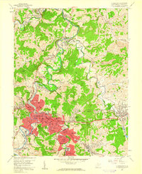 1958 Clarksburg1960 Print · USGSHarrison County in the late fifties shows a bustling industrial landscape centered on the West Fork River. Researchers can trace old neighborhoods and local institutions like Victory High Sch, the Laura Lee Mine, and Stewart Chapel.3 unique versions available
 - 1958 Map of Fairmont West, 1960 Print
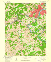 1958 Fairmont West1960 Print · USGSMarion County at the end of the 1950s shows the bustling city of Fairmont as a regional hub of education and transport. Researchers can locate family roots at Mount Calvary Cem, trace the rail lines of the Baltimore and Ohio Railroad, or find old schools like Coons Run Sch.4 unique versions available
 - 1960 Map of Century, 1961 Print
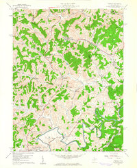 1960 Century1961 Print · USGSBarbour and Upshur counties are shown here at the height of the mid-century coal era. Genealogists can locate family sites like the Rohrbough Cem, rural schoolhouses such as Kesling Sch, and coal company towns like Century No 2.3 unique versions available
 - 1960 Map of Wolf Summit, 1962 Print
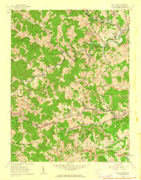 1960 Wolf Summit1962 Print · USGSCentral Harrison County in the early sixties remains a hub of rail and mining activity. Genealogists and historians can trace family locations through Olive Cem, the County Infirmary, and settlements like Wolf Summit or Sardis.2 unique versions available
 - 1960 Map of Shinnston, 1962 Print
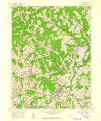 1960 Shinnston1962 Print · USGSMid-century West Virginia coal country comes into sharp focus here, showing the river-and-rail economy along the West Fork River. Researchers can trace early infrastructure and family landmarks, from Sturms Mill to the Hess Cem and Tavebaugh Chapel.3 unique versions available
Showing maps 1-25 of 115
Top cities of Harrison County
- Clarksburg historical maps
- Bridgeport historical maps
- Shinnston historical maps
- Salem historical maps
- Stonewood historical maps
- Nutter Fort historical maps
See more
Frequently asked questions
- What are the different types of historical maps available for Harrison County?
- What is the oldest map of Harrison County?
- Where can I purchase historical maps of Harrison County for my home or office?
- Where can I download high-res historical maps of Harrison County?
- Are there historical topographic maps available for Harrison County?
- Is there historical aerial imagery available for Harrison County?
- Where are historical maps of Harrison County sourced from?