Old Maps of Pleasant View, West Virginia for Academic Research
Study the evolution of Pleasant View with 16 high-resolution historic maps. Whether you're teaching, researching, or modeling changes in land use, these maps provide essential visual documentation of urban, environmental, and geographic change.
- Analyze long-term change: Track patterns in development, transportation, and natural features.
- Ideal for environmental or urban studies: Support academic projects with primary historical map data.
- Use in the classroom or lab: Educators and researchers rely on these maps to bring historical context to life.
These maps are a powerful tool for teaching, research, and visualizing how Pleasant View has changed over the decades.
Pleasant View, WV maps
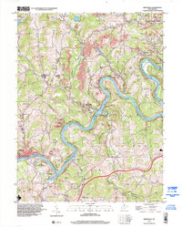
(16)- 1904 Map of Blacksville
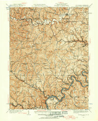
 1904 Blacksville1904 Print · USGSThe West Virginia and Pennsylvania border comes alive in this survey from the early twentieth century. Researchers can trace the river economy along the Monongahela at Lock No. 13 or locate rural homesteads near Fairview Amos P.O. and Blacksville.3 unique versions available
 - 1923 Map of Blacksville, 1956 Print
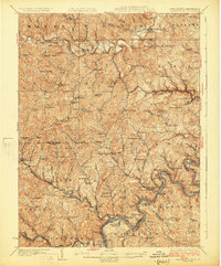
 1923 Blacksville1956 Print · USGSMonongalia and Marion counties appear here during the early twentieth century as the coal and rail economy began to reshape the rural landscape. Researchers can find numerous family landmarks, from Town School and Olive Church to the industrial works at Montana Mines.
 - 1925 Map of Blacksville
 1925 Blacksville1925 Print · USGSMonongalia and Marion Counties are shown in the mid-1920s, a period when rural life centered on a vast network of neighborhood schools and churches. Genealogists can trace family roots through specific landmarks like Stumptown School, Montana Mines, and Monumental Church.4 unique versions available
 - 1949 Map of Clarksburg
 1949 Clarksburg1949 Print · USGSThe upper Ohio River valley and the industrial heart of West Virginia come into focus during this post-war period. Genealogists and researchers can trace the rail corridors of the Baltimore and Ohio and locate centers like Fairmont, Grafton, and Waynesburg.
 - 1956 Map of Clarksburg, 1966 Print
 1956 Clarksburg1966 Print · USGSThe Ohio River valley and the industrial heart of West Virginia are seen here in the mid-1950s as rail and river commerce thrived. Researchers can trace historic transport lines like the Baltimore and Ohio RR and locate ancestral homes in Clarksburg, Moundsville, or Parkersburg.2 unique versions available
 - 1960 Map of Rivesville, 1962 Print
 1960 Rivesville1962 Print · USGSThe Monongahela River valley was a bustling corridor of coal and rail in the early sixties. Genealogists and historians can trace family locations near the Site of Fort Prickett, the Montana Mines post office, and Snider Temple.4 unique versions available
 - 1961 Map of Clarksburg
 1961 Clarksburg1961 Print · USGSThe mid-century industrial and river landscapes of West Virginia and Ohio are detailed here, centered on the Ohio River. Researchers can trace the Baltimore and Ohio rail lines connecting towns like Parkersburg, Clarksburg, and Monongah.
 - 1976 Map of Rivesville, 1979 Print
 1976 Rivesville1979 Print · USGSThe Monongahela River valley comes into sharp focus during the mid-seventies in this detailed aerial study. Researchers can examine the industrial landscape and trace development patterns near settlements like Everettville and Booth along the river banks.
 - 1984 Map of Moundsville
 1984 Moundsville1984 Print · USGSThe Ohio River valley and the Appalachian interior meet in the mid-eighties as a hub of rail and river commerce. Genealogists and historians can trace the development of river towns like New Martinsville, inland hubs like Waynesburg, and the path of the B & O RR.
 - 1988 Map of Clarksburg, 1989 Print
 1988 Clarksburg1989 Print · USGSThe central Appalachians are documented in detail during the late eighties, showing the industrial and river-based economies of West Virginia, Ohio, and Pennsylvania. Researchers can trace historic rail routes like the B & O RR and locate river towns from St Marys to Parkersburg.
 - 1997 Map of Rivesville, 2002 Print
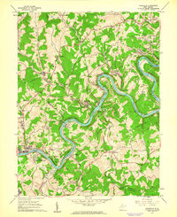
 1997 Rivesville2002 Print · USGSThe Monongahela River valley north of Fairmont thrived on coal and river transport during the late twentieth century. Genealogists can trace family roots through numerous former mine sites and local landmarks like Montana (Montana Mines PO), Arnettsville Sch, and Pricketts Fort State Park.
 - 2011 Map of Rivesville, 2011 Print
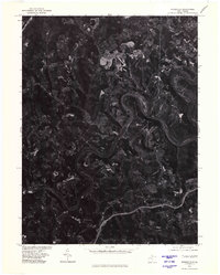
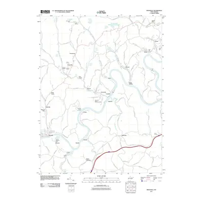 2011 Rivesville2011 Print · USGSCovers Pleasant View, including Fairmont, Rivesville, and other nearby areas
 - 2014 Map of Rivesville, 2014 Print
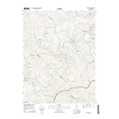 2014 Rivesville2014 Print · USGSCovers Pleasant View, including Fairmont, Rivesville, and other nearby areas
 - 2016 Map of Rivesville, 2016 Print
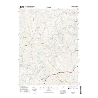 2016 Rivesville2016 Print · USGSCovers Pleasant View, including Fairmont, Rivesville, and other nearby areas
 - 2019 Map of Rivesville, 2019 Print
 2019 Rivesville2019 Print · USGSCovers Pleasant View, including Fairmont, Rivesville, and other nearby areas
 - 2023 Map of Rivesville, 2023 Print
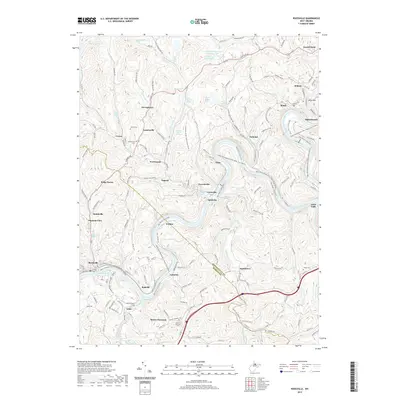
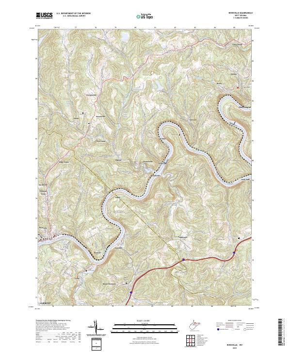 2023 Rivesville2023 Print · USGSThe Monongahela River valley comes into focus in this recent survey of the West Virginia coal and river country. Researchers can trace historic family burial sites at Snider Cem and Pisgah Cem or explore rail-to-trail corridors like the Mon River South Rail-Trl.
End of results
Showing maps 1-16 of 16
Top cities near Pleasant View
- Morgantown historical maps
- Fairmont historical maps
- Clarksburg historical maps
- Bridgeport historical maps
- Grafton historical maps
- Westover historical maps
See more
Frequently asked questions
- What are the different types of historical maps available for Pleasant View?
- What is the oldest map of Pleasant View?
- Where can I purchase historical maps of Pleasant View for my home or office?
- Where can I download high-res historical maps of Pleasant View?
- Are there historical topographic maps available for Pleasant View?
- Is there historical aerial imagery available for Pleasant View?
- Where are historical maps of Pleasant View sourced from?