1960s Maps of McDowell County, West Virginia
Explore 19 historic maps of McDowell County from the 1960s. These maps offer a rare glimpse into what life looked like during the 1960s — showing old roads, neighborhoods, homes, and landmarks that have changed or disappeared over time.
Whether you're researching your family's past, planning a metal detecting trip, or studying how McDowell County's landscape evolved across the 1960s, these high-resolution maps are a powerful tool for exploring the history of this region.
- Focus on a specific era: All maps on this page are from the 1960s, giving you a focused view of this time period.
- See what’s changed: Compare century-old streets, trails, and buildings to today's modern landscape using overlays and satellite layers.
- Research with precision: Use these maps for genealogy, historical research, land use analysis, or educational projects.
- View, download, or print: Maps are fully viewable online in high resolution, and can be downloaded or printed for your own records.
Start exploring McDowell County's history through authentic maps from the 1960s. This is your window into the past.
McDowell County, WV maps
(19)- 1961 Map of Bluefield
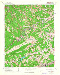
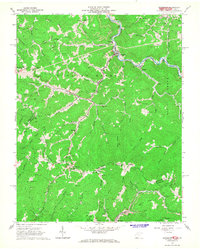
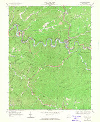
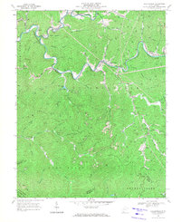
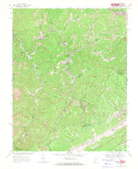
 1961 Bluefield1961 Print · USGSThe coalfields and mountain ridges of southern West Virginia and southwest Virginia are captured in the early sixties. Genealogists can trace family ties through rail-linked towns like Princeton and Richlands or along the shores of Bluestone Reservoir.
 - 1962 Map of Bramwell, 1964 Print
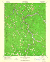
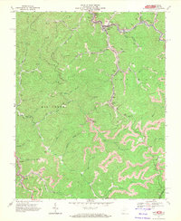
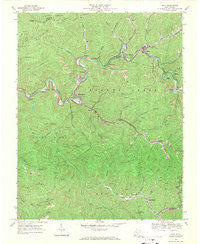
 1962 Bramwell1964 Print · USGSThe coal and rail corridor of the West Virginia-Virginia border is frozen in time during the early sixties. Genealogists and historians can trace family plots at Pocahontas Cem and Mt Tabor Cem or locate industrial sites like the strip mines near Bramwell.2 unique versions available
 - 1963 Map of Gilbert, 1964 Print
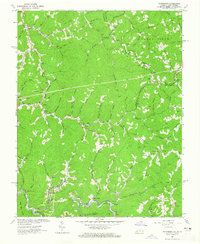
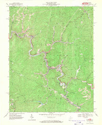
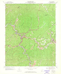
 1963 Gilbert1964 Print · USGSMingo and Wyoming Counties are captured here in the early 1960s, showing the coal-and-rail economy along the winding Guyandotte River. Genealogists can trace family names and local landmarks from Sprattsville and Ikes Fork to the Stafford Ch and Longpole Sch.3 unique versions available
 - 1963 Map of Panther, 1965 Print
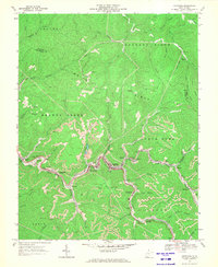
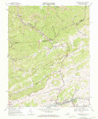
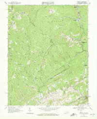
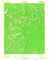 1963 Panther1965 Print · USGSThe West Virginia-Virginia borderlands are captured here in the early sixties, showing a landscape defined by the coal economy and the Norfolk and Western rail line. Researchers can trace family history through dozens of remote sites like Justice Cem, Little Dove Ch, and McKinley Sch.3 unique versions available
 - 1963 Map of Wharncliffe, 1966 Print
 1963 Wharncliffe1966 Print · USGSThe coal country of the West Virginia and Kentucky borderlands comes alive in the early sixties as the railroad navigates the winding Tug Fork. Genealogists can trace family names at Cline Sch, Wharncliffe Ch, and the many hollows near Isaban.3 unique versions available
 - 1964 Map of Bradshaw, 1965 Print
 1964 Bradshaw1965 Print · USGSMid-century coal country comes alive in this survey of the mountains along the West Virginia and Virginia border. Genealogists can trace family names at Bradshaw Cemetery and Wimmer Cemetery, or locate old school sites like Jolo School.3 unique versions available
 - 1964 Map of Iaeger, 1965 Print
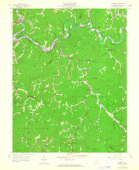
 1964 Iaeger1965 Print · USGSMcDowell County mining and rail operations are at their peak in the mid-1960s. Genealogists can trace family landmarks like Lockhart Cem and Kennedy Cem, or locate local hubs such as the Carlos Sch and Iaeger rail junction.3 unique versions available
 - 1964 Map of Patterson, 1965 Print
 1964 Patterson1965 Print · USGSThe Virginia and West Virginia borderlands in the 1960s show a landscape of heavy industry and deep-hollow settlements. Genealogists and historians can locate dozens of family cemeteries and local institutions like Big Butt Sch, Patterson, and the Lower Big Branch Ch.3 unique versions available
 - 1967 Map of Crumpler, 1970 Print
 1967 Crumpler1970 Print · USGSSouthern West Virginia's coal country is shown in detail during the late sixties, where rail lines and mining towns sit in the shadow of Flat Top Mountain. Genealogists and historians can trace the foundations of McComas, Crumpler, and Ashland, or locate the Prosperity Sch and Bailey Cem.2 unique versions available
 - 1967 Map of Keystone, 1971 Print
 1967 Keystone1971 Print · USGSThe McDowell County coalfields are at their peak in the late sixties, showing a dense industrial corridor along Elkhorn Creek. Genealogists and historians can trace the precise footprints of Keystone, Vivian, and Northfork alongside numerous mines and family sites like Rotenberry Cem.2 unique versions available
 - 1967 Map of Pineville, 1971 Print
 1967 Pineville1971 Print · USGSWyoming County in the late sixties is defined by its deep river valleys and the coal-driven rail lines of the Norfolk and Western. Trace the winding hollows to find local landmarks like Turkey Creek Ch, the Marianna tipple, and the Lookout Tower on the high ridges.2 unique versions available
 - 1967 Map of Gary, 1971 Print
 1967 Gary1971 Print · USGSMcDowell County's coal country is shown in detail during the late sixties, where the Norfolk and Western railway links industrial settlements. Genealogists can trace family roots in Gary, Thorpe, and Newhall, or locate specific Mines and Cemeteries along the Tug Fork.2 unique versions available
 - 1967 Map of War, 1971 Print
 1967 War1971 Print · USGSThe McDowell County coalfields are captured here in the late sixties, showing the industrial density of the Dry Fork and War Creek valleys. Genealogists can trace family footprints in War, Berwind, and Caretta, or locate vanished Tipple and Strip Mine sites.2 unique versions available
 - 1968 Map of Tazewell North, 1971 Print
 1968 Tazewell North1971 Print · USGSThe Clinch River valley and the West Virginia border come alive in the late 1960s, showing a landscape shaped by coal and rail. Genealogists and historians can trace the foundations of Tazewell, the community at Bishop, and landmarks like Lila Chapel and Maplewood Cem.2 unique versions available
 - 1968 Map of Baileysville, 1971 Print
 1968 Baileysville1971 Print · USGSSouthern West Virginia in the late sixties shows a landscape of narrow hollows and industrial growth. Genealogists and historians can trace coal-era infrastructure near Stoneville or find local landmarks like Shands Memorial Ch and Horse Creek Lake.2 unique versions available
 - 1968 Map of Davy, 1971 Print
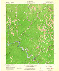
 1968 Davy1971 Print · USGSMcDowell County's coal country is documented here during the late sixties, showing the vital rail-and-river network that sustained local industry. Genealogists and historians can trace family-named hollows and sites like Marytown Ch, Coalwood, and the Langer Memorial Cem.2 unique versions available
 - 1968 Map of Welch, 1971 Print
 1968 Welch1971 Print · USGSMcDowell County's coal country comes into sharp focus in the late sixties, where the Norfolk and Western railroad winds through the deep valleys of the Tug Fork. Genealogists and local historians can locate many family landmarks, from the New Belcher Mtn Community Cem to the homes of Welch, Kimball, and Wilcoe.2 unique versions available
 - 1968 Map of Amonate, 1972 Print
 1968 Amonate1972 Print · USGSThe Virginia and West Virginia border in the late sixties reveals a coal-mining landscape shaped by deep hollows and the Norfolk and Western rail line. Researchers can trace historic company towns and settlements like Amonate, Vallscreek, and Dunford Village amidst a maze of strip mines.2 unique versions available
 - 1968 Map of Anawalt, 1972 Print
 1968 Anawalt1972 Print · USGSThe coalfields of the West Virginia and Virginia border are shown here in the late sixties, where the Norfolk and Western rail lines link mountain hollows. Trace the industrial footprint of Jenkinjones or locate landmarks like the Abbs Valley Boissevain School.2 unique versions available
End of results
Showing maps 1-19 of 19
Top cities of McDowell County
- Welch historical maps
- Gary historical maps
- War historical maps
- Northfork historical maps
- Keystone historical maps
- Raysal historical maps
See more
Frequently asked questions
- What are the different types of historical maps available for McDowell County?
- What is the oldest map of McDowell County?
- Where can I purchase historical maps of McDowell County for my home or office?
- Where can I download high-res historical maps of McDowell County?
- Are there historical topographic maps available for McDowell County?
- Is there historical aerial imagery available for McDowell County?
- Where are historical maps of McDowell County sourced from?