Old Maps of Limestone, West Virginia for Genealogy
Trace your family roots with 19 historic maps of Limestone. These high-res maps reveal old neighborhoods, homesites, landmarks, and streets — helping you uncover where your ancestors lived and how the area evolved over time.
- Explore historic neighborhoods: Identify where your relatives may have lived in the 1800s or 1900s.
- Compare maps over time: Trace the changes in streets, buildings, and landmarks for multi-generational research.
- Perfect for genealogy & ancestry research: Used by family historians and researchers to map out lineage and migration.
These maps are an incredible resource for exploring your personal connection to Limestone's past.
Limestone, WV maps
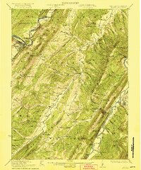
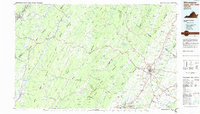
(19)- 1891 Map of Romney, 1897 Print
 1891 Romney1897 Print · USGSHampshire, Hardy, and Mineral counties are captured here in the 1880s as the river valleys were transitioning from frontier outposts to connected industrial hubs. Genealogists and historians can trace family locations near Capon Iron Works, Adams Mill, and the many hamlets along Patterson Creek.5 unique versions available
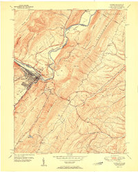
 - 1920 Map of Keyser, 1964 Print
 1920 Keyser1964 Print · USGSMineral and Hampshire counties in the 1920s reveal a landscape of deep river valleys and prominent ridges tied together by the Baltimore and Ohio RR. Researchers can locate dozens of country schools and churches, from Trinity Church to the Pancake School and Reeses Mill.
 - 1921 Map of Keyser
 1921 Keyser1921 Print · USGSThe Potomac River valley and the ridges of Mineral and Hampshire counties are captured here in the early twenties. Researchers can locate vanished landmarks like the Russellville PO, industrial sites at Ochre, and dozens of rural schoolhouses from Red Star School to Knobly School.2 unique versions available
 - 1922 Map of Keyser
 1922 Keyser1922 Print · USGSThe Potomac borderlands in the early 1920s reveal a landscape of deep valleys and vital rail connections along the West Virginia-Maryland line. Genealogists and local historians can trace rural family life through dozens of named schools like Red Star School and historic landmarks such as Trinity Church and Vanderlip P.O.3 unique versions available
 - 1948 Map of Cumberland
 1948 Cumberland1948 Print · USGSMid-century Appalachia and the Shenandoah Valley are shown in detail, documenting the industrial and transportation hubs of the tri-state area. Genealogists can trace family roots through settlements like Double Tollgate and Bunker Hill or along the Baltimore & Ohio RR.3 unique versions available
 - 1949 Map of Keyser, 1965 Print
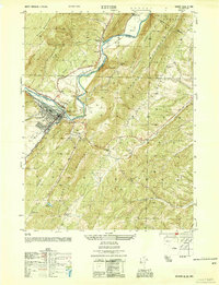
 1949 Keyser1965 Print · USGSKeyser and the Potomac River valley are captured in the late 1940s as a vital railroad and college hub. Researchers can trace family roots through numerous sites like Meadow View Cem, Potomac State College, and the rural Willow Dale Chapel.3 unique versions available
 - 1950 Map of Keyser, 1954 Print
 1950 Keyser1954 Print · USGSMid-century Mineral County is defined by the heavy rail and river industrial corridor centered on Keyser. Genealogists and local historians can trace landmarks like the County Farm, the Fountain Sch, and several family cemeteries including Meadow View Cem.
 - 1951 Map of Keyser
 1951 Keyser1951 Print · USGSMineral County in the early fifties shows a bustling industrial and academic center where the Baltimore and Ohio railroad meets the river. Researchers can trace family burial grounds like Queens Point Cem and rural landmarks such as Willow Dale Chapel or Fountain Sch.
 - 1952 Map of Cumberland
 1952 Cumberland1952 Print · USGSThe Potomac Highlands and the Shenandoah Valley are revealed in this early 1950s survey of the Appalachian interior. Researchers can trace the river-and-rail corridors connecting Cumberland, Winchester, and the recreational waters of Deep Creek Lake.
 - 1956 Map of Cumberland, 1966 Print
 1956 Cumberland1966 Print · USGSThe tri-state Highlands in the mid-1950s show a landscape shaped by coal, timber, and the massive presence of the Baltimore & Ohio RR. Researchers can trace the industrial corridor from Cumberland through the Allegheny Mountains to mountain retreats like Deep Creek Lake.6 unique versions available
 - 1957 Map of Cumberland
 1957 Cumberland1957 Print · USGSThe Potomac River valley and the ridges of the Allegheny Front define this mid-century landscape at the intersection of Maryland, West Virginia, and Pennsylvania. Trace the steam-era rail lines of the Baltimore and Ohio RR or locate rural landmarks like St Stephens Church and Stony River Dam.
 - 1961 Map of Cumberland
 1961 Cumberland1961 Print · USGSThe tri-state highlands of Maryland, West Virginia, and Pennsylvania are shown in the mid-twentieth century as a complex landscape of ridges and river valleys. Researchers can trace the winding Potomac River and find old rail-and-river towns like Cumberland, Keyser, and Morgantown.
 - 1962 Map of Cumberland
 1962 Cumberland1962 Print · USGSThe central Appalachians meet at the height of the mid-century industrial era, showing the rugged topography between Morgantown and Winchester. Genealogists can trace family lands near Fort Necessity or along the vital Baltimore & Ohio RR corridors.
 - 1983 Map of Winchester, 1985 Print
 1983 Winchester1985 Print · USGSThe northern Shenandoah Valley and the rugged West Virginia borderlands are captured here in the early eighties. Researchers can trace the rail networks of the B & O RR and find local landmarks like Potomac State College, Three Churches, and the Old Iron Furnace.3 unique versions available
 - 2011 Map of Keyser, 2011 Print
 2011 Keyser2011 Print · USGSCovers Limestone, including Keyser, McCoole, and other nearby areas
 - 2014 Map of Keyser, 2014 Print
 2014 Keyser2014 Print · USGSCovers Limestone, including Keyser, McCoole, and other nearby areas
 - 2016 Map of Keyser, 2016 Print
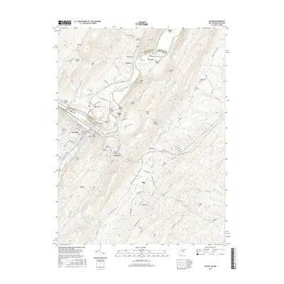 2016 Keyser2016 Print · USGSCovers Limestone, including Keyser, McCoole, and other nearby areas
 - 2019 Map of Keyser, 2019 Print
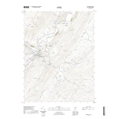 2019 Keyser2019 Print · USGSCovers Limestone, including Keyser, McCoole, and other nearby areas
 - 2023 Map of Keyser, 2023 Print
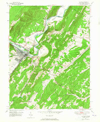
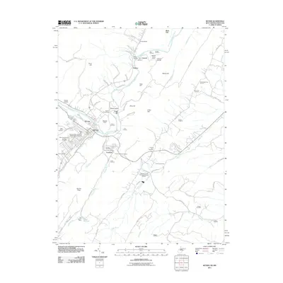
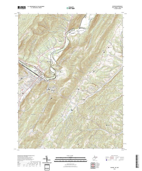 2023 Keyser2023 Print · USGSKeyser and the Potomac valley are shown here in the early 2020s, highlighting the area's deep institutional and family history. Genealogists can trace roots at Saint Marys Cem and Mount Zion Cem, while researchers will find Mineral County Courthouse at the heart of the settlement.
End of results
Showing maps 1-19 of 19
Top cities near Limestone
- Cumberland historical maps
- Frostburg historical maps
- Keyser historical maps
- Westernport historical maps
- Romney historical maps
- Bel Air historical maps
See more
Frequently asked questions
- What are the different types of historical maps available for Limestone?
- What is the oldest map of Limestone?
- Where can I purchase historical maps of Limestone for my home or office?
- Where can I download high-res historical maps of Limestone?
- Are there historical topographic maps available for Limestone?
- Is there historical aerial imagery available for Limestone?
- Where are historical maps of Limestone sourced from?