Old Maps of Franklin, West Virginia for Genealogy
Trace your family roots with 14 historic maps of Franklin. These high-res maps reveal old neighborhoods, homesites, landmarks, and streets — helping you uncover where your ancestors lived and how the area evolved over time.
- Explore historic neighborhoods: Identify where your relatives may have lived in the 1800s or 1900s.
- Compare maps over time: Trace the changes in streets, buildings, and landmarks for multi-generational research.
- Perfect for genealogy & ancestry research: Used by family historians and researchers to map out lineage and migration.
These maps are an incredible resource for exploring your personal connection to Franklin's past.
Franklin, WV maps
(14)- 1892 Map of Franklin
 1892 Franklin1892 Print · USGSPendleton County and the Potomac Highlands are shown here in the 1890s, organized by the dramatic ridges and river valleys of the Alleghanies. Researchers can trace historic homesteads and early post offices at Fort Seybert, Upper Tract, and the riverside crossroads of Kline Cross Roads.
 - 1896 Map of Franklin, 1907 Print
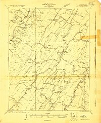
 1896 Franklin1907 Print · USGSThe Potomac River's headwaters and the high ridges of the Alleghenies are documented here in the final years of the nineteenth century. Genealogists and local historians can trace early valley communities like Fort Seybert, Sugar Grove, and the mills at Harper Mill.4 unique versions available
 - 1922 Map of Circleville, 1961 Print
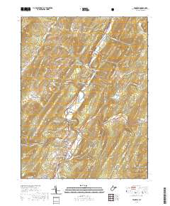
 1922 Circleville1961 Print · USGSPendleton County in the early twenties is a landscape of high ridges and narrow valley settlements like Circleville and Riverton. Genealogists and historians can locate numerous rural schoolhouses, including Sinnet School, and small crossroads like Zigler and McCoys Mill.2 unique versions available
 - 1924 Map of Circleville
 1924 Circleville1924 Print · USGSThe Potomac headwaters in the 1920s reveal a high-mountain landscape of close-knit hollows and ridge-line schools. Genealogists can locate family landmarks like Johnstown, the Harper Mill, and rural centers such as Dolly School and Ruddle School.4 unique versions available
 - 1949 Map of Charlottesville
 1949 Charlottesville1949 Print · USGSThe Shenandoah Valley and Blue Ridge appear in the late 1940s as a thriving corridor of rail and river commerce. Researchers can trace the mid-century footprints of Harrisonburg, Staunton, and Culpeper alongside the historic routes of the Southern Railway.2 unique versions available
 - 1956 Map of Charlottesville, 1966 Print
 1956 Charlottesville1966 Print · USGSThe Shenandoah Valley and Blue Ridge are captured in detail during the mid-1960s as the modern interstate system began to emerge. Genealogists and historians can trace rail-connected hubs like Waynesboro or follow the river paths of the Rapidan River and Rivanna River.4 unique versions available
 - 1969 Map of Franklin, 1973 Print
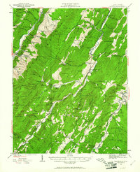
 1969 Franklin1973 Print · USGSPendleton County's valley floor and ridge-lines are captured here in the late sixties, centered on the river-bend town of Franklin. Genealogists and local historians can trace family locations near Ruddle, Oak Grove, and country churches like Laurel Hill Ch.3 unique versions available
 - 1981 Map of Elkins, 1983 Print
 1981 Elkins1983 Print · USGSThe West Virginia mountains in the early eighties were a hub of rail-based industry and emerging conservation lands. Genealogists and historians can trace the paths of the Western Maryland RR through Elkins and locate small upland communities like Harpertown, Bowden, and Wymer.
 - 1995 Map of Franklin, 1998 Print
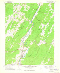
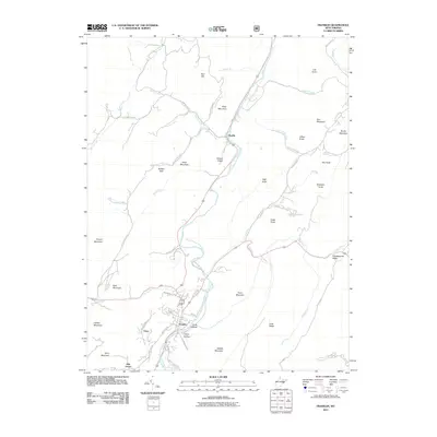
 1995 Franklin1998 Print · USGSIn the mid-nineties, the South Branch Potomac River valley in Pendleton County remains a landscape of river-bottom settlements and forest ridges. Researchers can locate family landmarks like Reeds Creek Ch, Ruddle Ch, and the streets of Franklin.
 - 2011 Map of Franklin, 2011 Print
 2011 Franklin2011 Print · USGSCovers Franklin, including Ruddle, Oak Grove, and other nearby areas
 - 2014 Map of Franklin, 2014 Print
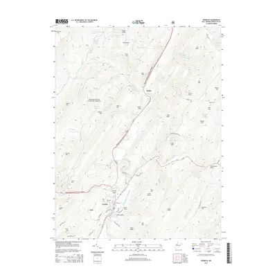 2014 Franklin2014 Print · USGSCovers Franklin, including Ruddle, Oak Grove, and other nearby areas
 - 2016 Map of Franklin, 2016 Print
 2016 Franklin2016 Print · USGSCovers Franklin, including Ruddle, Oak Grove, and other nearby areas
 - 2019 Map of Franklin, 2019 Print
 2019 Franklin2019 Print · USGSCovers Franklin, including Ruddle, Oak Grove, and other nearby areas
 - 2023 Map of Franklin, 2023 Print
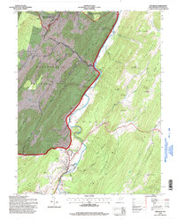
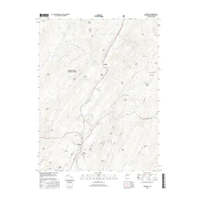
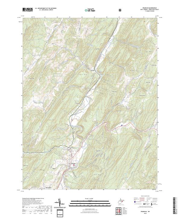 2023 Franklin2023 Print · USGSThe South Branch Potomac River corridor in Pendleton County is captured here in the early 2020s, centered on the county seat at Franklin. Genealogists and local historians can locate the Pendleton County Courthouse and trace rural lineages through landmarks like Smith Farm Spring, Ruddle, and Oak Grove.
End of results
Showing maps 1-14 of 14
Frequently asked questions
- What are the different types of historical maps available for Franklin?
- What is the oldest map of Franklin?
- Where can I purchase historical maps of Franklin for my home or office?
- Where can I download high-res historical maps of Franklin?
- Are there historical topographic maps available for Franklin?
- Is there historical aerial imagery available for Franklin?
- Where are historical maps of Franklin sourced from?