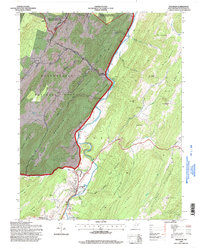
1995 Map of Franklin
USGS Topo · Published 1998About this map
South Branch Potomac River carves a deep path through this section of Pendleton County, anchoring a landscape where agricultural river bottoms meet the steep, wooded ridges of the Monongahela National Forest. The town of Franklin serves as the focal point, situated at the confluence of several runs including Friends Run and Propst Run. The settlement pattern reflects the constraints of the terrain, with homes and community centers like Ruddle and Oak Grove clustered along the valley floors, while expansive protected lands like the Spruce Knob-Seneca Rocks National Recreation Area dominate the western heights.
Find a feature on this map
58 named features on this map. Tap any name to fly to it.
Don’t see what you’re looking for? This feature index may not catch every label — zoom into the map to look around manually.
Map Details
Editions of this 1995 Franklin Map
This is the sole edition of this map. No revisions or reprints were ever made.
Other maps of this area

1892 · Franklin
USGS Topo · 1:125,000

1896 · Franklin
USGS Topo · 1:125,000

1920 · Petersburg
USGS Topo · 1:48,000

1920 · Onego
USGS Topo · 1:62,500

1921 · Petersburg
USGS Topo · 1:48,000

1921 · Onego
USGS Topo · 1:48,000

1922 · Onego
USGS Topo · 1:62,500

1922 · Fort Seybert
USGS Topo · 1:48,000

1922 · Petersburg
USGS Topo · 1:62,500

1922 · Circleville
USGS Topo · 1:62,500