
1921 Map of Onego
USGS Topo · Published 1921About this map
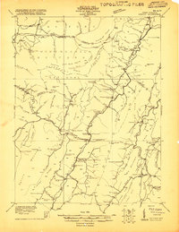
Monongahela National Forest land dominates this 1921 survey, capturing a landscape defined by its isolated schools and high-mountain gaps. The settlement pattern follows the narrow valley floors, with small communities like Onego and Macksville serving as local anchors. The topographic detail highlights the dramatic transition at the Roaring Allegheny Front and the prominent Seneca Rock formation.
Find a feature on this map
105 named features on this map. Tap any name to fly to it.
Don’t see what you’re looking for? This feature index may not catch every label — zoom into the map to look around manually.
Map Details
Editions of this 1921 Onego Map
2 editions found
Other maps of this area

1886 · St. George
USGS Topo · 1:125,000

1889 · Beverly
USGS Topo · 1:125,000

1891 · St. George
USGS Topo · 1:125,000

1892 · Beverly
USGS Topo · 1:125,000

1892 · Franklin
USGS Topo · 1:125,000

1895 · Piedmont
USGS Topo · 1:125,000

1896 · Franklin
USGS Topo · 1:125,000

1908 · Parsons
USGS Topo · 1:62,500

1916 · Davis
USGS Topo · 1:48,000

1918 · Davis
USGS Topo · 1:62,500