Old Maps of Beulah, West Virginia for Academic Research
Study the evolution of Beulah with 13 high-resolution historic maps. Whether you're teaching, researching, or modeling changes in land use, these maps provide essential visual documentation of urban, environmental, and geographic change.
- Analyze long-term change: Track patterns in development, transportation, and natural features.
- Ideal for environmental or urban studies: Support academic projects with primary historical map data.
- Use in the classroom or lab: Educators and researchers rely on these maps to bring historical context to life.
These maps are a powerful tool for teaching, research, and visualizing how Beulah has changed over the decades.
Beulah, WV maps
(13)- 1889 Map of Beverly
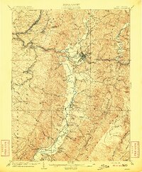
 1889 Beverly1889 Print · USGSThe high Allegheny ridges and river forks of West Virginia are mapped here in the late 1880s, highlighting the rugged settlement patterns of Randolph and Pocahontas counties. Researchers can trace early family-named locations such as Days Mills, locate the Boundary Line In Dispute, and find remote outposts like Traveller's Repose.
 - 1892 Map of Beverly
 1892 Beverly1892 Print · USGSCentral West Virginia's high-mountain settlements and disputed county lines are captured here in the late nineteenth century. Genealogists and historians can trace family locations and early industry near Beverly, Huttonsville, and the remote Days Mills.5 unique versions available
 - 1909 Map of Elkins
 1909 Elkins1909 Print · USGSRandolph County's river valleys and mountain ridges are captured here during the peak of the regional railroad and timber era. Genealogists can trace family roots through numerous named schools and churches, from Trinity Church to the Goff School, while following the paths of the Coal and Coke Ry and Staunton and Parkersburg Pike.4 unique versions available
 - 1949 Map of Charlottesville
 1949 Charlottesville1949 Print · USGSThe Shenandoah Valley and Blue Ridge appear in the late 1940s as a thriving corridor of rail and river commerce. Researchers can trace the mid-century footprints of Harrisonburg, Staunton, and Culpeper alongside the historic routes of the Southern Railway.2 unique versions available
 - 1956 Map of Charlottesville, 1966 Print
 1956 Charlottesville1966 Print · USGSThe Shenandoah Valley and Blue Ridge are captured in detail during the mid-1960s as the modern interstate system began to emerge. Genealogists and historians can trace rail-connected hubs like Waynesboro or follow the river paths of the Rapidan River and Rivanna River.4 unique versions available
 - 1969 Map of Beverly East, 1971 Print
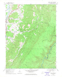 1969 Beverly East1971 Print · USGSThe Tygart Valley and the high ridges of the Monongahela National Forest are captured here in the late sixties. Genealogists and historians can trace the rural landscape of Beverly and Hazelwood, or locate remote points like Elk River Junction and Mt Vernon Ch.3 unique versions available
 - 1981 Map of Elkins, 1983 Print
 1981 Elkins1983 Print · USGSThe West Virginia mountains in the early eighties were a hub of rail-based industry and emerging conservation lands. Genealogists and historians can trace the paths of the Western Maryland RR through Elkins and locate small upland communities like Harpertown, Bowden, and Wymer.
 - 1995 Map of Beverly East, 1998 Print
 1995 Beverly East1998 Print · USGSThe Randolph County highlands are captured here in the mid-1990s as the river-and-rail landscape of the Alleghenies continues to evolve. Genealogists and hikers can trace the Allegheny Trail through the Monongahela National Forest and locate points like Elk River Junction or Hazelwood.
 - 2011 Map of Beverly East, 2011 Print
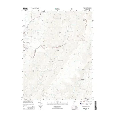
 2011 Beverly East2011 Print · USGSCovers Beulah, including Elkins, Beverly, and other nearby areas
 - 2014 Map of Beverly East, 2014 Print
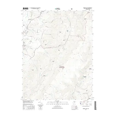
 2014 Beverly East2014 Print · USGSCovers Beulah, including Elkins, Beverly, and other nearby areas
 - 2016 Map of Beverly East, 2016 Print
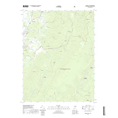
 2016 Beverly East2016 Print · USGSCovers Beulah, including Elkins, Beverly, and other nearby areas
 - 2019 Map of Beverly East, 2019 Print
 2019 Beverly East2019 Print · USGSCovers Beulah, including Elkins, Beverly, and other nearby areas
 - 2023 Map of Beverly East, 2023 Print
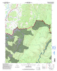
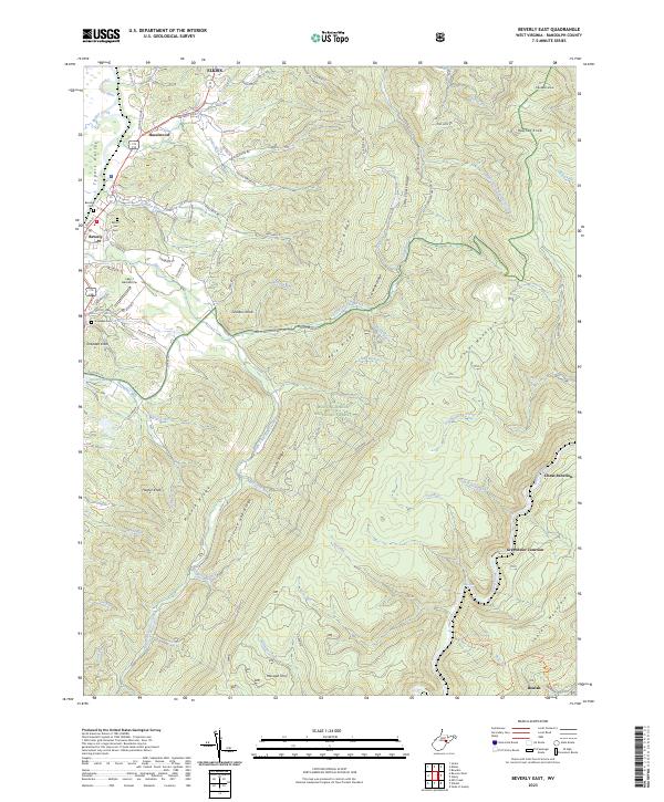 2023 Beverly East2023 Print · USGSThe Tygart Valley and the high ridges of the Monongahela National Forest meet here in recent years. Genealogists and historians can trace family locations near Beverly Cem, identify the Lazy J Aerodrome, and locate old transit points like Cheat Junction.
End of results
Showing maps 1-13 of 13
Top cities near Beulah
- Elkins historical maps
- Beverly historical maps
- Mill Creek historical maps
- Valley Bend historical maps
- East Dailey historical maps
- Junior historical maps
See more
Frequently asked questions
- What are the different types of historical maps available for Beulah?
- What is the oldest map of Beulah?
- Where can I purchase historical maps of Beulah for my home or office?
- Where can I download high-res historical maps of Beulah?
- Are there historical topographic maps available for Beulah?
- Is there historical aerial imagery available for Beulah?
- Where are historical maps of Beulah sourced from?