Old Maps of Kerens, West Virginia for Metal Detecting
Plan your next treasure hunt with 15 historic maps of Kerens. Find old homesites, ghost towns, trails, and gathering spots that may be lost to time — perfect for identifying promising metal detecting locations.
- Locate forgotten sites: Uncover places like long-lost settlements, abandoned rail lines, or gathering spots.
- Plan better hunts: Use map overlays combined with LiDAR or satellite views to narrow in on historically rich areas.
- Made for detectorists: Thousands of hobbyists use these maps to discover relics, coins, and hidden history.
Use these historic maps to boost your research and find new opportunities beneath the surface of Kerens.
Kerens, WV maps
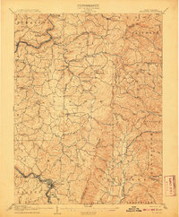
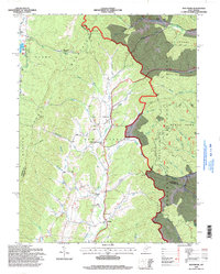
(15)- 1886 Map of St. George
 1886 St. George1886 Print · USGSNorthern West Virginia’s rugged river valleys and early rail corridors are mapped here in the mid-1880s. Genealogists can trace family roots in settlements like St George or Terra Alta, while following the path of the Baltimore and Ohio Railroad.
 - 1891 Map of St. George, 1895 Print
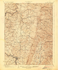
 1891 St. George1895 Print · USGSNorthern West Virginia at the end of the nineteenth century was defined by the expansion of the Baltimore and Ohio Railroad. Genealogists can trace early homesteads and landmarks like Valley Furnace, St George, and Terra Alta.3 unique versions available
 - 1907 Map of Belington
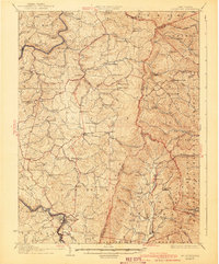
 1907 Belington1907 Print · USGSBelington was a bustling railway hub at the turn of the century where multiple rail lines met the Tygart River. Genealogists can locate family homesteads near landmarks like Olive Hill Schoolhouse, Wilmoth Ford, and the old Turnpike.2 unique versions available
 - 1927 Map of Belington
 1927 Belington1927 Print · USGSNorth Central West Virginia is documented here in the late twenties as a network of ridge-top schools and river-bottom rail hubs. Genealogists can trace family landmarks and local institutions like Vannoy's Mill, Valley Furnace, and Moatsville Sta.2 unique versions available
 - 1941 Map of Belington
 1941 Belington1941 Print · USGSBarbour and Randolph counties are shown here during the pre-war era as the Baltimore and Ohio railroad powered the local economy. Genealogists can trace family homesteads near dozens of landmarks including Vannoys Mill, Kalamazoo, and St Joseph School.
 - 1948 Map of Cumberland
 1948 Cumberland1948 Print · USGSMid-century Appalachia and the Shenandoah Valley are shown in detail, documenting the industrial and transportation hubs of the tri-state area. Genealogists can trace family roots through settlements like Double Tollgate and Bunker Hill or along the Baltimore & Ohio RR.3 unique versions available
 - 1952 Map of Cumberland
 1952 Cumberland1952 Print · USGSThe Potomac Highlands and the Shenandoah Valley are revealed in this early 1950s survey of the Appalachian interior. Researchers can trace the river-and-rail corridors connecting Cumberland, Winchester, and the recreational waters of Deep Creek Lake.
 - 1956 Map of Cumberland, 1966 Print
 1956 Cumberland1966 Print · USGSThe tri-state Highlands in the mid-1950s show a landscape shaped by coal, timber, and the massive presence of the Baltimore & Ohio RR. Researchers can trace the industrial corridor from Cumberland through the Allegheny Mountains to mountain retreats like Deep Creek Lake.6 unique versions available
 - 1957 Map of Cumberland
 1957 Cumberland1957 Print · USGSThe Potomac River valley and the ridges of the Allegheny Front define this mid-century landscape at the intersection of Maryland, West Virginia, and Pennsylvania. Trace the steam-era rail lines of the Baltimore and Ohio RR or locate rural landmarks like St Stephens Church and Stony River Dam.
 - 1961 Map of Cumberland
 1961 Cumberland1961 Print · USGSThe tri-state highlands of Maryland, West Virginia, and Pennsylvania are shown in the mid-twentieth century as a complex landscape of ridges and river valleys. Researchers can trace the winding Potomac River and find old rail-and-river towns like Cumberland, Keyser, and Morgantown.
 - 1962 Map of Cumberland
 1962 Cumberland1962 Print · USGSThe central Appalachians meet at the height of the mid-century industrial era, showing the rugged topography between Morgantown and Winchester. Genealogists can trace family lands near Fort Necessity or along the vital Baltimore & Ohio RR corridors.
 - 1969 Map of Montrose, 1971 Print
 1969 Montrose1971 Print · USGSRandolph and Tucker Counties are seen here in the late sixties as the mountain landscape remained defined by valley farming and timber. Researchers can trace the Maryland Western RR past Montrose to find rural landmarks like Israel Ch and the Elkins Speedway.3 unique versions available
 - 1981 Map of Kingwood, 1982 Print
 1981 Kingwood1982 Print · USGSThe West Virginia highlands in the early eighties were a hub of mountain railroading and wilderness conservation. Trace the path of the Baltimore & Ohio RR through Kingwood or explore the early footprints of Canaan Valley State Park and Dolly Sods.
 - 1995 Map of Montrose, 1998 Print
 1995 Montrose1998 Print · USGSThe West Virginia highlands near Montrose are captured here in the mid-1990s as the Monongahela National Forest meets valley settlements. Genealogists and local historians can trace rural landmarks from Union Chapel to the community of Smith Crossing and the Elkins Speedway.
 - 2023 Map of Montrose, 2023 Print
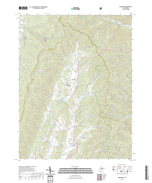 2023 Montrose2023 Print · USGSRandolph and Barbour counties are shown here in the 2020s, centered on the Leading Creek valley and the high ridges of the Allegheny Mountains. Researchers can trace family sites near Montrose or visit the Leading Creek Primitive Baptist Cem along the winding US Rte 219.
End of results
Showing maps 1-15 of 15
Top cities near Kerens
- Elkins historical maps
- Philippi historical maps
- Parsons historical maps
- Beverly historical maps
- Junior historical maps
- Norton historical maps
See more
Frequently asked questions
- What are the different types of historical maps available for Kerens?
- What is the oldest map of Kerens?
- Where can I purchase historical maps of Kerens for my home or office?
- Where can I download high-res historical maps of Kerens?
- Are there historical topographic maps available for Kerens?
- Is there historical aerial imagery available for Kerens?
- Where are historical maps of Kerens sourced from?