Old Maps of Thomas, West Virginia for Hiking & Exploration
Hike through history with 46 historic maps of Thomas. Explore old trails, ghost towns, and forgotten backroads — perfect for outdoor adventurers and local explorers.
- Rediscover forgotten places: Map out old mining camps, roads, and footpaths that no longer exist on modern maps.
- Layer with modern tools: Combine with LiDAR or satellite views to plan hikes through historical terrain.
- Made for exploration: Popular among hikers, overlanders, and local history lovers.
Use these maps to find adventure and explore the hidden past of Thomas.
Thomas, WV maps
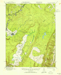
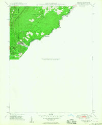
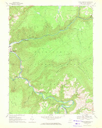
(46)- 1886 Map of St. George
 1886 St. George1886 Print · USGSNorthern West Virginia’s rugged river valleys and early rail corridors are mapped here in the mid-1880s. Genealogists can trace family roots in settlements like St George or Terra Alta, while following the path of the Baltimore and Ohio Railroad.
 - 1891 Map of St. George, 1895 Print
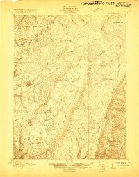
 1891 St. George1895 Print · USGSNorthern West Virginia at the end of the nineteenth century was defined by the expansion of the Baltimore and Ohio Railroad. Genealogists can trace early homesteads and landmarks like Valley Furnace, St George, and Terra Alta.3 unique versions available
 - 1895 Map of Piedmont
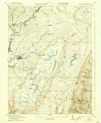
 1895 Piedmont1895 Print · USGSThe West Virginia and Maryland borderlands come to life in the 1890s, when coal and timber drove the expansion of the Potomac River valleys. Genealogists can trace the early industrial roots of Piedmont, locate the historic Fairfax Stone, or find the long-lost operations at Rees Tannery.4 unique versions available
 - 1908 Map of Parsons
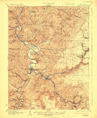
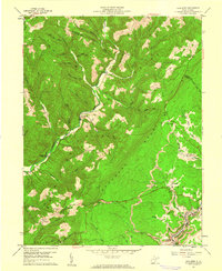
 1908 Parsons1908 Print · USGSThe West Virginia high country comes to life in this early century survey of the Parsons area. Genealogists and historians can trace the early rail networks of the W M R R and LUMBER R R connecting settlements like Thomas and St George.
 - 1916 Map of Davis
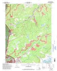
 1916 Davis1916 Print · USGSHigh in the Allegheny plateau during the mid-teens, this area centers on the bustling timber and rail hubs of Thomas and Davis. Researchers can trace the path of the Lumber RR and locate rural neighborhood centers like Maple Grove School and Cortland School.2 unique versions available
 - 1918 Map of Davis
 1918 Davis1918 Print · USGSTucker County's high mountain plateaus and timber industry are at their peak during the First World War. Genealogists and historians can trace the early development of Davis and Thomas alongside rural landmarks like Maple Grove School and the Fairfax Stone.
 - 1919 Map of Davis, 1955 Print
 1919 Davis1955 Print · USGSThe West Virginia and Maryland borderlands are captured here during a peak era of timber and rail expansion. Genealogists can trace family roots through rural landmarks like the Fairfax Stone, the village of Cortland, and the Maple Grove School.2 unique versions available
 - 1920 Map of Davis
 1920 Davis1920 Print · USGSWest Virginia's high mountain plateaus and the Maryland border are captured here just after the Great War. Genealogists can trace family footprints near the Fairfax Stone or locate rural landmarks like Rohrbaugh School and the Stony River Dam.
 - 1921 Map of Davis, 1938 Print
 1921 Davis1938 Print · USGSThe West Virginia highlands and the Maryland border come alive in this early twentieth-century survey of the Allegheny Front. Researchers can trace the legacy of timber and coal through the Lumber RR and find local landmarks like the Fairfax Stone and Cortland School.2 unique versions available
 - 1926 Map of Parsons
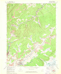
 1926 Parsons1926 Print · USGSTucker County's industrial valleys and remote mountain ridges come alive in the mid-1920s as the rail-and-river economy boomed. Genealogists and historians can trace the foundations of local life through community hubs like Parsons, Thomas, and numerous rural sites like Macedonia Church and Fairview School.2 unique versions available
 - 1948 Map of Cumberland
 1948 Cumberland1948 Print · USGSMid-century Appalachia and the Shenandoah Valley are shown in detail, documenting the industrial and transportation hubs of the tri-state area. Genealogists can trace family roots through settlements like Double Tollgate and Bunker Hill or along the Baltimore & Ohio RR.3 unique versions available
 - 1949 Map of Kempton
 1949 Kempton1949 Print · USGSThe high plateau of the Maryland-West Virginia border comes into focus in the late 1940s, highlighting the industrial rail corridor along the Potomac River. Genealogists can trace the rural landscape around Kempton, Henry, and the historic Fairfax Stone monument.2 unique versions available
 - 1952 Map of Cumberland
 1952 Cumberland1952 Print · USGSThe Potomac Highlands and the Shenandoah Valley are revealed in this early 1950s survey of the Appalachian interior. Researchers can trace the river-and-rail corridors connecting Cumberland, Winchester, and the recreational waters of Deep Creek Lake.
 - 1956 Map of Cumberland, 1966 Print
 1956 Cumberland1966 Print · USGSThe tri-state Highlands in the mid-1950s show a landscape shaped by coal, timber, and the massive presence of the Baltimore & Ohio RR. Researchers can trace the industrial corridor from Cumberland through the Allegheny Mountains to mountain retreats like Deep Creek Lake.6 unique versions available
 - 1957 Map of Cumberland
 1957 Cumberland1957 Print · USGSThe Potomac River valley and the ridges of the Allegheny Front define this mid-century landscape at the intersection of Maryland, West Virginia, and Pennsylvania. Trace the steam-era rail lines of the Baltimore and Ohio RR or locate rural landmarks like St Stephens Church and Stony River Dam.
 - 1959 Map of Lead Mine, 1961 Print
 1959 Lead Mine1961 Print · USGSThe West Virginia highlands in the late fifties show a landscape of coal mining and mountain farming across the Tucker County line. Genealogists can locate family landmarks like Knotts Cem and Mt Olive Ch or trace the industrial rail hubs of Coketon and Thomas.3 unique versions available
 - 1961 Map of Cumberland
 1961 Cumberland1961 Print · USGSThe tri-state highlands of Maryland, West Virginia, and Pennsylvania are shown in the mid-twentieth century as a complex landscape of ridges and river valleys. Researchers can trace the winding Potomac River and find old rail-and-river towns like Cumberland, Keyser, and Morgantown.
 - 1962 Map of Cumberland
 1962 Cumberland1962 Print · USGSThe central Appalachians meet at the height of the mid-century industrial era, showing the rugged topography between Morgantown and Winchester. Genealogists can trace family lands near Fort Necessity or along the vital Baltimore & Ohio RR corridors.
 - 1967 Map of Davis, 1972 Print
 1967 Davis1972 Print · USGSThe West Virginia and Maryland borderlands come into focus in the late sixties, highlighting a rugged mining landscape and rail corridor. Trace the Western Maryland railroad through Kempton, locate the historic Fairfax Stone, or find the Thomas Cemetery.5 unique versions available
 - 1968 Map of Blackwater Falls, 1972 Print
 1968 Blackwater Falls1972 Print · USGSTucker County's high-country wilderness is documented here in the late sixties as state parks and national forests began defining the region's character. Local historians and hikers can trace the Western Maryland railroad, locate the Cem near Cortland, and find natural landmarks like Chimney Rock and Bearden Knob.3 unique versions available
 - 1968 Map of Mozark Mountain, 1972 Print
 1968 Mozark Mountain1972 Print · USGSTucker County during the late sixties is a landscape of industrial transit and Appalachian wilderness where the Blackwater River cuts through the forest. Genealogists and local historians can trace family locations near Hendricks, Elk, and Brights Chapel.2 unique versions available
 - 1981 Map of Kingwood, 1982 Print
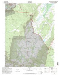
 1981 Kingwood1982 Print · USGSThe West Virginia highlands in the early eighties were a hub of mountain railroading and wilderness conservation. Trace the path of the Baltimore & Ohio RR through Kingwood or explore the early footprints of Canaan Valley State Park and Dolly Sods.
 - 1995 Map of Davis, 1998 Print
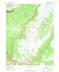
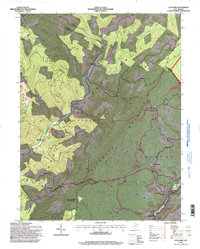
 1995 Davis1998 Print · USGSThe West Virginia highlands in the mid-nineties reveal a landscape shaped by coal and timber along the Blackwater River. Trace family history at Thomas Cem or locate industrial sites like the strip mines and tipple near Henry.
 - 1995 Map of Blackwater Falls, 1998 Print
 1995 Blackwater Falls1998 Print · USGSThe West Virginia highlands in the mid-nineties reveal a landscape of vast state parks and small mountain settlements. Researchers can locate remote family cemeteries, trace the old Cheat Potomac Rd, and see the footprint of local industry at the strip mine or Quarry.2 unique versions available
 - 1995 Map of Lead Mine, 1998 Print
 1995 Lead Mine1998 Print · USGSTucker County and the Monongahela National Forest are shown in the mid-nineties as the industrial and natural landscapes converged. Genealogists can trace family landmarks like Sugarland Ch Cem while historians locate coal works at Coketon and Thomas.
Showing maps 1-25 of 46
Top cities near Thomas
- Parsons historical maps
- Rowlesburg historical maps
- Davis historical maps
- Hendricks historical maps
- Bayard historical maps
- Hambleton historical maps
See more
Top neighborhoods of Thomas
Frequently asked questions
- What are the different types of historical maps available for Thomas?
- What is the oldest map of Thomas?
- Where can I purchase historical maps of Thomas for my home or office?
- Where can I download high-res historical maps of Thomas?
- Are there historical topographic maps available for Thomas?
- Is there historical aerial imagery available for Thomas?
- Where are historical maps of Thomas sourced from?