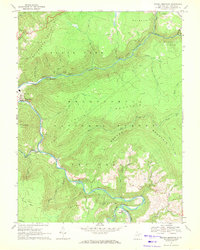
1968 Map of Mozark Mountain
USGS Topo · Published 1972About this map
Mozark Mountain and the deep river canyons of the Monongahela National Forest dominate this late 1960s topographic study of Tucker County. The landscape is defined by the dramatic descent of the Blackwater River and the Dry Fork, which converge near the settlement of Hendricks. This era shows the region as a hub for both industry and early mountain recreation, featuring the Western Maryland railroad lines threading through narrow valleys alongside a high-altitude Ski Area and Blackwater Falls State Park. High atop Backbone Mountain, the Olson Lookout Tower provides a strategic vantage point over the rugged terrain. Local life is anchored in small clusters such as Elk, where Brights Chapel and nearby cemeteries provide important markers for genealogists tracing families in these isolated hollows. Signs of extraction are present in the north, where a Strip Mine sits near the Western Maryland tracks.
Find a feature on this map
41 named features on this map. Tap any name to fly to it.
Don’t see what you’re looking for? This feature index may not catch every label — zoom into the map to look around manually.
Map Details
Editions of this 1968 Mozark Mountain Map
2 editions found
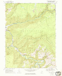
Other maps of this area

1886 · St. George
USGS Topo · 1:125,000

1889 · Beverly
USGS Topo · 1:125,000

1891 · St. George
USGS Topo · 1:125,000

1892 · Beverly
USGS Topo · 1:125,000

1892 · Franklin
USGS Topo · 1:125,000

1895 · Piedmont
USGS Topo · 1:125,000

1896 · Franklin
USGS Topo · 1:125,000

1908 · Parsons
USGS Topo · 1:62,500

1916 · Davis
USGS Topo · 1:48,000

1918 · Davis
USGS Topo · 1:62,500