2000s (21st Century) Maps of Buckhannon, West Virginia
Explore 4 historic maps of Buckhannon from the 2000s (21st Century). These maps offer a rare glimpse into what life looked like during the 2000s — showing old roads, neighborhoods, homes, and landmarks that have changed or disappeared over time.
Whether you're researching your family's past, planning a metal detecting trip, or studying how Buckhannon's landscape evolved across the 2000s, these high-resolution maps are a powerful tool for exploring the history of this region.
- Focus on a specific era: All maps on this page are from the 2000s, giving you a focused view of this time period.
- See what’s changed: Compare century-old streets, trails, and buildings to today's modern landscape using overlays and satellite layers.
- Research with precision: Use these maps for genealogy, historical research, land use analysis, or educational projects.
- View, download, or print: Maps are fully viewable online in high resolution, and can be downloaded or printed for your own records.
Start exploring Buckhannon's history through authentic maps from the 2000s. This is your window into the past.
Buckhannon, WV maps
(4)- 2023 Map of Buckhannon, 2023 Print
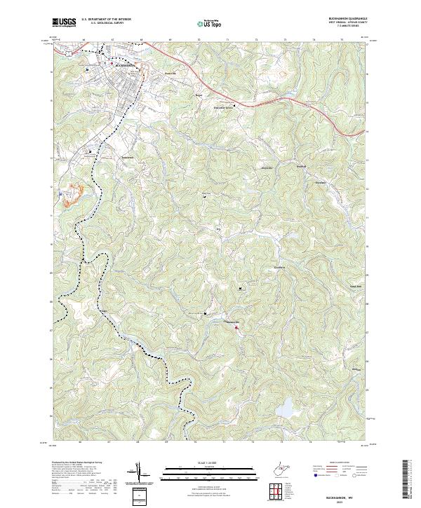 2023 Buckhannon2023 Print · USGSThe Buckhannon River valley comes alive in this contemporary record of Upshur County, showing the evolution of its college town and outlying rural districts. Researchers can trace historic local sites like Our Mills, Excelsior School, and Mount Carmel Cem.
 - 2023 Map of Berlin, 2023 Print
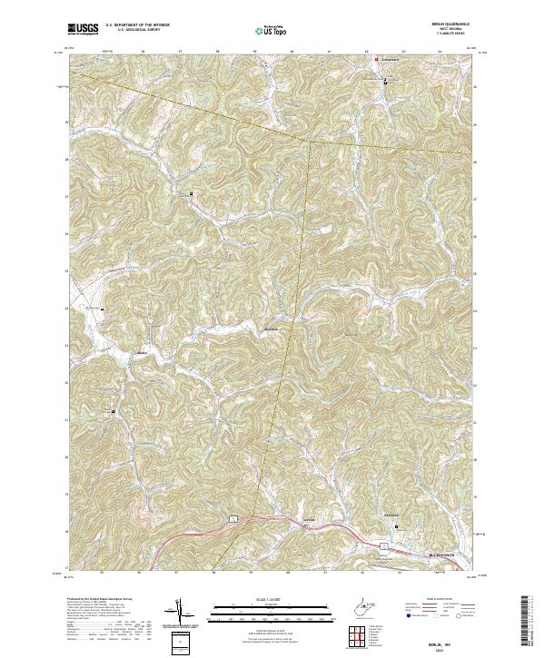 2023 Berlin2023 Print · USGSThis part of Lewis and Upshur Counties reflects a heritage of ridge-top villages and small-scale farming as it appeared recently. Genealogists can trace family names through several historic burial grounds like Laurel Lick Cem, Jesse Run Cem, and the communities of Berlin and Lorentz.
 - 2023 Map of Adrian, 2023 Print
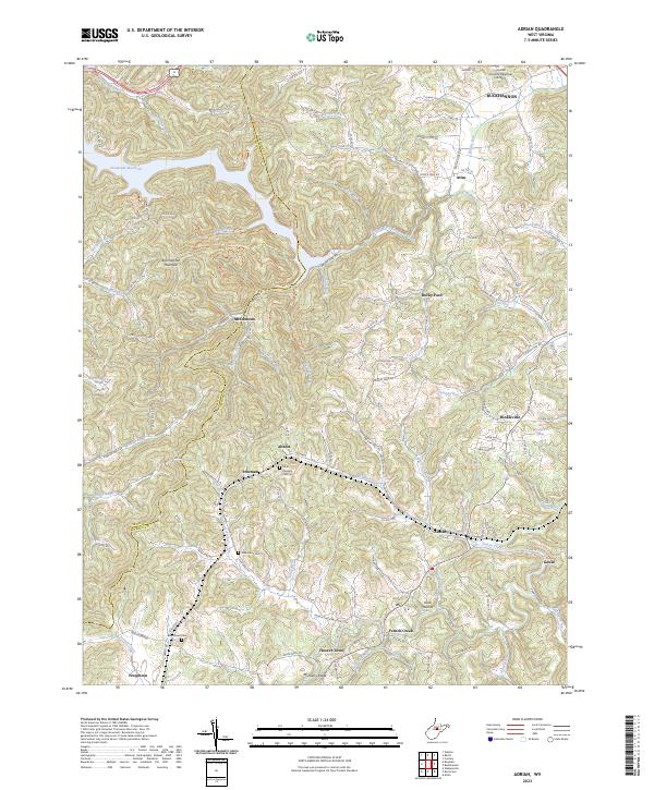 2023 Adrian2023 Print · USGSCentral West Virginia is shown here in contemporary detail, centering on the communities south of the Buckhannon area. Trace local genealogy and geography through sites like Point Pleasant Cem, the Stonecoal Reservoir, and the village of Adrian.
 - 2023 Map of Century, 2023 Print
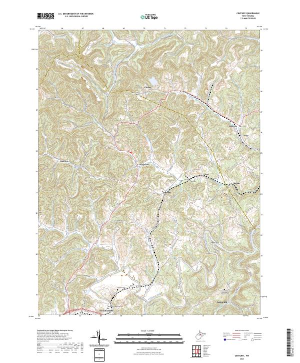 2023 Century2023 Print · USGSThe West Virginia hill country at the intersection of Harrison, Barbour, and Upshur counties shows a landscape of deep hollows and high ridges. Researchers can trace family history at the Methodist Episcopal Church Cem or locate the old industrial sites of Kesling Mill and Millers Bend along the Buckhannon River.
End of results
Showing maps 1-4 of 4
Top cities near Buckhannon
- Weston historical maps
- Philippi historical maps
- West Milford historical maps
- Lost Creek historical maps
- Jane Lew historical maps
- Bentley historical maps
Top neighborhoods of Buckhannon
Frequently asked questions
- What are the different types of historical maps available for Buckhannon?
- What is the oldest map of Buckhannon?
- Where can I purchase historical maps of Buckhannon for my home or office?
- Where can I download high-res historical maps of Buckhannon?
- Are there historical topographic maps available for Buckhannon?
- Is there historical aerial imagery available for Buckhannon?
- Where are historical maps of Buckhannon sourced from?