1960s Maps of Buckhannon, West Virginia
Explore 5 historic maps of Buckhannon from the 1960s. These maps offer a rare glimpse into what life looked like during the 1960s — showing old roads, neighborhoods, homes, and landmarks that have changed or disappeared over time.
Whether you're researching your family's past, planning a metal detecting trip, or studying how Buckhannon's landscape evolved across the 1960s, these high-resolution maps are a powerful tool for exploring the history of this region.
- Focus on a specific era: All maps on this page are from the 1960s, giving you a focused view of this time period.
- See what’s changed: Compare century-old streets, trails, and buildings to today's modern landscape using overlays and satellite layers.
- Research with precision: Use these maps for genealogy, historical research, land use analysis, or educational projects.
- View, download, or print: Maps are fully viewable online in high resolution, and can be downloaded or printed for your own records.
Start exploring Buckhannon's history through authentic maps from the 1960s. This is your window into the past.
Buckhannon, WV maps
(5)- 1960 Map of Century, 1961 Print
 1960 Century1961 Print · USGSBarbour and Upshur counties are shown here at the height of the mid-century coal era. Genealogists can locate family sites like the Rohrbough Cem, rural schoolhouses such as Kesling Sch, and coal company towns like Century No 2.3 unique versions available
 - 1961 Map of Clarksburg
 1961 Clarksburg1961 Print · USGSThe mid-century industrial and river landscapes of West Virginia and Ohio are detailed here, centered on the Ohio River. Researchers can trace the Baltimore and Ohio rail lines connecting towns like Parkersburg, Clarksburg, and Monongah.
 - 1961 Map of Charleston
 1961 Charleston1961 Print · USGSWest Virginia's capital region and the highlands to the east are shown in detail during the early sixties. Genealogists and historians can trace rail networks like the Baltimore and Ohio RR and find early state parks such as Watoga State Park.
 - 1961 Map of Berlin, 1962 Print
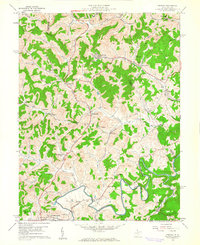
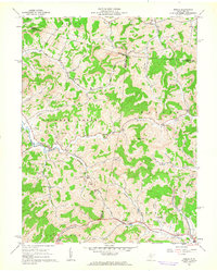 1961 Berlin1962 Print · USGSWest Virginia's Lewis County uplands come alive in this early 1960s survey, showing the deep-cut valleys and ridgeline settlements of the era. Genealogists and historians can trace family locations near Berlin, the Reger Cem, and rural centers like the Buckhannon Run Ch.2 unique versions available
 - 1966 Map of Adrian, 1967 Print
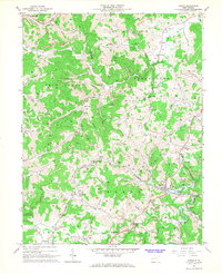 1966 Adrian1967 Print · USGSIn the mid-1960s, this area of Upshur and Lewis counties centered on the Baltimore and Ohio rail line and the gas-producing hills of Skin Creek. Genealogists and historians can trace numerous family-named landmarks, from Collins Settlement and McCue Town to country churches like Reger Chapel.2 unique versions available
End of results
Showing maps 1-5 of 5
Top cities near Buckhannon
- Weston historical maps
- Philippi historical maps
- West Milford historical maps
- Lost Creek historical maps
- Jane Lew historical maps
- Bentley historical maps
Top neighborhoods of Buckhannon
Frequently asked questions
- What are the different types of historical maps available for Buckhannon?
- What is the oldest map of Buckhannon?
- Where can I purchase historical maps of Buckhannon for my home or office?
- Where can I download high-res historical maps of Buckhannon?
- Are there historical topographic maps available for Buckhannon?
- Is there historical aerial imagery available for Buckhannon?
- Where are historical maps of Buckhannon sourced from?