Old Maps of Barron County, Wisconsin for Hiking & Exploration
Hike through history with 208 historic maps of Barron County. Explore old trails, ghost towns, and forgotten backroads — perfect for outdoor adventurers and local explorers.
- Rediscover forgotten places: Map out old mining camps, roads, and footpaths that no longer exist on modern maps.
- Layer with modern tools: Combine with LiDAR or satellite views to plan hikes through historical terrain.
- Made for exploration: Popular among hikers, overlanders, and local history lovers.
Use these maps to find adventure and explore the hidden past of Barron County.
Barron County, WI maps
(208)- 1948 Map of Downing, 1970 Print
 1948 Downing1970 Print · USGSWestern Wisconsin's agricultural and rail heartland is captured here in the late 1940s, centered on the villages of the Tiffany Creek valley. Genealogists can trace family roots through dozens of rural landmarks like Beaver Valley Sch, Graytown, and Immanuel Ch.
 - 1949 Map of Rice Lake, 1961 Print
 1949 Rice Lake1961 Print · USGSIn the Wisconsin Northwoods after the war, the lakeside communities and rural schools of Barron and Washburn counties remained tightly knit. Genealogists can find family landmarks like Loveland Corners, Evergreen Ch, and the many rural schools including Lincoln Sch.
 - 1949 Map of New Auburn, 1967 Print
 1949 New Auburn1967 Print · USGSWisconsin's rural dairy and timber heartland is meticulously documented here just after the war, showing the tight-knit settlement of western Chippewa County. Genealogists can trace family roots through numerous local landmarks like Fox Settlement, Lower Lutheran Ch, and New Auburn Cem.
 - 1949 Map of Ridgeland, 1970 Print
 1949 Ridgeland1970 Print · USGSThe rural borderlands of Barron and Dunn counties are captured here in the late 1940s, when small-town rail hubs and country schoolhouses still dotted the landscape. Researchers can trace family roots through numerous sites like Evergreen Cem, Vanceburg, and Parkman Sch.
 - 1950 Map of Downing
 1950 Downing1950 Print · USGSWisconsin's dairy and timber heartland is captured here just after the war, centered on the rail-linked towns of Glenwood City and Boyceville. Genealogists can trace family roots through numerous country schools like Peaceful Valley and local landmarks like Chimney Rock.
 - 1950 Map of Turtle Lake, 1968 Print
 1950 Turtle Lake1968 Print · USGSBarron and Polk Counties are mapped here in the mid-twentieth century at a pivotal moment of rail-centered commerce and rural education. Genealogists and historians can locate dozens of country institutions, from Holy Trinity Ch and Bethany Cem to the Hay River Valley Sch.
 - 1951 Map of Cumberland
 1951 Cumberland1951 Print · USGSCumberland and the surrounding lake country appear in the early fifties as a landscape of rural schoolhouses and small farming hamlets. Researchers can trace the locations of Roosevelt Sch, Loraine, and the lakeside settlement of Timberland.
 - 1951 Map of Ridgeland
 1951 Ridgeland1951 Print · USGSDunn and Barron counties thrive as a network of small-town centers and rural school districts during the early fifties. Genealogists can trace family roots through numerous sites like Lutheran Cem, Zion Ch, and the Little Beaver Sch.
 - 1951 Map of Shell Lake
 1951 Shell Lake1951 Print · USGSWisconsin's lakeland region comes to life in this mid-century survey of the Washburn and Barron county line. Genealogists and local historians can trace rural school districts like Clam River Sch and country churches such as Golden Valley Ch.
 - 1951 Map of Rice Lake
 1951 Rice Lake1951 Print · USGSNorthwest Wisconsin’s lake country is captured in the early fifties, showing the transition from rail-dependent commerce to modern aviation. Researchers can trace dozens of country schoolhouses like Pioneer Sch and Lincoln Sch, or locate the Rice Lake Municipal Airport.
 - 1951 Map of New Auburn
 1951 New Auburn1951 Print · USGSThe intersection of Barron, Dunn, and Chippewa counties comes into focus in the early 1950s, showing a landscape thick with local school districts and rural parishes. Genealogists can trace family footprints through dozens of named sites like Fox Settlement Sch, Dovre Ch, and the New Auburn Cem.
 - 1951 Map of Chetek, 1953 Print
 1951 Chetek1953 Print · USGSThe Chetek region in the early fifties shows a landscape of interconnected glacial lakes and growing rail towns. Trace the history of rural education and transport through local landmarks like Edgewood Sch and the CHICAGO AND NORTH WESTERN railroad.2 unique versions available
 - 1951 Map of Barron, 1953 Print
 1951 Barron1953 Print · USGSBarron County in the early fifties shows a thriving rural landscape built around the rail-and-river economy. Researchers can trace dozens of local landmarks, from the Old Hillsdale Cem to the tracks of the Minneapolis St Paul and Sault Ste Marie RR.2 unique versions available
 - 1952 Map of Turtle Lake
 1952 Turtle Lake1952 Print · USGSIn the early 1950s, the railroad junction at Turtle Lake served as the heartbeat of this lake-dotted Wisconsin landscape. Genealogists and local historians can trace rural family roots through numerous sites like St Anne Cem, Magnor Lake Sch, and the settlement of Clayton.
 - 1953 Map of Rice Lake, 1967 Print
 1953 Rice Lake1967 Print · USGSNorthwest Wisconsin during the mid-fifties reveals a landscape defined by timber, rail, and water. Genealogists and historians can trace the development of river towns like Ladysmith and Rice Lake along the Soo Line and Chicago and North Western railroads.2 unique versions available
 - 1953 Map of Stillwater, 1980 Print
 1953 Stillwater1980 Print · USGSThe Twin Cities and the St. Croix Valley are captured in this mid-century survey as the interstate era began to transform the Upper Midwest. Genealogists and historians can trace the rail-and-river geography of Stillwater, locate landmarks in Anoka, or explore the sprawling St Croix State Park.
 - 1955 Map of Stillwater, 1965 Print
 1955 Stillwater1965 Print · USGSThe Upper St. Croix Valley and the growing Twin Cities area are shown here during the mid-fifties, before the interstate era transformed the regional commute. You can trace the lines of the Northern Pacific RR through towns like Rush City or locate the Saint Croix Indian Reservation.
 - 1956 Map of Cumberland, 1957 Print
 1956 Cumberland1957 Print · USGSIn the mid-1950s, the lake country of Northwest Wisconsin was a patchwork of small townships and rural school districts. Genealogists can trace family connections through numerous local landmarks like Clam River Cem, Corpus Christi Ch, and the many rural schools like Bergman Sch and Emerson Sch.2 unique versions available
 - 1958 Map of Stillwater
 1958 Stillwater1958 Print · USGSThe Upper Mississippi and St. Croix River valleys appear in the mid-fifties as the Twin Cities expanded north. Genealogists can locate family landmarks like Oak Park Cem, Saint Michael Church, and the Soo Line RR rail corridors.2 unique versions available
 - 1959 Map of Rice Lake
 1959 Rice Lake1959 Print · USGSNorthwest Wisconsin in the late fifties was a land of expanding road networks and deep-seated timber history. Genealogists and historians can trace rail lines like the Soo Line RR and Chicago St Paul Minneapolis and Omaha Ry as they link settlements from Spooner to Medford.
 - 1965 Map of Stillwater
 1965 Stillwater1965 Print · USGSThe Twin Cities and the St. Croix Valley are mapped here during a period of significant post-war growth and industrial transit. Genealogists and historians can trace rail lines like the Northern Pacific RR through towns such as Rush City, Amery, and Balsam Lake.
 - 1965 Map of Rice Lake, 1967 Print
 1965 Rice Lake1967 Print · USGSThe lake country of Barron and Washburn counties is shown here in the mid-1960s, a landscape of interconnected waterways and rural townships. Genealogists and local historians can trace legacy sites like the Oak Grove Center Sch, Evergreen Cem, and the settlement at Mikana.
 - 1965 Map of Shell Lake, 1967 Print
 1965 Shell Lake1967 Print · USGSWisconsin's lake country in the mid-1960s is preserved here, centered on the rail-linked communities of Washburn and Barron Counties. Genealogists and historians can trace local landmarks like Heart Lake Church, Sarona Cemetery, and the Section Ten School.2 unique versions available
 - 1975 Map of Stillwater
 1975 Stillwater1975 Print · USGSThe Twin Cities and the St. Croix Valley are captured in the mid-seventies, showing the urban growth of Minneapolis and St Paul. Researchers can trace old rail corridors of the Northern Pacific RR and locate tribal lands at the Mille Lacs Indian Reservation.2 unique versions available
 - 1975 Map of Connorsville, 1978 Print
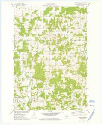 1975 Connorsville1978 Print · USGSDunn and Barron Counties are captured in the mid-seventies, showing a network of rural hamlets and winding waterways. Genealogists can locate family sites like Akers Cem and New Haven Cem or trace the early paths of Sheridan Rd.
Showing maps 1-25 of 208
Top cities of Barron County
- Rice Lake historical maps
- Barron historical maps
- Cumberland historical maps
- Chetek historical maps
- Cameron historical maps
- Almena historical maps
See more
Frequently asked questions
- What are the different types of historical maps available for Barron County?
- What is the oldest map of Barron County?
- Where can I purchase historical maps of Barron County for my home or office?
- Where can I download high-res historical maps of Barron County?
- Are there historical topographic maps available for Barron County?
- Is there historical aerial imagery available for Barron County?
- Where are historical maps of Barron County sourced from?