1960s Maps of Bayfield County, Wisconsin
Explore 28 historic maps of Bayfield County from the 1960s. These maps offer a rare glimpse into what life looked like during the 1960s — showing old roads, neighborhoods, homes, and landmarks that have changed or disappeared over time.
Whether you're researching your family's past, planning a metal detecting trip, or studying how Bayfield County's landscape evolved across the 1960s, these high-resolution maps are a powerful tool for exploring the history of this region.
- Focus on a specific era: All maps on this page are from the 1960s, giving you a focused view of this time period.
- See what’s changed: Compare century-old streets, trails, and buildings to today's modern landscape using overlays and satellite layers.
- Research with precision: Use these maps for genealogy, historical research, land use analysis, or educational projects.
- View, download, or print: Maps are fully viewable online in high resolution, and can be downloaded or printed for your own records.
Start exploring Bayfield County's history through authentic maps from the 1960s. This is your window into the past.
Bayfield County, WI maps
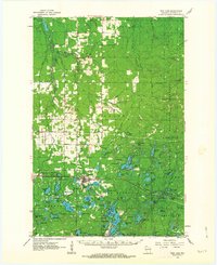
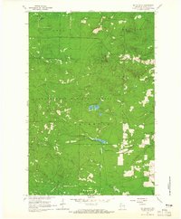
(28)- 1961 Map of Iron Lake SW
 1961 Iron Lake SW1961 Print · USGSBayfield County's lake-dotted landscape is captured here during the early sixties, centered on the junction of the Northern Pacific and the Iron River. Genealogists can locate family landmarks like Oulu Sch and Oulu Ch, or trace the many lakeside Boat Access points near Spider Lake.
 - 1961 Map of Iron Lake, 1963 Print
 1961 Iron Lake1963 Print · USGSNorthern Wisconsin's timber and rail corridor is captured here in the early sixties, centered on the junction at Iron River. Genealogists and local researchers can locate family sites near Hillside Cem, Oulu Ch, and the old Townhall.2 unique versions available
 - 1961 Map of Port Wing, 1963 Print
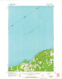 1961 Port Wing1963 Print · USGSThe South Shore of Lake Superior comes into focus in the early sixties, highlighting the coastal life of Bayfield County. Researchers can trace the development of Port Wing and Herbster or locate family sites near Greenwood Cem.2 unique versions available
 - 1961 Map of Ellison Lake, 1963 Print
 1961 Ellison Lake1963 Print · USGSNorthern Wisconsin's lake country is captured in the early sixties as a center for conservation and recreation. Researchers can trace family history at the Barnes Cem or explore the wilderness around the Bois Brule River and Lake Nebagamon.2 unique versions available
 - 1961 Map of Brule, 1963 Print
 1961 Brule1963 Print · USGSNorthern Wisconsin's lake country and timberlands are captured here in the early sixties, showing the transition from the Brule River valley to the big lake. Researchers can trace family roots at Rest Haven Cem, locate the State Fish Hatchery, and follow the Northern Pacific Railroad through Blueberry.2 unique versions available
 - 1961 Map of Iron Lake SE, 1985 Print
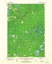
 1961 Iron Lake SE1985 Print · USGSBayfield County at the dawn of the 1960s reveals a rugged landscape of glacial lakes and managed timberlands within the Chequamegon National Forest. Genealogists and historians can locate Tripp Cem and trace the old Northern Pacific line past Long Lake and Lake Millicent.
 - 1961 Map of Iron Lake NE, 1985 Print
 1961 Iron Lake NE1985 Print · USGSBayfield County saw significant conservation during the early sixties as the Chequamegon National Forest expanded. You can trace the remnants of the logging era along the Old Railroad Grade or locate the headwaters of the Flag River.
 - 1964 Map of Two Harbors
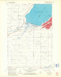
 1964 Two Harbors1964 Print · USGSThe North Shore of Lake Superior is captured here during the mid-1950s, a time of significant industrial mining growth and emerging tourism. Genealogists and historians can trace the rail lines of the Duluth Missabe and Iron Range and locate landmarks like Split Rock Light and the U S Air Force Radar Station.
 - 1964 Map of Squaw Bay, 1965 Print
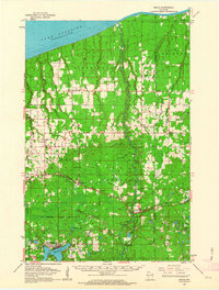
 1964 Squaw Bay1965 Print · USGSCoastal Bayfield County comes into focus in the mid-1960s, showing the intersection of the mainland woods and the great lake. You can trace the rocky perimeter of Eagle Island and explore the depths near Squaw Bay and Squaw Point.2 unique versions available
 - 1964 Map of Moquah NW, 1965 Print
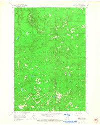 1964 Moquah NW1965 Print · USGSBayfield County’s timberlands are shown here in the mid-sixties, a period when the forest was managed for both conservation and legacy industrial use. Genealogists and historians can trace the Old Railroad Grade and locate remote landmarks like the Brinks Guard Sta and Sunken Camp Lakes.3 unique versions available
 - 1964 Map of Ashland West, 1965 Print
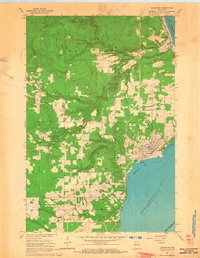
 1964 Ashland West1965 Print · USGSThe Lake Superior shoreline at the mid-century shows the city of Ashland as a vital rail and educational center. Researchers can trace the legacy of the Chicago and North Western lines, local schools like Ondassagon Sch, and the grounds of the University of Wisconsin Experiment Station.4 unique versions available
 - 1964 Map of Sand Island, 1965 Print
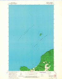
 1964 Sand Island1965 Print · USGSBayfield County's northern coast and the Apostle Islands come into focus during the mid-sixties, showing the intersection of tribal lands and maritime navigation. You can trace the trails and lighthouse on Sand Island or locate resources like the Gravel Pits near the Raspberry River.2 unique versions available
 - 1964 Map of Bayfield, 1965 Print
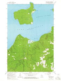
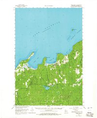
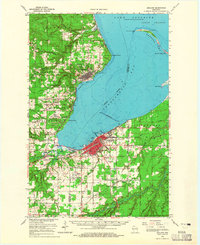
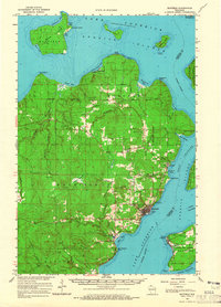 1964 Bayfield1965 Print · USGSThe Bayfield Peninsula and Apostle Islands are captured in the mid-1960s, showing the intersection of tribal lands and Lake Superior maritime life. Researchers can trace the Chicago and North Western rail line and locate landmarks like the Bayfield State Fish Hatchery and Calvary Cem.
 - 1964 Map of York Island, 1965 Print
 1964 York Island1965 Print · USGSThe Bayfield Peninsula and the Apostle Islands appear here in the mid-1960s, showing a landscape defined by tribal lands and maritime navigation. Trace the borders of the Red Cliff Indian Reservation and locate landmarks like the Light on Raspberry Island.
 - 1964 Map of Cornucopia, 1965 Print
 1964 Cornucopia1965 Print · USGSThe Lake Superior shoreline at the height of the mid-sixties reveals the remote settlement of Cornucopia and its maritime connection to Siskiwit Bay. Researchers can trace the rural footprint of Bell township through sites like the Bell Cem and St Anthony Ch.3 unique versions available
 - 1964 Map of Long Island, 1965 Print
 1964 Long Island1965 Print · USGSThe Lake Superior coast of Bayfield County is captured here in the mid-1960s, showing the vital maritime connection between the mainland and the Apostle Islands. Researchers can locate the navigational La Pointe Light, trace the Chicago and North Western rail line through Washburn, and explore the shoreline from Houghton Point to Oak Point.
 - 1964 Map of Moquah, 1965 Print
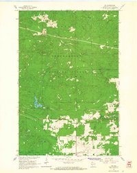
 1964 Moquah1965 Print · USGSBayfield County is captured in the mid-sixties as the timber and rail industries shaped the landscape around the Chequamegon National Forest. Genealogists and historians can locate rural landmarks like St Peters Ch and the Benoit settlement near the Chicago and North Western tracks.2 unique versions available
 - 1964 Map of Moquah, 1965 Print
 1964 Moquah1965 Print · USGSBayfield County in the mid-sixties shows a landscape shaped by timber management and railway transit. Genealogists and researchers can trace the rail-side settlements of Moquah and Ino, or locate landmarks like the Moquah Lookout Tower and St Florian Ch.
 - 1964 Map of Mt. Ashwabay, 1965 Print
 1964 Mt. Ashwabay1965 Print · USGSThe Bayfield Peninsula highlands in the mid-1960s reveal a landscape defined by forest-shrouded peaks and Lake Superior drainage. Local researchers can trace the headwaters of the Little Sioux River and Sand River, or locate industrial sites like the Gravel Pit near Mt Ashwabay.2 unique versions available
 - 1964 Map of Cornucopia, 1965 Print
 1964 Cornucopia1965 Print · USGSThe Bayfield County shoreline meets the Apostle Islands in the mid-1960s, showing the quiet transition from working lakefront to deep forest. Local historians can trace the foundations of Cornucopia and locate rural landmarks like St Anthony Ch and Herbster Cem.
 - 1964 Map of Washburn, 1965 Print
 1964 Washburn1965 Print · USGSCoastal Wisconsin communities and timberlands are captured here in the mid-sixties as the region balanced lakefront industry with recreation. You can trace the path of the Chicago and North Western railroad or locate local landmarks like Woodlawn Cem and the Big Rock Rapids.2 unique versions available
 - 1964 Map of Ino, 1965 Print
 1964 Ino1965 Print · USGSBayfield County timberlands and rail corridors are captured in the mid-1960s just as the national forest boundary was firmly established. Genealogists and local historians can locate St Florian Ch and the village of Ino, while tracking the path of the Northern Pacific Railroad.3 unique versions available
 - 1964 Map of Mt. Valhalla, 1965 Print
 1964 Mt. Valhalla1965 Print · USGSThe northern Wisconsin wilderness of the mid-sixties is captured here, centered on the high reaches of Mt Valhalla. Researchers can trace the extensive network of the Old Railroad Grade and locate the Washburn Lookout Tower deep within the forest.3 unique versions available
 - 1964 Map of Bark Bay, 1965 Print
 1964 Bark Bay1965 Print · USGSThe Bayfield Peninsula coastline is documented in the mid-1960s, showing the intersection of maritime geography and industrial forestry. Genealogists and researchers can trace local landmarks like Herbster Cem or the drainages of Bark River and Lost Creek No 1.2 unique versions available
 - 1964 Map of Ashland, 1965 Print
 1964 Ashland1965 Print · USGSChequamegon Bay was a bustling hub of maritime and rail transport in the mid-sixties. Researchers can trace the extensive rail lines at Ashland Junction, find local heritage sites like Northland College, and locate family names at St Agnes Cem.2 unique versions available
Showing maps 1-25 of 28
Top cities of Bayfield County
- Washburn historical maps
- Iron River historical maps
- Cable historical maps
- Bayfield historical maps
- Drummond historical maps
- Port Wing historical maps
See more
Frequently asked questions
- What are the different types of historical maps available for Bayfield County?
- What is the oldest map of Bayfield County?
- Where can I purchase historical maps of Bayfield County for my home or office?
- Where can I download high-res historical maps of Bayfield County?
- Are there historical topographic maps available for Bayfield County?
- Is there historical aerial imagery available for Bayfield County?
- Where are historical maps of Bayfield County sourced from?