1970s Maps of Bayfield County, Wisconsin
Explore 15 historic maps of Bayfield County from the 1970s. These maps offer a rare glimpse into what life looked like during the 1970s — showing old roads, neighborhoods, homes, and landmarks that have changed or disappeared over time.
Whether you're researching your family's past, planning a metal detecting trip, or studying how Bayfield County's landscape evolved across the 1970s, these high-resolution maps are a powerful tool for exploring the history of this region.
- Focus on a specific era: All maps on this page are from the 1970s, giving you a focused view of this time period.
- See what’s changed: Compare century-old streets, trails, and buildings to today's modern landscape using overlays and satellite layers.
- Research with precision: Use these maps for genealogy, historical research, land use analysis, or educational projects.
- View, download, or print: Maps are fully viewable online in high resolution, and can be downloaded or printed for your own records.
Start exploring Bayfield County's history through authentic maps from the 1970s. This is your window into the past.
Bayfield County, WI maps
(15)- 1971 Map of Upper Eau Claire Lake, 1973 Print
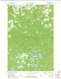
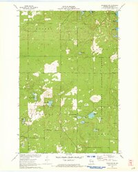
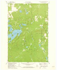 1971 Upper Eau Claire Lake1973 Print · USGSBayfield County in the early seventies is a landscape of glacial waters and deep timberlands preserved within national forests. Researchers can trace the layout of northern shorelines and remote springs like Shunenberg Springs, Bearsdale Springs, and Upper Eau Claire Lake.2 unique versions available
 - 1971 Map of Delta, 1973 Print
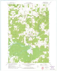
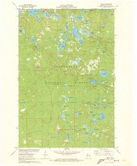 1971 Delta1973 Print · USGSIn the early 1970s, the northwoods of Bayfield County remained a dense landscape of glacial lakes and managed timber. You can trace the road networks and shoreline details of over a dozen water bodies including Lake Delta, Eagle Lake, and the vicinity of the Delta Lookout Tower.2 unique versions available
 - 1971 Map of Cable, 1973 Print
 1971 Cable1973 Print · USGSBayfield County in the early seventies shows a landscape of deep forests and glacial lakes at the height of its mid-century recreational growth. Genealogists and local historians can trace the residents of Cable and Seeley or locate ancestral plots at St Anne Cem and Greenwood Cem.2 unique versions available
 - 1971 Map of Totagatic Lake, 1973 Print
 1971 Totagatic Lake1973 Print · USGSBayfield and Sawyer counties are captured here in the early seventies, a landscape of protected wetlands and thick forest at the edge of the Northwoods. Researchers can trace the courses of Hills Mill Creek and the Totagatic River or locate landmarks like the Smoky Hill Lookout Tower.2 unique versions available
 - 1971 Map of Grand View, 1973 Print
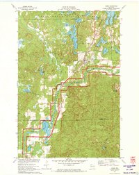
 1971 Grand View1973 Print · USGSBayfield County’s forest and lake country is captured here in the early seventies, centered on the settlement of Grand View. Researchers can find the University of Wisconsin Surveying Camp, the Long Mile Lookout Tower, and an Old Railroad Grade.
 - 1971 Map of Mason, 1973 Print
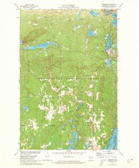
 1971 Mason1973 Print · USGSThe village of Mason and the surrounding timberlands are captured here in the early seventies, just as the Bibon Marsh remains a wild contrast to local farms. Trace old transport routes including the Chicago and North Western line and an Old Railroad Grade.
 - 1971 Map of Chittamo NE, 1973 Print
 1971 Chittamo NE1973 Print · USGSThe northwoods of Douglas and Bayfield counties are shown here in the early seventies, a landscape defined by complex river systems and township boundaries. Genealogists and outdoorsmen can trace the Totagatic River through the Totagatic River State Wildlife Management Area or locate landmarks like Goose Lake and Frog Creek Road.
 - 1971 Map of Drummond, 1973 Print
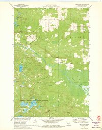
 1971 Drummond1973 Print · USGSBayfield County's timberlands and glacial lakes are captured here in the early seventies, centered on the historic company town of Drummond. Genealogists and researchers can trace the rail-and-water geography of the era, from the Chicago and North Western tracks to remote landmarks like the Lookout Tower and Lake Dinner Camp.3 unique versions available
 - 1971 Map of Lake Tahkodah, 1973 Print
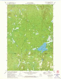
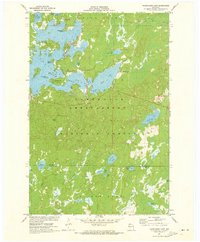
 1971 Lake Tahkodah1973 Print · USGSThe Northwoods of Bayfield and Sawyer counties are captured here in the early seventies, dominated by the Namekagon River. You can trace the development of recreation at Mount Telemark or locate remote camps on Star Lake and Lake Tahkodah.
 - 1971 Map of Namekagon Lake, 1973 Print
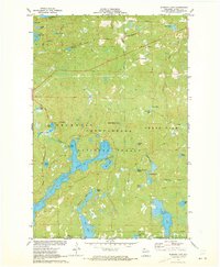
 1971 Namekagon Lake1973 Print · USGSBayfield and Sawyer counties are captured in the early 1970s, showcasing the dense woods and glaciated waters of the Chequamegon National Forest. Researchers can trace the irregular shorelines of Namekagon Lake and find landmarks like Missionary Point or the small settlement at Namekagon.2 unique versions available
 - 1971 Map of Drummond NW, 1973 Print
 1971 Drummond NW1973 Print · USGSBayfield County’s glacial lakelands are captured here in the early seventies as timber and recreational interests shaped the Northwoods. Trace family-named roads and remote forest sites like Barnes Road, Camp Nine Lake, and Silver Lake.2 unique versions available
 - 1971 Map of Grand View NW, 1973 Print
 1971 Grand View NW1973 Print · USGSBayfield County at the start of the 1970s shows a landscape defined by the expansive Bibon Marsh and the lakelands of the Northwoods. Researchers can trace the Old Railroad Grade near Sutherland or locate family sites near Pike River Cem and Bethany Ch.3 unique versions available
 - 1971 Map of Diamond Lake, 1973 Print
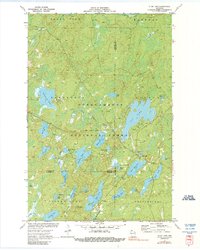
 1971 Diamond Lake1973 Print · USGSBayfield County's north woods are captured here in the early seventies, showing a landscape defined by the Chequamegon National Forest. Trace family vacation spots around Owen Lake or the old Chicago and North Western rail line.3 unique versions available
 - 1971 Map of Clam Lake, 1990 Print
 1971 Clam Lake1990 Print · USGSThe Northwoods of Ashland and Bayfield Counties come alive in this early 1970s survey of the lake-studded forestry landscape. Researchers can locate the Clam Lake Lookout Tower, trace burials at Wildwood Cem, and find the Job Corps Camp near Chippewa Lake.
 - 1978 Map of Outer Island
 1978 Outer Island1978 Print · USGSThe Apostle Islands archipelago and the vast expanse of Lake Superior are shown in the late seventies. Researchers can trace maritime landmarks like the Outer Island Light, explore island terrain from Bear Island to Cat Island, and locate the old Landing Strip.
End of results
Showing maps 1-15 of 15
Top cities of Bayfield County
- Washburn historical maps
- Iron River historical maps
- Cable historical maps
- Bayfield historical maps
- Drummond historical maps
- Port Wing historical maps
See more
Frequently asked questions
- What are the different types of historical maps available for Bayfield County?
- What is the oldest map of Bayfield County?
- Where can I purchase historical maps of Bayfield County for my home or office?
- Where can I download high-res historical maps of Bayfield County?
- Are there historical topographic maps available for Bayfield County?
- Is there historical aerial imagery available for Bayfield County?
- Where are historical maps of Bayfield County sourced from?