Old Maps of Clark County, Wisconsin for Metal Detecting
Plan your next treasure hunt with 239 historic maps of Clark County. Find old homesites, ghost towns, trails, and gathering spots that may be lost to time — perfect for identifying promising metal detecting locations.
- Locate forgotten sites: Uncover places like long-lost settlements, abandoned rail lines, or gathering spots.
- Plan better hunts: Use map overlays combined with LiDAR or satellite views to narrow in on historically rich areas.
- Made for detectorists: Thousands of hobbyists use these maps to discover relics, coins, and hidden history.
Use these historic maps to boost your research and find new opportunities beneath the surface of Clark County.
Clark County, WI maps
(239)- 1924 Map of Black River Falls, 1963 Print
 1924 Black River Falls1963 Print · USGSBlack River Falls and the surrounding central Wisconsin hills are captured in the mid-1920s during a period of established rail transport and rural education. Genealogists can trace a dense network of country schools and settlements including Winnebago Mission, Charter Oak Mill, and Vaudreuil.2 unique versions available
 - 1926 Map of Black River Falls
 1926 Black River Falls1926 Print · USGSJackson County is shown during a period of steady rural growth in the 1920s, centered on the bustling river town of Black River Falls. Local historians can trace dozens of rural schoolhouses and vanished sidings like Vaudreuil and Sheppard along the rail lines.
 - 1948 Map of Fairchild, 1966 Print
 1948 Fairchild1966 Print · USGSWisconsin's West-Central borderlands emerge in this post-war study of the rail-centered towns of Fairchild and Humbird. You can trace the legacy of rural education and industry through numerous landmarks like Blackberry Sch, Wildcat Mound, and the Chicago and North Western rail line.2 unique versions available
 - 1949 Map of Fairchild
 1949 Fairchild1949 Print · USGSThe rural borderlands of Eau Claire, Clark, and Jackson Counties appear here in the late 1940s, centered on the towns of Fairchild and Humbird. Researchers can locate numerous one-room schools like Lone Pine Sch, trace the Chicago and North Western rail line, or find local family sites at Cleveland Cem.
 - 1951 Map of Lublin, 1953 Print
 1951 Lublin1953 Print · USGSTaylor County agriculture meets the northern timberlands in the early fifties, centering on the rail hub of Lublin. Genealogists and historians can locate vanished rural schoolhouses like Redville Sch and trace the original paths of the MINNEAPOLIS ST PAUL AND SAULT STE MARIE railroad.
 - 1951 Map of Medford, 1954 Print
 1951 Medford1954 Print · USGSMedford and the surrounding Taylor County townships are captured here in the early fifties, showing a landscape defined by dairy farming and rail transport. Genealogists can locate numerous country schoolhouses like Thielke Sch and rural burial grounds including Little Black Cem.
 - 1951 Map of Gilman, 1969 Print
 1951 Gilman1969 Print · USGSTaylor and Clark counties are captured here in the early fifties, showing a rural landscape defined by the Yellow River and the Soo Line railroad. Genealogists can locate numerous landmarks including the Russian Ch, Meadowbrook Cem, and the Sunnyview Sch.
 - 1952 Map of Stanley, 1954 Print
 1952 Stanley1954 Print · USGSStanley and Thorp anchor this central Wisconsin landscape in the early fifties as the rural schoolhouse system reaches its peak. Genealogists can locate family names at the Evergreen Cem or trace rural education at Busy Bee Sch and Sol Mohr Sch.
 - 1953 Map of Neillsville, 1955 Print
 1953 Neillsville1955 Print · USGSMid-century Clark County comes into focus as a landscape of rural school districts and evolving rail corridors. Genealogists and historians can trace family locations through sites like Willard National Cemetery, York Center Ch, and over a dozen country schools including Ortole Hill Sch.2 unique versions available
 - 1953 Map of Abbotsford, 1955 Print
 1953 Abbotsford1955 Print · USGSCentral Wisconsin dairy country in the early fifties reveals a landscape tightly organized around the rail line and township sections. Genealogists can trace family roots through numerous local landmarks like Riplinger, St Johannis Ch, and Pickard Sch.
 - 1953 Map of Owen, 1955 Print
 1953 Owen1955 Print · USGSCentral Wisconsin farmland and river valleys are captured here in the early fifties, showing the peak of the rural school and church network. Researchers can trace family roots through numerous sites like Riverside Cemetery, Hoard Center Sch, and the West Beaver Church.
 - 1953 Map of Eau Claire, 1965 Print
 1953 Eau Claire1965 Print · USGSWest-central Wisconsin in the mid-fifties shows a landscape of river-valley industry and vast wildlife refuges during the transition from rails to modern highways. Genealogists and historians can trace the rail corridors of the Chicago and North Western or locate family-named landmarks like Decorah Mound and Chippewa Island.4 unique versions available
 - 1953 Map of Rice Lake, 1967 Print
 1953 Rice Lake1967 Print · USGSNorthwest Wisconsin during the mid-fifties reveals a landscape defined by timber, rail, and water. Genealogists and historians can trace the development of river towns like Ladysmith and Rice Lake along the Soo Line and Chicago and North Western railroads.2 unique versions available
 - 1954 Map of Granton, 1956 Print
 1954 Granton1956 Print · USGSCentral Wisconsin's farming heartland and rural school network are preserved here during the mid-1950s. Genealogists can locate family-named landmarks and institutions like Spokeville Sch, Grace Ch, and the high ground of Lindsey Bluffs.2 unique versions available
 - 1957 Map of City Point, 1960 Print
 1957 City Point1960 Print · USGSJackson and Clark Counties are shown here in the late fifties, dominated by the timber and cranberry industries of the Central Wisconsin Sand County. Genealogists and historians can locate rural landmarks like Audubon Sch, Martyrs Cem, and the old rail siding at Spaulding.2 unique versions available
 - 1958 Map of Eau Claire
 1958 Eau Claire1958 Print · USGSWestern Wisconsin in the late fifties shows a landscape of growing regional hubs and massive wildlife refuges. Trace the rail lines of the Chicago and North Western between Eau Claire and Marshfield, or explore the terrain around Iron Mound and Lake Wissota.
 - 1958 Map of Hatfield, 1960 Print
 1958 Hatfield1960 Print · USGSIn the late fifties, the central Wisconsin lake country was defined by its vast flowage systems and timbered mounds. Researchers can trace rural school locations like Carlyle Sch and explore old transport routes through Komensky Station or along an old railroad grade.
 - 1959 Map of Rice Lake
 1959 Rice Lake1959 Print · USGSNorthwest Wisconsin in the late fifties was a land of expanding road networks and deep-seated timber history. Genealogists and historians can trace rail lines like the Soo Line RR and Chicago St Paul Minneapolis and Omaha Ry as they link settlements from Spooner to Medford.
 - 1963 Map of Abbotsford, 1964 Print
 1963 Abbotsford1964 Print · USGSWisconsin's dairy heartland is mapped here in the early sixties, showing the vital junctions of the central townships. Local historians can trace family land across Unity, Beaver, and Sherman, locating landmarks like Beaver Center Sch and St Johns Cem.
 - 1963 Map of Owen, 1964 Print
 1963 Owen1964 Print · USGSCentral Clark County comes alive in the early sixties as a network of river-towns and rural school districts. Genealogists can locate family names at St Marys Cem or trace roots at the Braun Settlement Sch and Frenchtown Sch.
 - 1964 Map of Eau Claire
 1964 Eau Claire1964 Print · USGSWest-central Wisconsin in the mid-1960s was a hub of river-driven industry and expanding rail networks. Researchers can trace historic homesteads near Menomonie, follow the Soo Line RR through Marshfield, or explore the grounds of the Camp McCoy Military Reservation.
 - 1968 Map of Black River Falls, 1971 Print
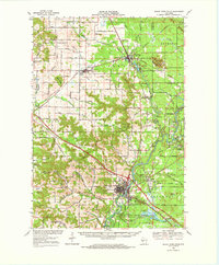 1968 Black River Falls1971 Print · USGSThe Black River valley comes alive in this late-sixties survey, showing the busy rail junction at Merrillan and the growing county seat at Black River Falls. Genealogists and historians can trace local roots at the Winnebago Mission, Cloverdale School, and Stanford Cem.
 - 1969 Map of Medford SW, 1971 Print
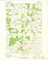 1969 Medford SW1971 Print · USGSTaylor and Clark counties in the late sixties remain a patchwork of small dairy farms and rural schoolhouses. Researchers can locate community anchors like Amish Cem, Holway Ch, and several local schools including Green Meadow Sch and Hillside Sch.
 - 1969 Map of Stetsonville, 1971 Print
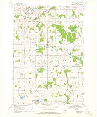 1969 Stetsonville1971 Print · USGSThe dairy lands of Central Wisconsin are documented here in the late sixties, showing the rural communities of Stetsonville and Dorchester along the Soo Line. Genealogists and historians can locate legacy sites like Sacred Heart Cem, Victory Sch, and the North Memorial Cem.
 - 1969 Map of Lublin, 1971 Print
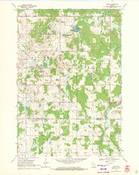 1969 Lublin1971 Print · USGSWisconsin’s north-central dairy and timber country is documented here in the late sixties, centered on the village of Lublin. Researchers can trace old township boundaries and family ties at St Stanislaus Cem, Maplehurst Cem, and along the Soo Line railroad corridor.
Showing maps 1-25 of 239
Top cities of Clark County
- Neillsville historical maps
- Thorp historical maps
- Loyal historical maps
- Greenwood historical maps
- Owen historical maps
- Dorchester historical maps
See more
Frequently asked questions
- What are the different types of historical maps available for Clark County?
- What is the oldest map of Clark County?
- Where can I purchase historical maps of Clark County for my home or office?
- Where can I download high-res historical maps of Clark County?
- Are there historical topographic maps available for Clark County?
- Is there historical aerial imagery available for Clark County?
- Where are historical maps of Clark County sourced from?