1950s Maps of Door County, Wisconsin
Explore 6 historic maps of Door County from the 1950s. These maps offer a rare glimpse into what life looked like during the 1950s — showing old roads, neighborhoods, homes, and landmarks that have changed or disappeared over time.
Whether you're researching your family's past, planning a metal detecting trip, or studying how Door County's landscape evolved across the 1950s, these high-resolution maps are a powerful tool for exploring the history of this region.
- Focus on a specific era: All maps on this page are from the 1950s, giving you a focused view of this time period.
- See what’s changed: Compare century-old streets, trails, and buildings to today's modern landscape using overlays and satellite layers.
- Research with precision: Use these maps for genealogy, historical research, land use analysis, or educational projects.
- View, download, or print: Maps are fully viewable online in high resolution, and can be downloaded or printed for your own records.
Start exploring Door County's history through authentic maps from the 1950s. This is your window into the past.
Door County, WI maps
(6)- 1952 Map of Casco, 1954 Print
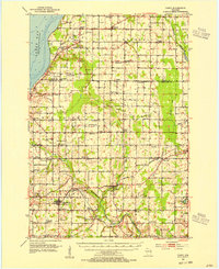 1952 Casco1954 Print · USGSWisconsin's Door Peninsula hinterlands come to life in the early 1950s, showing a landscape of small dairy towns and local rail lines. Genealogists can trace family roots through numerous country parishes and burial sites like St Marys Cem, Holy Trinity Cem, and the rural Luxemburg area.2 unique versions available
 - 1954 Map of Escanaba, 1967 Print
 1954 Escanaba1967 Print · USGSThe Upper Peninsula and Door County shorelines meet here in the mid-fifties, showing the vital maritime and timber networks of the Great Lakes. Researchers can trace historic rail lines, old fire lookouts like the Stonington Fire Tower, and island settlements such as Washington Island.2 unique versions available
 - 1954 Map of Manitowoc, 1968 Print
 1954 Manitowoc1968 Print · USGSLake Michigan served as a vital transit corridor in the mid-fifties, with car and auto ferries linking the industrial ports of Wisconsin to the Michigan timberlands. Genealogists and maritime historians can trace active ferry routes like the Ann Arbor Railway Car and Auto Ferry and locate early settlements from Brussels to Algoma.2 unique versions available
 - 1957 Map of Escanaba
 1957 Escanaba1957 Print · USGSThe Upper Peninsula and Door County shorelines meet in the mid-fifties, capturing a landscape of timber, iron, and maritime trade. Genealogists and local historians can trace the Chicago & North Western RR through settlements like Hermansville or locate St Vitals Church and the Potawatome Indian Reservation.
 - 1958 Map of Escanaba
 1958 Escanaba1958 Print · USGSNorthern Lake Michigan maritime commerce and timberlands are captured here in the mid-fifties. Genealogists and historians can trace rail networks like the Escanaba and Lake Superior or locate island settlements such as Detroit Harbor and Fish Creek.
 - 1958 Map of Manitowoc
 1958 Manitowoc1958 Print · USGSLake Michigan and its shorelines are shown in the late fifties when maritime transport defined the region. Researchers can trace the routes of the Ann Arbor Railroad Ferry or locate old settlements like St. Nazianz, Rostock, and Two Creeks.
End of results
Showing maps 1-6 of 6
Top cities of Door County
- Sturgeon Bay historical maps
- Brussels historical maps
- Baileys Harbor historical maps
- Sister Bay historical maps
- Jacksonport historical maps
- Washington historical maps
See more
Frequently asked questions
- What are the different types of historical maps available for Door County?
- What is the oldest map of Door County?
- Where can I purchase historical maps of Door County for my home or office?
- Where can I download high-res historical maps of Door County?
- Are there historical topographic maps available for Door County?
- Is there historical aerial imagery available for Door County?
- Where are historical maps of Door County sourced from?