Old Maps of Door County, Wisconsin for Hiking & Exploration
Hike through history with 72 historic maps of Door County. Explore old trails, ghost towns, and forgotten backroads — perfect for outdoor adventurers and local explorers.
- Rediscover forgotten places: Map out old mining camps, roads, and footpaths that no longer exist on modern maps.
- Layer with modern tools: Combine with LiDAR or satellite views to plan hikes through historical terrain.
- Made for exploration: Popular among hikers, overlanders, and local history lovers.
Use these maps to find adventure and explore the hidden past of Door County.
Door County, WI maps
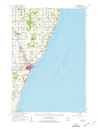
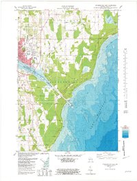
(72)- 1939 Map of Marinette
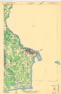 1939 Marinette1939 Print · USGSThe Green Bay shoreline and the Menominee River border come to life in the late 1930s as industrial and rural landscapes intersect. Genealogists can trace family footprints through numerous rural schools like Garfield Sch and Columbus Sch or the settlement at Winesville.
 - 1952 Map of Casco, 1954 Print
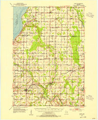 1952 Casco1954 Print · USGSWisconsin's Door Peninsula hinterlands come to life in the early 1950s, showing a landscape of small dairy towns and local rail lines. Genealogists can trace family roots through numerous country parishes and burial sites like St Marys Cem, Holy Trinity Cem, and the rural Luxemburg area.2 unique versions available
 - 1954 Map of Escanaba, 1967 Print
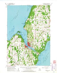
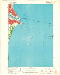
 1954 Escanaba1967 Print · USGSThe Upper Peninsula and Door County shorelines meet here in the mid-fifties, showing the vital maritime and timber networks of the Great Lakes. Researchers can trace historic rail lines, old fire lookouts like the Stonington Fire Tower, and island settlements such as Washington Island.2 unique versions available
 - 1954 Map of Manitowoc, 1968 Print
 1954 Manitowoc1968 Print · USGSLake Michigan served as a vital transit corridor in the mid-fifties, with car and auto ferries linking the industrial ports of Wisconsin to the Michigan timberlands. Genealogists and maritime historians can trace active ferry routes like the Ann Arbor Railway Car and Auto Ferry and locate early settlements from Brussels to Algoma.2 unique versions available
 - 1957 Map of Escanaba
 1957 Escanaba1957 Print · USGSThe Upper Peninsula and Door County shorelines meet in the mid-fifties, capturing a landscape of timber, iron, and maritime trade. Genealogists and local historians can trace the Chicago & North Western RR through settlements like Hermansville or locate St Vitals Church and the Potawatome Indian Reservation.
 - 1958 Map of Escanaba
 1958 Escanaba1958 Print · USGSNorthern Lake Michigan maritime commerce and timberlands are captured here in the mid-fifties. Genealogists and historians can trace rail networks like the Escanaba and Lake Superior or locate island settlements such as Detroit Harbor and Fish Creek.
 - 1958 Map of Manitowoc
 1958 Manitowoc1958 Print · USGSLake Michigan and its shorelines are shown in the late fifties when maritime transport defined the region. Researchers can trace the routes of the Ann Arbor Railroad Ferry or locate old settlements like St. Nazianz, Rostock, and Two Creeks.
 - 1960 Map of Sturgeon Bay, 1962 Print
 1960 Sturgeon Bay1962 Print · USGSThe Door County peninsula in the early sixties shows a bustling maritime corridor defined by the Sturgeon Bay ship canal. Researchers can locate numerous vanished country schoolhouses like Hainesville Sch, the Ahnapee and Western rail line, and family landmarks like Monument Point.
 - 1960 Map of Jacksonport, 1962 Print
 1960 Jacksonport1962 Print · USGSThe Door Peninsula shoreline comes alive in the early sixties, showing the vital coastal settlements and inland crossroads that defined the area. Genealogists and local historians can locate family landmarks like the Zion Ch, Fairview Sch, and the Jacksonport Cem.
 - 1960 Map of Washington Island, 1962 Print
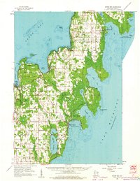
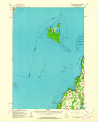
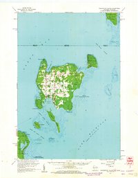 1960 Washington Island1962 Print · USGSDoor County’s northern archipelago appears here in the early sixties, showing the vital maritime connections between the mainland and the island communities. Genealogists and historians can locate Trinity Ch, the remote St Martin Cem, and early landmarks like Pottawatomie Light.2 unique versions available
 - 1960 Map of Algoma, 1962 Print
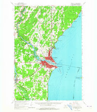
 1960 Algoma1962 Print · USGSCoastal Kewaunee County thrived in the early sixties as a network of rail and water centered on the port of Algoma. Researchers can trace old family names and community foundations at Brockhausen Cem, the Kodan School, and along the Ahnapee and Western line.2 unique versions available
 - 1960 Map of Sister Bay, 1962 Print
 1960 Sister Bay1962 Print · USGSThe Door Peninsula's mid-century landscape is defined here by its coastal villages and timbered interiors during the 1960s. Researchers can locate local landmarks like the Settlement School, Boynton Chapel, and the historic Cana Island light.2 unique versions available
 - 1960 Map of Ellison Bay, 1962 Print
 1960 Ellison Bay1962 Print · USGSThe tip of the Door Peninsula in the early sixties reveals a landscape of maritime transit and quiet coastal villages. Genealogists and historians can trace the foundations of Gills Rock, find the Bethel Ch, or locate the Ferry landing near Hedgehog Harbor.2 unique versions available
 - 1961 Map of Little Sturgeon, 1963 Print
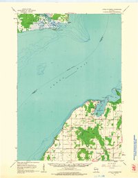 1961 Little Sturgeon1963 Print · USGSThe Door Peninsula and Green Bay coastline come alive in this early sixties survey of the waterside townships. Researchers can trace rural landmarks like the Tornado Sch, White Star Ch, and the many small cemeteries dotting the hills near Little Sturgeon.
 - 1961 Map of Chambers Island, 1963 Print
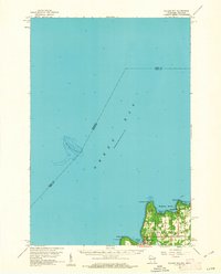
 1961 Chambers Island1963 Print · USGSThe Door Peninsula and its surrounding islands are captured here in the early sixties, showing a maritime landscape of isolated lighthouses and small coastal settlements. Genealogists and local historians can locate St Johns Cem, Sunny Point Sch, and the Chambers Island Lighthouse.2 unique versions available
 - 1963 Map of Marinette East, 1964 Print
 1963 Marinette East1964 Print · USGSMarinette and Menominee appear as vibrant twin ports in the early 1960s, flanking the river mouth where the Wisconsin and Michigan borders meet. Genealogists and historians can trace neighborhood growth through local schools like Sacred Heart Sch, the busy rail lines of the C & N W, and landmarks like Spies Field.2 unique versions available
 - 1963 Map of Marinette, 1965 Print
 1963 Marinette1965 Print · USGSThe industrial twin cities of the Michigan-Wisconsin border are captured here in the early sixties, centered on the Menominee River and Green Bay coast. Genealogists and historians can trace rail lines, rural schoolhouses like Hamilton Sch, and family sites at Riverside Cem.
 - 1978 Map of Namur, 1979 Print
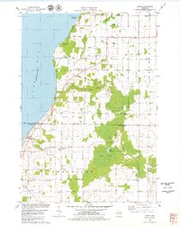 1978 Namur1979 Print · USGSDoor County's Belgian settlement corridor is captured here in the late seventies as rural life clustered around old parishes and the bay shore. Genealogists can locate family landmarks like St Marys Cem, the community of Duvall, and Gospel Truth Hall.2 unique versions available
 - 1978 Map of Brussels, 1979 Print
 1978 Brussels1979 Print · USGSThe Door Peninsula landscape appears here in the late seventies, showing the transition from the high ridges of the Niagara Escarpment to the eastern lowlands. Researchers can locate family landmarks like St Francis Ch and St Michaels Cem or trace the early Ahnapee State Trail.
 - 1981 Map of Sturgeon Bay West
 1981 Sturgeon Bay West1981 Print · USGSThe Door Peninsula's rugged coast and maritime corridors are captured here in the early eighties. Genealogists and historians can trace family-named sites like Schulties Cem, the old Ahnapee and Western rail line, and Hainesville.
 - 1981 Map of Institute
 1981 Institute1981 Print · USGSDoor County's rural heartland and Green Bay shoreline are frozen in time during the early eighties. Genealogists and local historians can trace family land via red field lines and locate community centers like Institute, St Johns Ch, and the State Agricultural Experimental Station.
 - 1981 Map of Idlewild
 1981 Idlewild1981 Print · USGSThe Door County coast in the early eighties shows a landscape shaped by both recreation and industry between the bays. Researchers can trace the layout of Potawatomi State Park, several active Quarry sites, and the quiet settlement at Idlewild.
 - 1981 Map of Sturgeon Bay East
 1981 Sturgeon Bay East1981 Print · USGSThe Door County coast comes alive in the early eighties as the city of Sturgeon Bay expands toward Lake Michigan. Genealogy and local-history researchers can locate the St Joseph Cem, the Drive-in Theater, and the U S Coast Guard Station.2 unique versions available
 - 1981 Map of Marinette, 1982 Print
 1981 Marinette1982 Print · USGSThe Menominee River valley and Door County peninsula are captured here in the early 1980s, showcasing the region's timber and maritime foundations. Researchers can trace historic shorelines from Fish Creek to Deathdoor Bluff or locate inland landmarks like Lake Noquebay and Kangaroo Lake.
 - 1982 Map of Jacksonport
 1982 Jacksonport1982 Print · USGSThe Door County coastline near Jacksonport comes to life in the early 1980s, revealing a landscape of lakefront parks and rural parishes. Genealogists and historians can trace family sites at Whitefish Bay Cem or explore the geography of Clark Lake and Whitefish Dunes State Park.
Showing maps 1-25 of 72
Top cities of Door County
- Sturgeon Bay historical maps
- Brussels historical maps
- Baileys Harbor historical maps
- Sister Bay historical maps
- Jacksonport historical maps
- Washington historical maps
See more
Frequently asked questions
- What are the different types of historical maps available for Door County?
- What is the oldest map of Door County?
- Where can I purchase historical maps of Door County for my home or office?
- Where can I download high-res historical maps of Door County?
- Are there historical topographic maps available for Door County?
- Is there historical aerial imagery available for Door County?
- Where are historical maps of Door County sourced from?