2020s Maps of Amnicon, Wisconsin
Explore 5 historic maps of Amnicon from the 2020s. These maps offer a rare glimpse into what life looked like during the 2020s — showing old roads, neighborhoods, homes, and landmarks that have changed or disappeared over time.
Whether you're researching your family's past, planning a metal detecting trip, or studying how Amnicon's landscape evolved across the 2020s, these high-resolution maps are a powerful tool for exploring the history of this region.
- Focus on a specific era: All maps on this page are from the 2020s, giving you a focused view of this time period.
- See what’s changed: Compare century-old streets, trails, and buildings to today's modern landscape using overlays and satellite layers.
- Research with precision: Use these maps for genealogy, historical research, land use analysis, or educational projects.
- View, download, or print: Maps are fully viewable online in high resolution, and can be downloaded or printed for your own records.
Start exploring Amnicon's history through authentic maps from the 2020s. This is your window into the past.
Amnicon, WI maps
(5)- 2022 Map of Poplar, 2022 Print
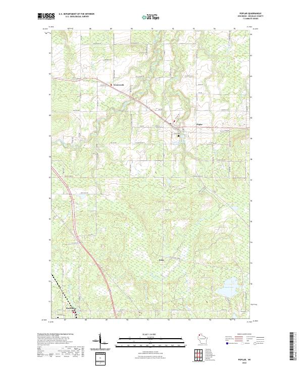 2022 Poplar2022 Print · USGSNorthwestern Wisconsin at the start of the 2020s shows a landscape of rural settlements and winding river systems. Genealogists and historians can trace family locations near Poplar, Wentworth, and Poplar Cem, or explore the course of the Tri Co Corridor.
 - 2022 Map of Poplar NE, 2022 Print
 2022 Poplar NE2022 Print · USGSCoastal Douglas County meets the southern shore of Lake Superior in this modern survey of northern Wisconsin. Researchers can trace rural lineages through family-named routes and landmarks like Lakeside Cem, Kaarto Rd, and the Poplar River.
 - 2022 Map of South Range, 2022 Print
 2022 South Range2022 Print · USGSNorthwestern Wisconsin’s rural landscape comes alive in this survey of the river valleys and rail-trail corridors south of Superior. Genealogists and local researchers can trace family lands near South Range, Amnicon Falls, and the Little Amnicon River.
 - 2022 Map of Parkland, 2022 Print
 2022 Parkland2022 Print · USGSThe Lake Superior shoreline near Superior, Wisconsin, comes to life in this contemporary mapping of the region's unique coastal geography. Researchers can trace the narrow Wisconsin Point peninsula or explore the drainage of the Amnicon River and the rural settlement of Cutter.
 - 2022 Map of Lake Nebagamon, 2022 Print
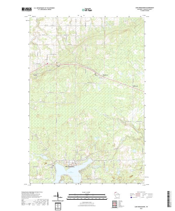 2022 Lake Nebagamon2022 Print · USGSDouglas County’s lake country and northern settlements are detailed here in the early twenty-first century. Researchers can trace family-named roads and burial sites like Saint Anns Cem, or explore the geography of Lake Nebagamon and the Tri-Co Corridor.
End of results
Showing maps 1-5 of 5
Top cities near Amnicon
- Duluth historical maps
- Superior historical maps
- Parkland historical maps
- Hawthorne historical maps
- Lake Nebagamon historical maps
- Gordon historical maps
See more
Top neighborhoods of Amnicon
Frequently asked questions
- What are the different types of historical maps available for Amnicon?
- What is the oldest map of Amnicon?
- Where can I purchase historical maps of Amnicon for my home or office?
- Where can I download high-res historical maps of Amnicon?
- Are there historical topographic maps available for Amnicon?
- Is there historical aerial imagery available for Amnicon?
- Where are historical maps of Amnicon sourced from?