2020s Maps of Lamartine, Wisconsin
Explore 4 historic maps of Lamartine from the 2020s. These maps offer a rare glimpse into what life looked like during the 2020s — showing old roads, neighborhoods, homes, and landmarks that have changed or disappeared over time.
Whether you're researching your family's past, planning a metal detecting trip, or studying how Lamartine's landscape evolved across the 2020s, these high-resolution maps are a powerful tool for exploring the history of this region.
- Focus on a specific era: All maps on this page are from the 2020s, giving you a focused view of this time period.
- See what’s changed: Compare century-old streets, trails, and buildings to today's modern landscape using overlays and satellite layers.
- Research with precision: Use these maps for genealogy, historical research, land use analysis, or educational projects.
- View, download, or print: Maps are fully viewable online in high resolution, and can be downloaded or printed for your own records.
Start exploring Lamartine's history through authentic maps from the 2020s. This is your window into the past.
Lamartine, WI maps
(4)- 2022 Map of Rosendale, 2022 Print
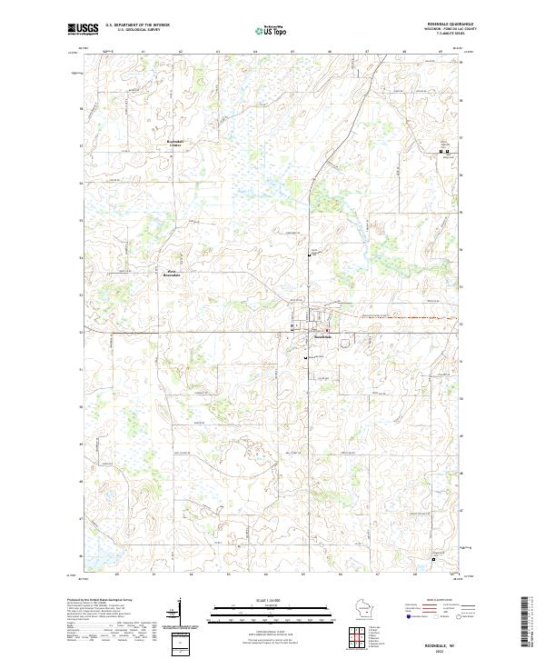 2022 Rosendale2022 Print · USGSFond du Lac County agriculture and rural life are documented here in the early 2020s. Genealogists and local historians can trace family locations near Rosendale Center, West Rosendale, and several regional burial grounds like Saint Marys Cem and Rogersville Cem.
 - 2022 Map of Oakfield, 2022 Print
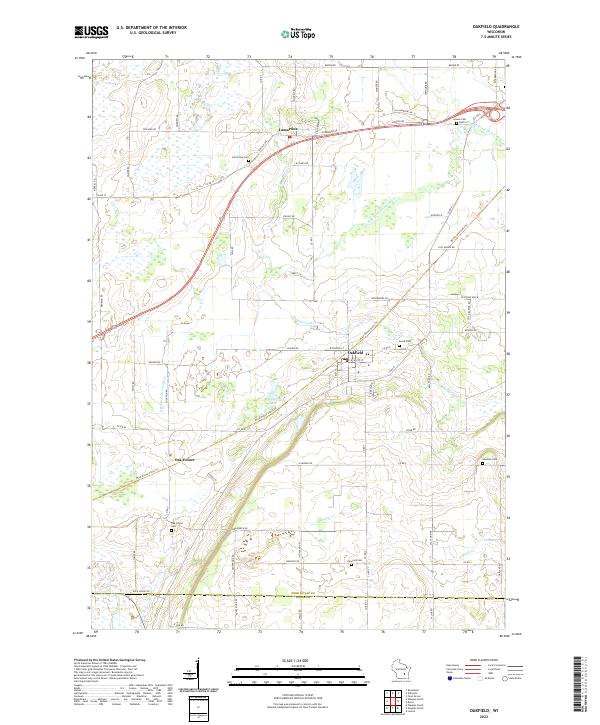 2022 Oakfield2022 Print · USGSOakfield and the surrounding Fond du Lac County farmlands are documented here in the early twenty-first century. Researchers can locate generational burial sites like Avoca Cem and Kinwood Cem or trace the path of the Wild Goose State Trl.
 - 2022 Map of Waupun North, 2022 Print
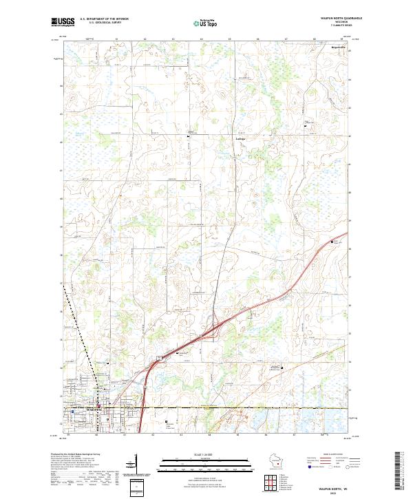 2022 Waupun North2022 Print · USGSThe agricultural landscape of Fond du Lac County is shown in detail during the early 2020s, centered on the city of Waupun. Local researchers can trace numerous rural burial grounds, including the Wisconsin State Prison Cem, Cattaraugus Cem, and East Ladoga Cem.
 - 2022 Map of Eldorado, 2022 Print
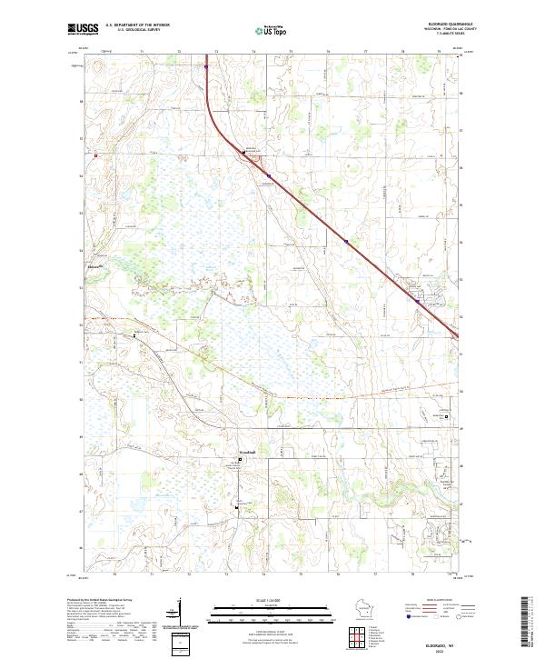 2022 Eldorado2022 Print · USGSFond du Lac County is shown here in the early twenty-first century, centered on the expansive wetlands of the Eldorado Marsh. Researchers can trace local heritage at Our Risen Savior Catholic Church Cem or follow the Mascoutin Valley State Trl through Eldorado and Woodhull.
End of results
Showing maps 1-4 of 4
Top cities near Lamartine
- Oshkosh historical maps
- Fond du Lac historical maps
- North Fond du Lac historical maps
- Taycheedah historical maps
- Waupun historical maps
- Lomira historical maps
See more
Top neighborhoods of Lamartine
Frequently asked questions
- What are the different types of historical maps available for Lamartine?
- What is the oldest map of Lamartine?
- Where can I purchase historical maps of Lamartine for my home or office?
- Where can I download high-res historical maps of Lamartine?
- Are there historical topographic maps available for Lamartine?
- Is there historical aerial imagery available for Lamartine?
- Where are historical maps of Lamartine sourced from?