2000s (21st Century) Maps of Armenia, Wisconsin
Explore 20 historic maps of Armenia from the 2000s (21st Century). These maps offer a rare glimpse into what life looked like during the 2000s — showing old roads, neighborhoods, homes, and landmarks that have changed or disappeared over time.
Whether you're researching your family's past, planning a metal detecting trip, or studying how Armenia's landscape evolved across the 2000s, these high-resolution maps are a powerful tool for exploring the history of this region.
- Focus on a specific era: All maps on this page are from the 2000s, giving you a focused view of this time period.
- See what’s changed: Compare century-old streets, trails, and buildings to today's modern landscape using overlays and satellite layers.
- Research with precision: Use these maps for genealogy, historical research, land use analysis, or educational projects.
- View, download, or print: Maps are fully viewable online in high resolution, and can be downloaded or printed for your own records.
Start exploring Armenia's history through authentic maps from the 2000s. This is your window into the past.
Armenia, WI maps
(20)- 2010 Map of Arkdale, 2010 Print
 2010 Arkdale2010 Print · USGSCovers Armenia, including Strongs Prairie, Big Flats, and other nearby areas
 - 2010 Map of Arkdale NW, 2010 Print
 2010 Arkdale NW2010 Print · USGSCovers Armenia, including Big Flats, Saratoga, and other nearby areas
 - 2010 Map of Necedah, 2010 Print
 2010 Necedah2010 Print · USGSCovers Armenia, including Strongs Prairie, Necedah, and other nearby areas
 - 2010 Map of New Miner, 2010 Print
 2010 New Miner2010 Print · USGSCovers Armenia, including Finley, New Miner, and other nearby areas
 - 2013 Map of Arkdale NW, 2013 Print
 2013 Arkdale NW2013 Print · USGSCovers Armenia, including Big Flats, Saratoga, and other nearby areas
 - 2013 Map of Arkdale, 2013 Print
 2013 Arkdale2013 Print · USGSCovers Armenia, including Strongs Prairie, Big Flats, and other nearby areas
 - 2013 Map of Necedah, 2013 Print
 2013 Necedah2013 Print · USGSCovers Armenia, including Strongs Prairie, Necedah, and other nearby areas
 - 2013 Map of New Miner, 2013 Print
 2013 New Miner2013 Print · USGSCovers Armenia, including Finley, New Miner, and other nearby areas
 - 2015 Map of Arkdale NW, 2015 Print
 2015 Arkdale NW2015 Print · USGSCovers Armenia, including Big Flats, Saratoga, and other nearby areas
 - 2015 Map of Arkdale, 2015 Print
 2015 Arkdale2015 Print · USGSCovers Armenia, including Strongs Prairie, Big Flats, and other nearby areas
 - 2015 Map of Necedah, 2015 Print
 2015 Necedah2015 Print · USGSCovers Armenia, including Strongs Prairie, Necedah, and other nearby areas
 - 2015 Map of New Miner, 2015 Print
 2015 New Miner2015 Print · USGSCovers Armenia, including Finley, New Miner, and other nearby areas
 - 2018 Map of Arkdale NW, 2018 Print
 2018 Arkdale NW2018 Print · USGSCovers Armenia, including Big Flats, Saratoga, and other nearby areas
 - 2018 Map of Arkdale, 2018 Print
 2018 Arkdale2018 Print · USGSCovers Armenia, including Strongs Prairie, Big Flats, and other nearby areas
 - 2018 Map of New Miner, 2018 Print
 2018 New Miner2018 Print · USGSCovers Armenia, including Finley, New Miner, and other nearby areas
 - 2018 Map of Necedah, 2018 Print
 2018 Necedah2018 Print · USGSCovers Armenia, including Strongs Prairie, Necedah, and other nearby areas
 - 2022 Map of Necedah, 2022 Print
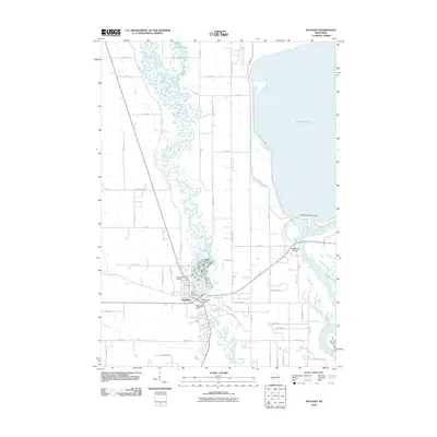
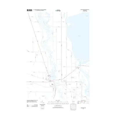
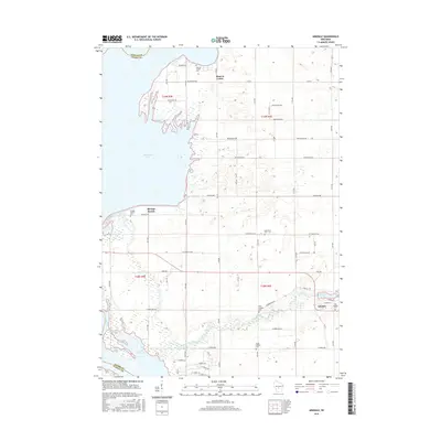
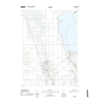
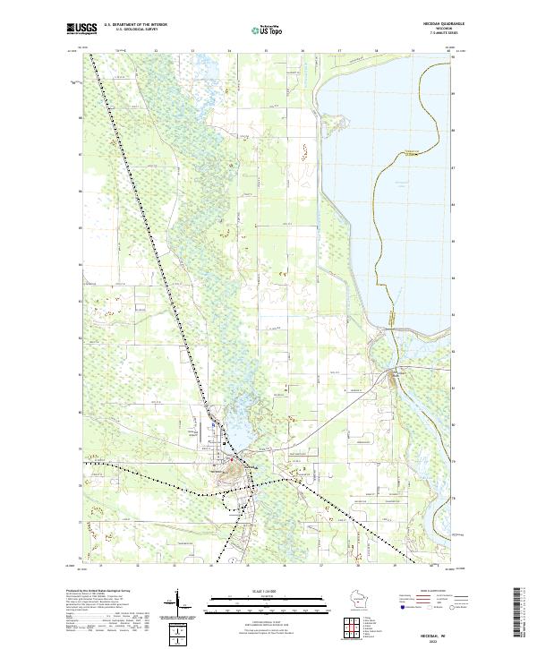 2022 Necedah2022 Print · USGSNecedah and the surrounding river lowlands are shown here in the early twenty-first century as the landscape transitions toward the massive Petenwell flowage. Researchers can locate Bayview Cemetery, the Necedah Airport, and prominent landmarks like Necedah Bluff.
 - 2022 Map of New Miner, 2022 Print
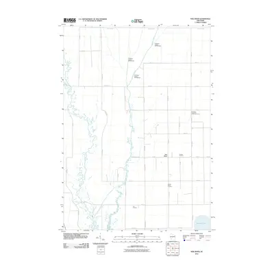
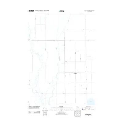
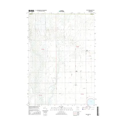
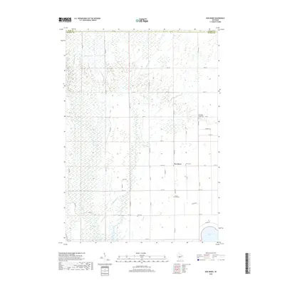
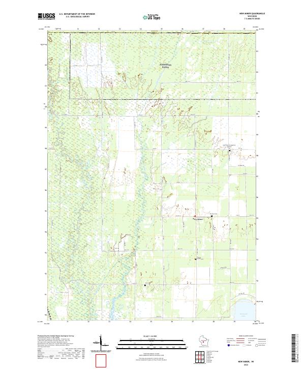 2022 New Miner2022 Print · USGSJuneau County’s wetland interior is documented here in the early twenty-first century, centered on the small community of New Miner. Researchers can locate several rural burial sites, including Searles Prairie Cemetery, and trace the shoreline of Petenwell Lake.
 - 2022 Map of Arkdale, 2022 Print
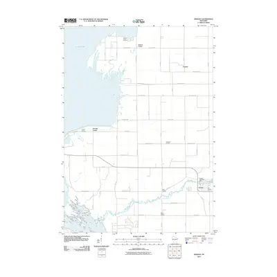
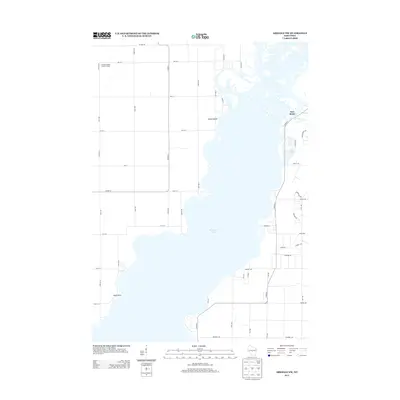
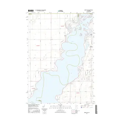
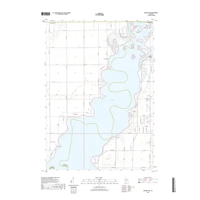
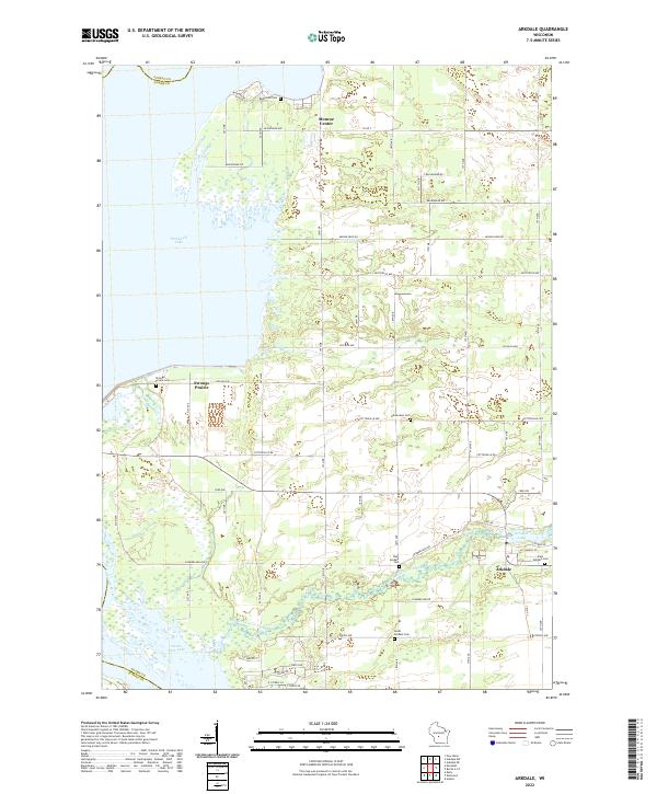 2022 Arkdale2022 Print · USGSThe eastern shores of Petenwell Lake and Castle Rock Lake are shown here in the 2020s. Researchers can trace rural lineages at Strongs Prairie Cem or follow the waters of Big Roche a Cri Creek through Arkdale and Monroe Center.
 - 2022 Map of Arkdale NW, 2022 Print
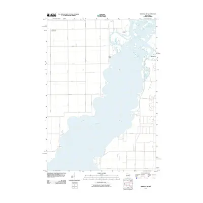
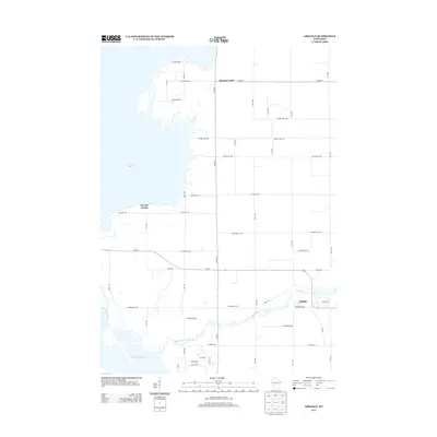
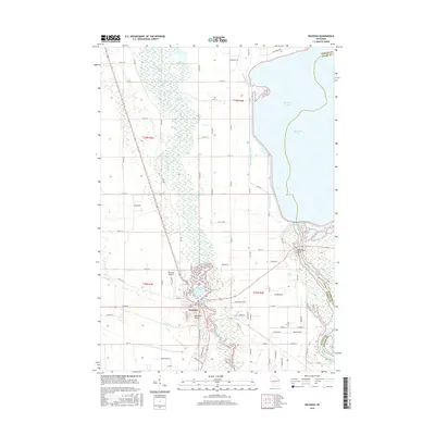
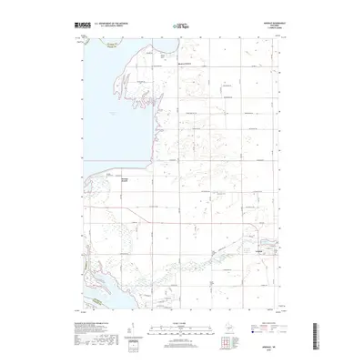
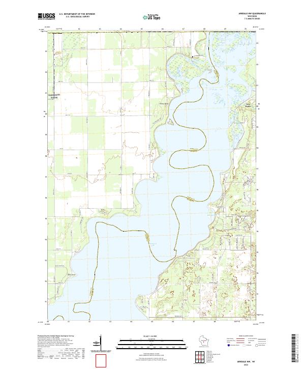 2022 Arkdale NW2022 Print · USGSThe sprawling waters of Petenwell Lake define this region along the Juneau and Adams county line in the early twenty-first century. Researchers can trace the development of New Rome and locate landmarks like Greenwood Cem and Halls Point.
End of results
Showing maps 1-20 of 20
Top cities near Armenia
- Wisconsin Rapids historical maps
- Nekoosa historical maps
- Adams historical maps
- Port Edwards historical maps
- Strongs Prairie historical maps
- Big Flats historical maps
See more
Top neighborhoods of Armenia
- New Miner historical maps
- Southview Shores historical maps
- Halls Point historical maps
- Pinewood Shores historical maps
- Clearview Estates historical maps
- Grandview Shores historical maps
See more
Frequently asked questions
- What are the different types of historical maps available for Armenia?
- What is the oldest map of Armenia?
- Where can I purchase historical maps of Armenia for my home or office?
- Where can I download high-res historical maps of Armenia?
- Are there historical topographic maps available for Armenia?
- Is there historical aerial imagery available for Armenia?
- Where are historical maps of Armenia sourced from?