Old Maps of Bergen, Wisconsin
Explore 19 old maps of Bergen, spanning from 1899 to today. These high-resolution historic maps reveal how streets, neighborhoods, landmarks, and natural features evolved over time — perfect for genealogy, metal detecting, research, and local history exploration.
What you can do with these maps:
- See how Bergen changed over time: Compare historical maps to modern-day views to trace roads, homesites, rail lines & more.
- View detailed metadata: Each map includes creators, publishers, year, scale, and archive source.
- Overlay maps with satellite & LiDAR: Visualize the past alongside modern tools to explore terrain & human change.
- Trusted historical sources: Maps sourced from the USGS, Library of Congress, and other archives.
- Access maps your way: View online, download high-res files, or order prints for personal or research use.
Start exploring old maps of Bergen to uncover forgotten places, hidden landmarks, and the deep history beneath your feet.
Bergen, WI maps
(19)- 1899 Map of Wausau, 1956 Print
 1899 Wausau1956 Print · USGSMarathon County was a bustling timber and rail corridor at the turn of the century, anchored by the river power of Wausau and Merrill. Researchers can trace early logging lines like the Bull Dessert Logging R R and find vanished stops such as Dessert Junction and Nutterville.
 - 1902 Map of Wausau
 1902 Wausau1902 Print · USGSWisconsin’s timber and rail heartland is meticulously documented at the turn of the century as Wausau and Merrill expand along the river. Genealogists can trace early homesteads and rail stops like Schofield, Granite Heights, and the grounds of the State Insane Asylum.2 unique versions available
 - 1902 Map of Marathon, 1938 Print
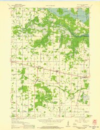
 1902 Marathon1938 Print · USGSMarathon County is captured here at the height of the timber era, when a dense network of logging railroads and new settlements defined the central Wisconsin woods. Genealogists and historians can trace early town sites like Athens, Rib Falls, and the specialized Connors Logging R. R.
 - 1953 Map of Wausau, 1955 Print
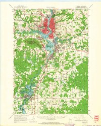
 1953 Wausau1955 Print · USGSThe Wisconsin River valley comes alive in the early 1950s, showing the paper-mill towns and rugged peaks of Marathon County. Trace the development of Wausau and Mosinee or locate rural landmarks like the Mosinee Lookout Tower and St Agnes Ch.
 - 1953 Map of Marathon, 1955 Print
 1953 Marathon1955 Print · USGSMarathon County's agricultural and river heartland is documented here in the early fifties, centering on the villages of Marathon and Edgar. Local historians can trace a dense network of country schools and churches like Rib Falls Ch and the St Anthony Friary.
 - 1955 Map of Green Bay, 1968 Print
 1955 Green Bay1968 Print · USGSCentral and Eastern Wisconsin are captured here in the mid-fifties, showing the industrial growth of the Fox Valley and Wisconsin River corridors. Genealogists and historians can trace rail lines like the Green Bay and Western through settlements like Weyauwega, Clintonville, and Pulaski.2 unique versions available
 - 1956 Map of Milladore, 1958 Print
 1956 Milladore1958 Print · USGSIn the mid-fifties, this section of Wood County was a busy crossroads for the Soo Line and Milwaukee Road railroads. Genealogists can trace a lost network of rural education through sites like Steppingstone Sch, Lone Elm Sch, and the Runkle Sch.
 - 1956 Map of Stevens Point, 1958 Print
 1956 Stevens Point1958 Print · USGSStevens Point and the central Wisconsin River valley are captured here in the mid-fifties during a period of significant educational and infrastructure growth. Researchers can locate numerous country schools and religious landmarks, from St Francis Ch to the State Teachers College and the Cranberry Bog.2 unique versions available
 - 1963 Map of Marathon, 1964 Print
 1963 Marathon1964 Print · USGSMarathon County in the early sixties is a landscape of established dairy farms and developing recreation areas. Researchers can trace the rail-side growth of Edgar and Marathon City or locate rural landmarks like Daisy Dell Sch and Sacred Heart Ch Cem.
 - 1963 Map of Wausau, 1965 Print
 1963 Wausau1965 Print · USGSMarathon County’s river valley is caught in a moment of mid-century growth, centered on the bustling Wisconsin River industrial corridor. Genealogists and local historians can trace family locations near landmarks like St Agnes Ch Cem, the Mount View Sanatorium, and the small settlement of Peplin.2 unique versions available
 - 1970 Map of Dancy, 1972 Print
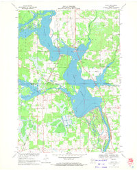 1970 Dancy1972 Print · USGSMarathon and Portage counties meet along the waters of Lake Du Bay in the early seventies, where the railroad still anchors local river towns. Genealogists and historians can trace the foundations of Knowlton and Dancy, locating landmarks like St Francis Ch and the Knowlton Sch.3 unique versions available
 - 1970 Map of Big Eau Pleine Reservoir, 1984 Print
 1970 Big Eau Pleine Reservoir1984 Print · USGSMarathon and Portage counties were defined by extensive wetland management and conservation efforts in the early seventies. Genealogists and outdoorsmen can trace landmarks like Runkle Cem, Big Eau Pleine County Park, and the winding Little Eau Pleine River.
 - 1981 Map of Halder, 1982 Print
 1981 Halder1982 Print · USGSMarathon County’s rural landscape is captured here in the early eighties, defined by the expansion of the Big Eau Pleine Reservoir. Genealogists and local historians can locate St Patricks Ch in Halder and trace the many Quarries that dotted these woodlots.
 - 1982 Map of Mosinee
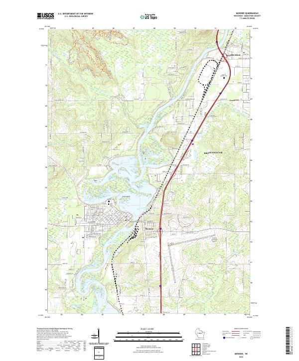
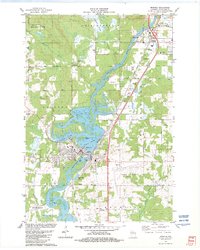 1982 Mosinee1982 Print · USGSCentral Wisconsin during the early eighties shows a landscape shaped by the Wisconsin River and growing aviation infrastructure. Genealogists and local historians can trace the foundations of Mosinee, identifying the Gate of Heaven Cem and the High Sch.
 - 1984 Map of Wausau, 1990 Print
 1984 Wausau1990 Print · USGSMarathon and Portage counties come into focus during the mid-eighties as industrial river towns and sprawling conservation areas define the Central Wisconsin landscape. Researchers can trace the rail corridors of the Soo Line or locate rural landmarks like Rib Mountain State Park and St Marys Cem.
 - 2022 Map of Halder, 2022 Print
 2022 Halder2022 Print · USGSMarathon County dairy country and the northern reaches of the reservoir are captured here during the 2020s. Genealogists can locate family lands near Halder and Moon or trace the rural drainage of Freeman Creek.
 - 2022 Map of Mosinee, 2022 Print
 2022 Mosinee2022 Print · USGSThe Wisconsin River corridor in Marathon County reveals a landscape of industrial growth and riverine history in this 2020s survey. Researchers can trace the development of Mosinee and Rothschild or locate family sites at Saint Paul Cem and Gate of Heaven Cem.
 - 2022 Map of Dancy, 2022 Print
 2022 Dancy2022 Print · USGSMarathon and Portage counties meet along the sprawling waters of the Wisconsin River in the early twenty-first century. Genealogists and local historians can trace the sites of Saint John the Baptist Cem, Knowlton, and Dancy.
 - 2022 Map of Big Eau Pleine Reservoir, 2022 Print
 2022 Big Eau Pleine Reservoir2022 Print · USGSThe tri-county borderlands of Marathon, Wood, and Portage counties come alive in this survey of a water-rich landscape. Genealogists and local researchers can locate Runkle Cem or trace the extensive flowages of the Little Eau Pleine River.
End of results
Showing maps 1-19 of 19
Top cities near Bergen
- Wausau historical maps
- Stevens Point historical maps
- Weston historical maps
- Kronenwetter historical maps
- Rib Mountain historical maps
- Rothschild historical maps
See more
Frequently asked questions
- What are the different types of historical maps available for Bergen?
- What is the oldest map of Bergen?
- Where can I purchase historical maps of Bergen for my home or office?
- Where can I download high-res historical maps of Bergen?
- Are there historical topographic maps available for Bergen?
- Is there historical aerial imagery available for Bergen?
- Where are historical maps of Bergen sourced from?