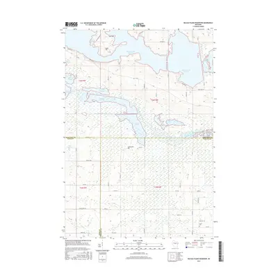
2015 Map of Big Eau Pleine Reservoir
USGS Topo · Published 2015About this map
The Big Eau Pleine Reservoir dominates the northern landscape of this Central Wisconsin region, where the convergence of Wood, Marathon, and Portage counties creates a complex network of wetlands and managed waterways. High points like Maple Hill and Haumschild Hill rise above a series of distinct impoundments, including the Townline Reservoir, Fisher Flowage, and Teal Flowage. The drainage of the Little Eau Pleine River is clearly defined here, showing the intricate relationship between the reservoir system and the surrounding timber and marshlands. To the southeast, the quiet presence of Runkle Cem offers a grounded point for genealogical interest near the Marathon and Portage county line. This survey details the modern road network, from the rural stretches of Co Rd C to specialized access points like Eau Pleine Park Rd and Dam Rd, illustrating how the mid-century reservoir projects transformed the local topography into its current character.
Find a feature on this map
54 named features on this map. Tap any name to fly to it.
Don’t see what you’re looking for? This feature index may not catch every label — zoom into the map to look around manually.
Map Details
Editions of this 2015 Big Eau Pleine Reservoir Map
This is the sole edition of this map. No revisions or reprints were ever made.
Other maps of this area

1899 · Wausau
USGS Topo · 1:125,000

1902 · Wausau
USGS Topo · 1:125,000

1902 · Marathon
USGS Topo · 1:125,000

1953 · Wausau
USGS Topo · 1:48,000

1953 · Marathon
USGS Topo · 1:48,000

1955 · Green Bay
USGS Topo · 1:250,000

1956 · Milladore
USGS Topo · 1:48,000

1956 · Stevens Point
USGS Topo · 1:48,000

1963 · Marathon
USGS Topo · 1:62,500

1963 · Wausau
USGS Topo · 1:62,500