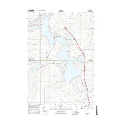
2015 Map of Dancy
USGS Topo · Published 2015About this map
The Wisconsin River and the expansive Lake Dubay dominate this central Wisconsin landscape, marking the transition where the waters of the Little Eau Pleine River and Peplin Creek converge. The settlement of Knowlton serves as a primary waypoint along the river, while the smaller community of Dancy sits further west near the Little Eau Pleine Flowage. This 2015 representation of the region illustrates a complex network of wetlands and backwaters, particularly around the prominently labeled Big Island. Local history is anchored by the presence of Saint Francis Cem and Knowlton Cem, which remain as fixed points of reference amidst the evolving shoreline and modern road developments like Co Rd DB and Redfield Rd. The map also clearly delineates the administrative boundary between Marathon and Portage counties, providing a clear look at how the river system defines the regional geography.
Find a feature on this map
75 named features on this map. Tap any name to fly to it.
Don’t see what you’re looking for? This feature index may not catch every label — zoom into the map to look around manually.
Map Details
Editions of this 2015 Dancy Map
This is the sole edition of this map. No revisions or reprints were ever made.
Other maps of this area

1899 · Wausau
USGS Topo · 1:125,000

1902 · Wausau
USGS Topo · 1:125,000

1902 · Marathon
USGS Topo · 1:125,000

1953 · Wausau
USGS Topo · 1:48,000

1953 · Marathon
USGS Topo · 1:48,000

1955 · Green Bay
USGS Topo · 1:250,000

1956 · Milladore
USGS Topo · 1:48,000

1956 · Stevens Point
USGS Topo · 1:48,000

1963 · Marathon
USGS Topo · 1:62,500

1963 · Wausau
USGS Topo · 1:62,500