2020s Maps of Amberg, Wisconsin
Explore 6 historic maps of Amberg from the 2020s. These maps offer a rare glimpse into what life looked like during the 2020s — showing old roads, neighborhoods, homes, and landmarks that have changed or disappeared over time.
Whether you're researching your family's past, planning a metal detecting trip, or studying how Amberg's landscape evolved across the 2020s, these high-resolution maps are a powerful tool for exploring the history of this region.
- Focus on a specific era: All maps on this page are from the 2020s, giving you a focused view of this time period.
- See what’s changed: Compare century-old streets, trails, and buildings to today's modern landscape using overlays and satellite layers.
- Research with precision: Use these maps for genealogy, historical research, land use analysis, or educational projects.
- View, download, or print: Maps are fully viewable online in high resolution, and can be downloaded or printed for your own records.
Start exploring Amberg's history through authentic maps from the 2020s. This is your window into the past.
Amberg, WI maps
(6)- 2022 Map of Athelstane, 2022 Print
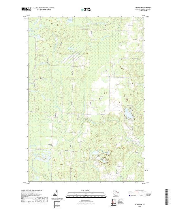 2022 Athelstane2022 Print · USGSThe rural settlement of Athelstane is captured here in the early twenty-first century, surrounded by a complex network of glacial lakes and northern rivers. Researchers can locate the Athelstane Cem or trace family-named roads like Beilak Rd and Sunny Farm Ln.
 - 2022 Map of Town Corner Lake, 2022 Print
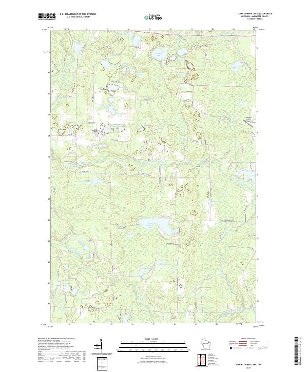 2022 Town Corner Lake2022 Print · USGSMarinette County’s lake country is captured here in the early 2020s, showing a landscape defined by the branching Pike River and dozens of named glacial pools. Researchers can trace local landmarks like Northland Scholars Academy or locate Red Roof Airport and Chipmunk Rapids.
 - 2023 Map of Wausaukee North, 2023 Print
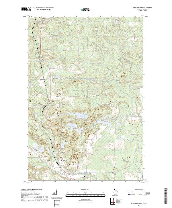 2023 Wausaukee North2023 Print · USGSMarinette County’s lake country is captured here in the early twenty-first century, showing the crossroads at Wausaukee and Amberg. Genealogists and local historians can locate Wausaukee Evergreen Cem and trace old family routes like Marcellis Rd and Feller Rd.
 - 2023 Map of Miscauno Island, 2023 Print
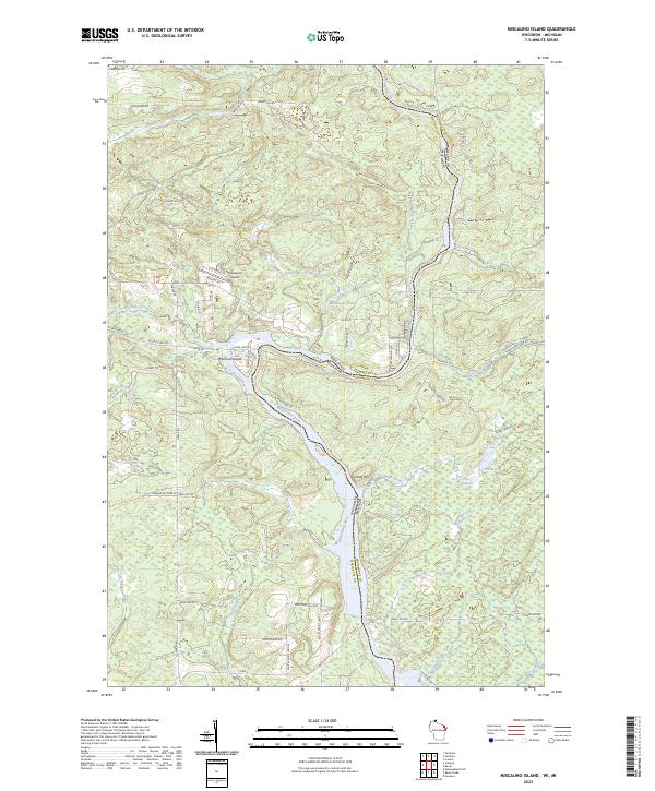 2023 Miscauno Island2023 Print · USGSThe border between Wisconsin and Michigan is defined here by the winding Menominee River in the early 2020s. Researchers can trace land use around Miscauno Island, find the Shangrila Airport, and locate Pemene Falls.
 - 2023 Map of Amberg, 2023 Print
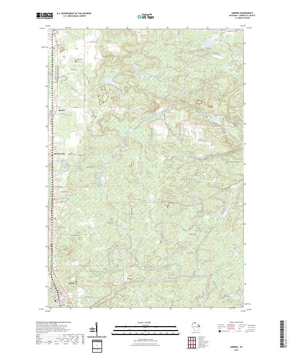 2023 Amberg2023 Print · USGSMarinette County’s northern woodlands and glacial lakes are shown here in the early twenty-first century, centering on the communities of Amberg and Beecher. Researchers can trace local lineage at Amberg Cem or locate private airfields like Red Roof Airport amidst the waters of Beecher Lake and the Pike River.
 - 2023 Map of Resort Lake, 2023 Print
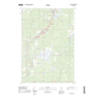 2023 Resort Lake2023 Print · USGSThe Menominee River borderlands at the Michigan-Wisconsin line are shown in this 2023 survey. Researchers can trace remote sites like Lost Lake Cem, the Lazy River Airport, and the river island groups including Sixty Islands.
End of results
Showing maps 1-6 of 6
Top cities near Amberg
- Dunbar historical maps
- Aurora historical maps
- Pembine historical maps
- Wagner historical maps
- Beecher historical maps
- Athelstane historical maps
See more
Frequently asked questions
- What are the different types of historical maps available for Amberg?
- What is the oldest map of Amberg?
- Where can I purchase historical maps of Amberg for my home or office?
- Where can I download high-res historical maps of Amberg?
- Are there historical topographic maps available for Amberg?
- Is there historical aerial imagery available for Amberg?
- Where are historical maps of Amberg sourced from?