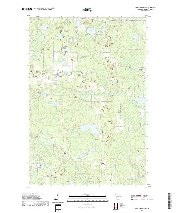
2022 Map of Town Corner Lake
USGS Topo · Published 2022About this map
Town Corner Lake serves as a central landmark in this portion of Marinette County, surrounded by a dense network of glacial lakes and river systems. The landscape is defined by the branching waters of the North Branch Pike River and the South Branch Pike River, which cut through the terrain alongside smaller tributaries like the S Br Pemebonwon River. This 2022 survey illustrates a region largely shaped by its natural hydrology, yet it includes notable human imprints such as the Northland Scholars Academy and the Red Roof Airport. The concentration of water bodies, including Christian Lake, Merriman Lake, and Williams Lake, suggests a landscape dedicated to recreation and conservation. Smaller features like Chipmunk Rapids and the naming of 12 Foot Falls Rd hint at the elevation changes and falls that characterize this northern Wisconsin wilderness.
Find a feature on this map
114 named features on this map. Tap any name to fly to it.
Don’t see what you’re looking for? This feature index may not catch every label — zoom into the map to look around manually.
Map Details
Editions of this 2022 Town Corner Lake Map
This is the sole edition of this map. No revisions or reprints were ever made.
Other maps of this area

1939 · Pembine
USGS Topo · 1:48,000

1939 · Dunbar
USGS Topo · 1:48,000

1940 · Athelstane
USGS Topo · 1:48,000

1941 · Dunbar
USGS Topo · 1:48,000

1942 · Athelstane
USGS Topo · 1:48,000

1942 · Wausaukee
USGS Topo · 1:48,000

1947 · Pembine
USGS Topo · 1:48,000

1947 · Dunbar
USGS Topo · 1:48,000

1947 · Wausaukee
USGS Topo · 1:48,000

1954 · Iron Mountain
USGS Topo · 1:250,000