Old Maps of Wilcox, Grover for Hiking & Exploration
Hike through history with 10 historic maps of Wilcox. Explore old trails, ghost towns, and forgotten backroads — perfect for outdoor adventurers and local explorers.
- Rediscover forgotten places: Map out old mining camps, roads, and footpaths that no longer exist on modern maps.
- Layer with modern tools: Combine with LiDAR or satellite views to plan hikes through historical terrain.
- Made for exploration: Popular among hikers, overlanders, and local history lovers.
Use these maps to find adventure and explore the hidden past of Wilcox.
Wilcox, Grover maps
(10)- 1954 Map of Manitowoc, 1968 Print
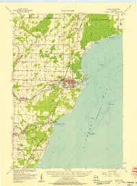
 1954 Manitowoc1968 Print · USGSLake Michigan served as a vital transit corridor in the mid-fifties, with car and auto ferries linking the industrial ports of Wisconsin to the Michigan timberlands. Genealogists and maritime historians can trace active ferry routes like the Ann Arbor Railway Car and Auto Ferry and locate early settlements from Brussels to Algoma.2 unique versions available
 - 1956 Map of Oconto, 1957 Print
 1956 Oconto1957 Print · USGSCoastal Oconto County at the mid-century mark shows a landscape of busy riverfronts and dense rural school districts. Genealogists can trace family roots through numerous country schools like Victory Sch and Brick Sch, or locate old lakeside settlements such as Pensaukee and Oak Orchard.2 unique versions available
 - 1958 Map of Manitowoc
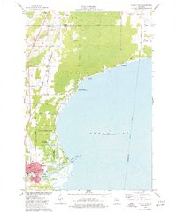
 1958 Manitowoc1958 Print · USGSLake Michigan and its shorelines are shown in the late fifties when maritime transport defined the region. Researchers can trace the routes of the Ann Arbor Railroad Ferry or locate old settlements like St. Nazianz, Rostock, and Two Creeks.
 - 1974 Map of Oconto East, 1977 Print
 1974 Oconto East1977 Print · USGSThe Lake Michigan shoreline at Oconto is captured in the mid-seventies, showing the transition from city streets to protected marshlands. Researchers can find old family sites at Garden of Hope Cem and trace the Chicago and North Western rail line.
 - 1984 Map of Sturgeon Bay, 1985 Print
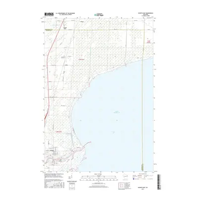
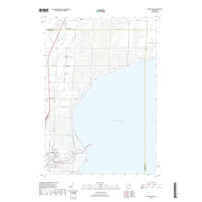
 1984 Sturgeon Bay1985 Print · USGSDoor Peninsula and the Kewaunee coast are documented here in the mid-eighties, showing the deep-water harbor at Sturgeon Bay and the rural agricultural interior. Genealogists can trace family roots through crossroads towns like Kolberg, Duvall, and Sugar Bush.2 unique versions available
 - 2010 Map of Oconto East, 2010 Print
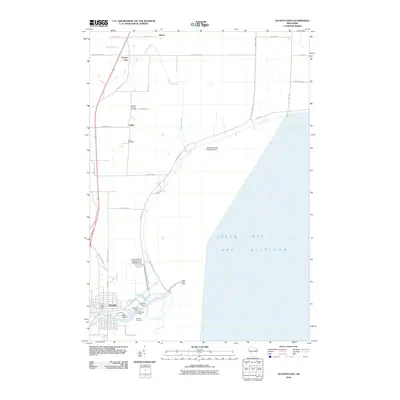 2010 Oconto East2010 Print · USGSCovers Wilcox, including Oconto, Peshtigo, and other nearby areas
 - 2013 Map of Oconto East, 2013 Print
 2013 Oconto East2013 Print · USGSCovers Wilcox, including Oconto, Peshtigo, and other nearby areas
 - 2015 Map of Oconto East, 2015 Print
 2015 Oconto East2015 Print · USGSCovers Wilcox, including Oconto, Peshtigo, and other nearby areas
 - 2018 Map of Oconto East, 2018 Print
 2018 Oconto East2018 Print · USGSCovers Wilcox, including Oconto, Peshtigo, and other nearby areas
 - 2022 Map of Oconto East, 2022 Print
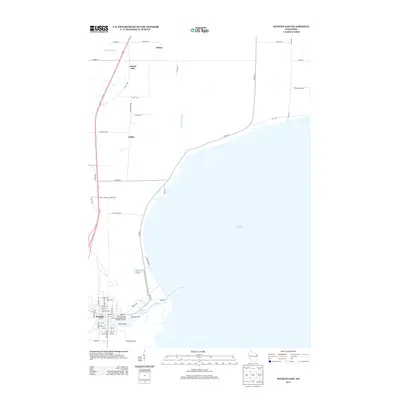
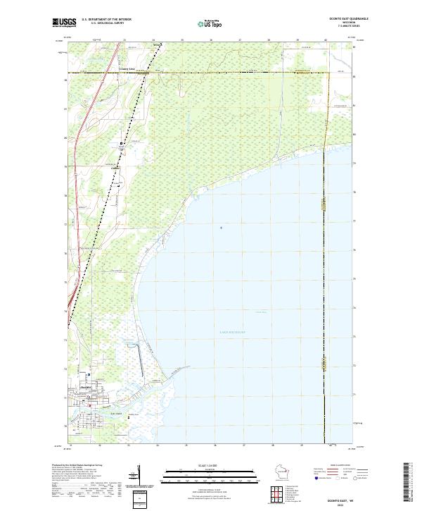 2022 Oconto East2022 Print · USGSThe western shores of Green Bay come alive in this contemporary survey of the Oconto riverfront and its rural surroundings. Researchers can pinpoint the Oconto County Courthouse or trace family roots at Garden of Hope Cem and Cullen Cem.
End of results
Showing maps 1-10 of 10
Top cities near Wilcox
- Marinette historical maps
- Menominee historical maps
- Oconto historical maps
- Peshtigo historical maps
- Peshtigo historical maps
- Porterfield historical maps
See more
Frequently asked questions
- What are the different types of historical maps available for Wilcox?
- What is the oldest map of Wilcox?
- Where can I purchase historical maps of Wilcox for my home or office?
- Where can I download high-res historical maps of Wilcox?
- Are there historical topographic maps available for Wilcox?
- Is there historical aerial imagery available for Wilcox?
- Where are historical maps of Wilcox sourced from?