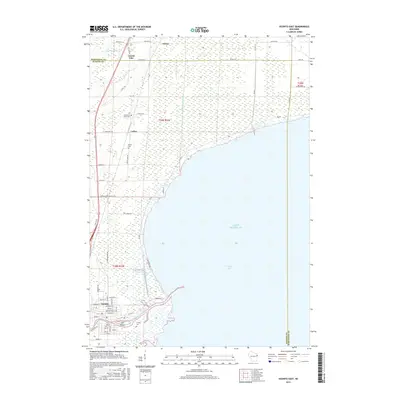
2015 Map of Oconto East
USGS Topo · Published 2015About this map
Oconto stands as the primary hub where the Oconto River empties into Green Bay, a landscape defined by its intricate shoreline and complex wetlands. This 2015 data illustrates a coastal environment where small settlements like Wilcox and Cullen are interspersed between vast stretches of marshland, including Thomas Slough and Lobbies Slough. The geography reveals a community built around its proximity to Lake Michigan, with landmarks like Ajax Island and several historic burial grounds such as Garden of Hope Cem and Lindsey Cem providing points of local interest. To the north, the County Line with Marinette County marks the edge of the survey area, while a network of rural roads like Maple Grove School Rd and Swedetown Rd connect the scattered homesteads and small inland communities to the harbor front.
Find a feature on this map
56 named features on this map. Tap any name to fly to it.
Don’t see what you’re looking for? This feature index may not catch every label — zoom into the map to look around manually.
Map Details
Editions of this 2015 Oconto East Map
This is the sole edition of this map. No revisions or reprints were ever made.
Other maps of this area

1939 · Marinette
USGS Topo · 1:48,000

1939 · Porterfield
USGS Topo · 1:48,000

1942 · Porterfield
USGS Topo · 1:48,000

1954 · Escanaba
USGS Topo · 1:250,000

1954 · Manitowoc
USGS Topo · 1:250,000

1956 · Oconto
USGS Topo · 1:62,500

1957 · Escanaba
USGS Topo · 1:250,000

1958 · Escanaba
USGS Topo · 1:250,000

1958 · Manitowoc
USGS Topo · 1:250,000

1961 · Little Sturgeon
USGS Topo · 1:62,500