2020s Maps of Whitefish Bay, Wisconsin
Explore 2 historic maps of Whitefish Bay from the 2020s. These maps offer a rare glimpse into what life looked like during the 2020s — showing old roads, neighborhoods, homes, and landmarks that have changed or disappeared over time.
Whether you're researching your family's past, planning a metal detecting trip, or studying how Whitefish Bay's landscape evolved across the 2020s, these high-resolution maps are a powerful tool for exploring the history of this region.
- Focus on a specific era: All maps on this page are from the 2020s, giving you a focused view of this time period.
- See what’s changed: Compare century-old streets, trails, and buildings to today's modern landscape using overlays and satellite layers.
- Research with precision: Use these maps for genealogy, historical research, land use analysis, or educational projects.
- View, download, or print: Maps are fully viewable online in high resolution, and can be downloaded or printed for your own records.
Start exploring Whitefish Bay's history through authentic maps from the 2020s. This is your window into the past.
Whitefish Bay, WI maps
(2)- 2022 Map of Thiensville, 2022 Print
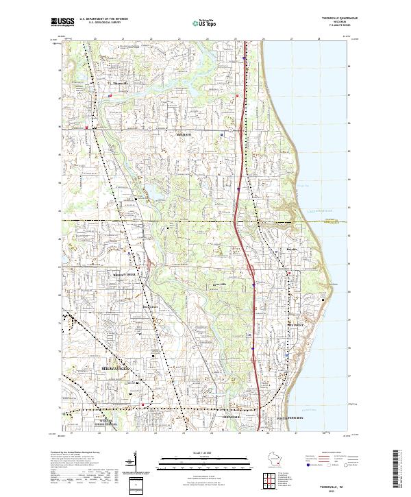 2022 Thiensville2022 Print · USGSThe northern suburbs of Milwaukee and the Lake Michigan shoreline come into focus in this recent topographic study. Researchers can trace family sites at Graceland Cem, Union Cem, and the specialized Fox Point Burial Ground.
 - 2022 Map of Milwaukee, 2022 Print
 2022 Milwaukee2022 Print · USGSGreater Milwaukee at the start of the 2020s reveals a cityscape defined by its historic river confluences and sprawling industrial heritage. Researchers can trace family sites near Forest Home Cem, explore the maritime infrastructure of Jones Island, or locate campus landmarks at Marquette University.
End of results
Showing maps 1-2 of 2
Top cities near Whitefish Bay
- Milwaukee historical maps
- West Allis historical maps
- Wauwatosa historical maps
- Brookfield historical maps
- New Berlin historical maps
- Franklin historical maps
See more
Frequently asked questions
- What are the different types of historical maps available for Whitefish Bay?
- What is the oldest map of Whitefish Bay?
- Where can I purchase historical maps of Whitefish Bay for my home or office?
- Where can I download high-res historical maps of Whitefish Bay?
- Are there historical topographic maps available for Whitefish Bay?
- Is there historical aerial imagery available for Whitefish Bay?
- Where are historical maps of Whitefish Bay sourced from?