Old Maps of Sugar Camp, Wisconsin for Genealogy
Trace your family roots with 62 historic maps of Sugar Camp. These high-res maps reveal old neighborhoods, homesites, landmarks, and streets — helping you uncover where your ancestors lived and how the area evolved over time.
- Explore historic neighborhoods: Identify where your relatives may have lived in the 1800s or 1900s.
- Compare maps over time: Trace the changes in streets, buildings, and landmarks for multi-generational research.
- Perfect for genealogy & ancestry research: Used by family historians and researchers to map out lineage and migration.
These maps are an incredible resource for exploring your personal connection to Sugar Camp's past.
Sugar Camp, WI maps
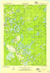
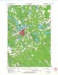
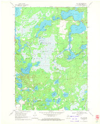
(62)- 1928 Map of Three Lakes
 1928 Three Lakes1928 Print · USGSThe Northwoods of Vilas and Oneida Counties come into focus in the late 1920s as early motor roads begin to connect the region's vast chain of lakes. Genealogists and local historians can locate early landmarks like Mayo Sch, the settlement of Hutchinson, and the original footprints of Eagle River and Three Lakes.
 - 1930 Map of Robbins
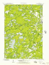
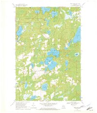
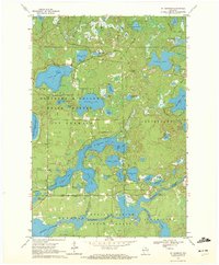
 1930 Robbins1930 Print · USGSThe Vilas and Oneida County lake country comes into focus in the early 1930s as tourism and industry overlap. Locate vanished rural schoolhouses like Evergreen Sch. and Sebastian Sch. or trace the early path of the Chicago and Northwestern RR.2 unique versions available
 - 1938 Map of Three Lakes, 1956 Print
 1938 Three Lakes1956 Print · USGSThe lake country of Oneida and Vilas counties is shown here in the late 1930s, capturing the early layout of regional resorts and logging outposts. Genealogists can trace family footprints near Three Lakes, Sanborn Sch, and the Chicago and Northwestern rail line.2 unique versions available
 - 1938 Map of Robbins, 1957 Print
 1938 Robbins1957 Print · USGSNorthern Wisconsin’s lake country was a mosaic of rural school districts and new hydroelectric power in the late 1930s. Genealogists can locate family-named landmarks like Kuehn Sch and Bohemian Sch or trace the early Rhinelander Trail.2 unique versions available
 - 1940 Map of Monico, 1955 Print
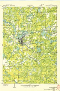
 1940 Monico1955 Print · USGSThe Northwoods of Oneida and Forest counties are captured here just before the mid-century, defined by the crossing of major rail lines and a maze of glacial lakes. Genealogists and researchers can trace the early footprints of Monico, Jennings, and Nashville, or locate local landmarks like Forest Home Cem.
 - 1940 Map of Rhinelander, 1961 Print
 1940 Rhinelander1961 Print · USGSRhinelander and the surrounding lake country are captured here in the early 1940s, just as the rail-and-timber era had matured. Genealogists and local historians can trace rural school districts like Burkhart Sch and Clovernook Sch or locate the Our Saviour Ch among the region's many lakes.
 - 1945 Map of Three Lakes, 1946 Print
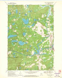
 1945 Three Lakes1946 Print · USGSThe Wisconsin Northwoods are seen here during the mid-1940s, a landscape defined by a sprawling lakeland and the Chicago and Northwestern railroad. Genealogists and historians can trace the early layout of Three Lakes and find rural landmarks like Evergreen Sch and Jones Dam.3 unique versions available
 - 1945 Map of Robbins, 1946 Print
 1945 Robbins1946 Print · USGSWisconsin's Northwoods come alive in this mid-century survey of the lake country around the Vilas and Oneida county line. Genealogists can trace family footprints through numerous rural schoolhouses like Lake Kathan Sch and forgotten sites like Wakefield and Robbins.
 - 1949 Map of Rhinelander
 1949 Rhinelander1949 Print · USGSNorthern Wisconsin lake country comes alive in this late 1940s survey centered on the bustling hub of Rhinelander. Genealogists and historians can trace the paths of the Chicago and North Western Railway or locate rural landmarks like Trotier Sch and Emden Sch.
 - 1950 Map of Monico
 1950 Monico1950 Print · USGSOneida County at mid-century is a landscape of glacial lakes and critical rail junctions during the height of the timber and transport era. Researchers can trace rural school locations like Wolf River Sch and rail outposts including Starks, Gagen, and Lennox.
 - 1954 Map of Iron Mountain, 1964 Print
 1954 Iron Mountain1964 Print · USGSUpper Michigan and Northeastern Wisconsin are shown in detail during the mid-fifties, when the logging and mining economies still moved by rail. Trace the rail lines of the Soo Line to remote stops like Koepenick Station or explore the Iron Range near Iron Mountain.2 unique versions available
 - 1959 Map of Iron Mountain
 1959 Iron Mountain1959 Print · USGSThe northwoods of Wisconsin and the Michigan border are captured here in the mid-fifties, showing a landscape defined by timber, water, and rail. Researchers can trace historic junctions like Hiles Junction, the expansive Nicolet National Forest, and lakefront settlements from Rhinelander to Tomahawk.2 unique versions available
 - 1965 Map of Starks, 1966 Print
 1965 Starks1966 Print · USGSOneida County's Northwoods character is on full display in the mid-sixties, defined by its rail junctions and glacial lake basins. Genealogists and local historians can trace the foundations of Starks and Gagen, noting the locations of Stella Sch and Townhall.2 unique versions available
 - 1966 Map of Rhinelander, 1968 Print
 1966 Rhinelander1968 Print · USGSMid-century Rhinelander is captured here at the intersection of major rail lines and a dense network of glacial lakes. Local historians can trace the footprints of old rural schools like Pine Lake Sch, find early neighborhood churches such as Our Saviour Ch, and locate family sites near Roosevelt or Malvern.
 - 1970 Map of Sugar Camp, 1972 Print
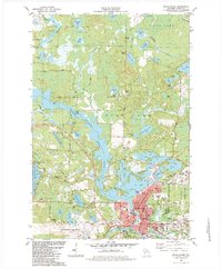
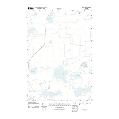
 1970 Sugar Camp1972 Print · USGSOneida County's lake-studded landscape is captured here in the early seventies, centered on the settlement of Sugar Camp. Local historians and genealogists can trace property lines near Sugar Camp Lake, locate the Indian Lookout Tower, and explore the northern woods of the American Legion State Forest.2 unique versions available
 - 1970 Map of Eagle River West, 1972 Print
 1970 Eagle River West1972 Print · USGSVilas and Oneida Counties appear here as a interconnected network of Northwoods lakes and timberlands during the early 1970s. Trace the industrial and civic landscape through the Chicago and North Western rail line, the Otter Rapids Dam, and the Fairground.2 unique versions available
 - 1970 Map of Three Lakes, 1972 Print
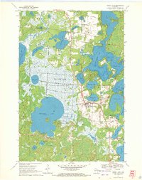 1970 Three Lakes1972 Print · USGSOneida County's lake country is captured here in the early seventies, showcasing a landscape of sprawling wetlands and growing lakeside communities. Genealogists and historians can trace the Chicago and North Western rail line and locate landmarks like the Seventh Day Adventist church or the Drive-in Theater.2 unique versions available
 - 1970 Map of Dam Lake, 1972 Print
 1970 Dam Lake1972 Print · USGSOneida County's Northwoods are captured here in the early seventies, showing a landscape defined by glacial lakes and the managed waters of the Rainbow Flowage. Local historians and genealogists can trace family-named features like Jenny Barnes Lake or the commercial Cranberry Bog.2 unique versions available
 - 1970 Map of St. Germain, 1972 Print
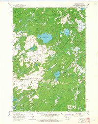
 1970 St. Germain1972 Print · USGSVilas and Oneida counties are captured here in the 1970s, a landscape defined by its glacial lakes and the expansive timberlands of the state forest. Genealogists and local historians can locate the St Germain Cem and trace the original paths of Birchwood Drive and Juve Road.3 unique versions available
 - 1982 Map of Rhinelander, 1983 Print
 1982 Rhinelander1983 Print · USGSRhinelander and the surrounding lake country of Oneida County are captured here in the early eighties, showcasing a region defined by its timber and water heritage. Genealogists and local researchers can locate landmarks like St Marys Cemetery, Pioneer Park, and the historic Chicago and Northwestern rail line.
 - 1982 Map of Moen Lake, 1983 Print
 1982 Moen Lake1983 Print · USGSOneida County's northwoods were a complex network of glacial lakes and small settlements in the early eighties. Genealogists and historians can trace the Soo Line rail corridor through Roosevelt and locate landmarks like the Foursquare Ch and Sowinski Landing Field.
 - 1989 Map of Rhinelander, 1990 Print
 1989 Rhinelander1990 Print · USGSThe Wisconsin Northwoods are captured here in the late eighties, showing a landscape defined by water and timber management. Researchers can trace the Soo Line rail corridors and find local landmarks like Rainbow Flowage, Pelican Lake, and the Rhinelander-Oneida Co Airport.
 - 2010 Map of Starks, 2010 Print
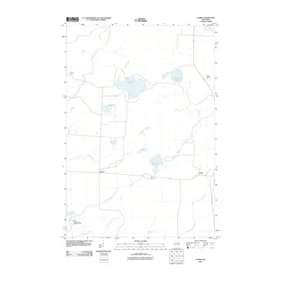 2010 Starks2010 Print · USGSCovers Sugar Camp, including Three Lakes, Stella, and other nearby areas
 - 2010 Map of Moen Lake, 2010 Print
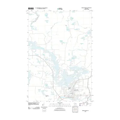
 2010 Moen Lake2010 Print · USGSCovers Sugar Camp, including Rhinelander, Stella, and other nearby areas
 - 2010 Map of Rhinelander, 2010 Print
 2010 Rhinelander2010 Print · USGSCovers Sugar Camp, including Rhinelander, Newbold, and other nearby areas
Showing maps 1-25 of 62
Top cities near Sugar Camp
- Rhinelander historical maps
- Newbold historical maps
- Three Lakes historical maps
- Washington historical maps
- Eagle River historical maps
- Phelps historical maps
See more
Frequently asked questions
- What are the different types of historical maps available for Sugar Camp?
- What is the oldest map of Sugar Camp?
- Where can I purchase historical maps of Sugar Camp for my home or office?
- Where can I download high-res historical maps of Sugar Camp?
- Are there historical topographic maps available for Sugar Camp?
- Is there historical aerial imagery available for Sugar Camp?
- Where are historical maps of Sugar Camp sourced from?