2000s (21st Century) Maps of Catawba, Wisconsin
Explore 22 historic maps of Catawba from the 2000s (21st Century). These maps offer a rare glimpse into what life looked like during the 2000s — showing old roads, neighborhoods, homes, and landmarks that have changed or disappeared over time.
Whether you're researching your family's past, planning a metal detecting trip, or studying how Catawba's landscape evolved across the 2000s, these high-resolution maps are a powerful tool for exploring the history of this region.
- Focus on a specific era: All maps on this page are from the 2000s, giving you a focused view of this time period.
- See what’s changed: Compare century-old streets, trails, and buildings to today's modern landscape using overlays and satellite layers.
- Research with precision: Use these maps for genealogy, historical research, land use analysis, or educational projects.
- View, download, or print: Maps are fully viewable online in high resolution, and can be downloaded or printed for your own records.
Start exploring Catawba's history through authentic maps from the 2000s. This is your window into the past.
Catawba, WI maps
(22)- 2005 Map of Jump River Fire Tower NE, 2006 Print
 2005 Jump River Fire Tower NE2006 Print · USGSUpper Price County and Taylor County meet along the Jump River at the dawn of the millennium, showcasing a landscape of managed forests and waterways. Researchers can trace the river's path through Big Falls, find the Steve Greek Flowage, and locate several Gravel Pits along rural routes.
 - 2005 Map of Ogema NW, 2006 Print
 2005 Ogema NW2006 Print · USGSNorthern Wisconsin's timberlands and river forks are captured here at the dawn of the millennium. Trace the path of the North Fork Jump River through Ogema and find landmarks like Hallberg Hill and Silver Creek.
 - 2010 Map of Pennington, 2010 Print
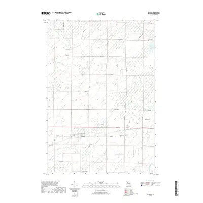
 2010 Pennington2010 Print · USGSCovers Catawba, including Ogema, Prentice, and other nearby areas
 - 2010 Map of Kennan, 2010 Print
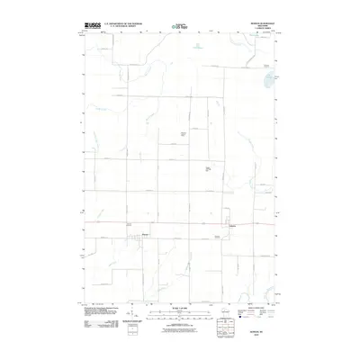 2010 Kennan2010 Print · USGSCovers Catawba, including Kennan, Kennan, and other nearby areas
 - 2011 Map of Jump River Fire Tower NE, 2011 Print
 2011 Jump River Fire Tower NE2011 Print · USGSCovers Catawba, including Ogema, Westboro, and other nearby areas
 - 2011 Map of Ogema NW, 2011 Print
 2011 Ogema NW2011 Print · USGSCovers Catawba, including Ogema, Westboro, and other nearby areas
 - 2013 Map of Kennan, 2013 Print
 2013 Kennan2013 Print · USGSCovers Catawba, including Kennan, Kennan, and other nearby areas
 - 2013 Map of Jump River Fire Tower NE, 2013 Print
 2013 Jump River Fire Tower NE2013 Print · USGSCovers Catawba, including Ogema, Westboro, and other nearby areas
 - 2013 Map of Pennington, 2013 Print
 2013 Pennington2013 Print · USGSCovers Catawba, including Ogema, Prentice, and other nearby areas
 - 2013 Map of Ogema NW, 2013 Print
 2013 Ogema NW2013 Print · USGSCovers Catawba, including Ogema, Westboro, and other nearby areas
 - 2015 Map of Pennington, 2015 Print
 2015 Pennington2015 Print · USGSCovers Catawba, including Ogema, Prentice, and other nearby areas
 - 2015 Map of Ogema NW, 2015 Print
 2015 Ogema NW2015 Print · USGSCovers Catawba, including Ogema, Westboro, and other nearby areas
 - 2015 Map of Jump River Fire Tower NE, 2015 Print
 2015 Jump River Fire Tower NE2015 Print · USGSCovers Catawba, including Ogema, Westboro, and other nearby areas
 - 2015 Map of Kennan, 2015 Print
 2015 Kennan2015 Print · USGSCovers Catawba, including Kennan, Kennan, and other nearby areas
 - 2018 Map of Jump River Fire Tower NE, 2018 Print
 2018 Jump River Fire Tower NE2018 Print · USGSCovers Catawba, including Ogema, Westboro, and other nearby areas
 - 2018 Map of Kennan, 2018 Print
 2018 Kennan2018 Print · USGSCovers Catawba, including Kennan, Kennan, and other nearby areas
 - 2018 Map of Ogema NW, 2018 Print
 2018 Ogema NW2018 Print · USGSCovers Catawba, including Ogema, Westboro, and other nearby areas
 - 2018 Map of Pennington, 2018 Print
 2018 Pennington2018 Print · USGSCovers Catawba, including Ogema, Prentice, and other nearby areas
 - 2022 Map of Jump River Fire Tower NE, 2022 Print
 2022 Jump River Fire Tower NE2022 Print · USGSThe Jump River region in Price County is captured here at a time when forestry and water management dominate the landscape. Trace the winding paths of North Fork Jump River and locate distinctive features like Yellow Banks and Steve Cr Flowage.
 - 2022 Map of Kennan, 2022 Print
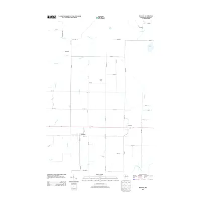
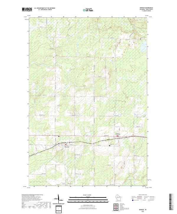 2022 Kennan2022 Print · USGSThe townships of Kennan and Catawba are shown in the twenty-first century, reflecting a landscape defined by small settlements and winding Northwoods creeks. Genealogists can locate family sites near Kennan Cem, Catawba Cem, or the namesake Old Mill Cr.
 - 2022 Map of Pennington, 2022 Print
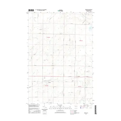
 2022 Pennington2022 Print · USGSPrice County settlement and wetland management are documented here in the early twenty-first century. Genealogists and local historians can trace property access near Pennington and along family-named routes like Moonshine Aly and Wears Rd.
 - 2022 Map of Ogema NW, 2022 Print
 2022 Ogema NW2022 Print · USGSPrice and Taylor counties meet in this northern Wisconsin forest landscape during the early 2020s. Trace the winding paths of the North Fork Jump River and the Mondeaux River alongside rural routes like Catawba Fire Ln and Co Rd M.
End of results
Showing maps 1-22 of 22
Top cities near Catawba
- Worcester historical maps
- Phillips historical maps
- Ogema historical maps
- Chelsea historical maps
- Westboro historical maps
- Prentice historical maps
See more
Frequently asked questions
- What are the different types of historical maps available for Catawba?
- What is the oldest map of Catawba?
- Where can I purchase historical maps of Catawba for my home or office?
- Where can I download high-res historical maps of Catawba?
- Are there historical topographic maps available for Catawba?
- Is there historical aerial imagery available for Catawba?
- Where are historical maps of Catawba sourced from?